We stand at an existential crossroads while someone else decides our future. I don’t mean the choice of direction, currently roiling the front pages, that pits the national health against the national economy. No, this one doesn’t get the attention it deserves, outside of the PNT and the telecom communities, though arguably it could have equally long-running and widespread, perhaps catastrophic effects.
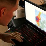
Experts at the NATO Communications and Information (NCI) Agency have developed a software-based tool that can estimate the area where an interfering signal would degrade or deny GNSS signals, and assess the scale of the interfering signal and its potential impact on operations. Principally of interest are jamming or spoofing attacks on GPS or Galileo, of course.
The Radar Electromagnetic and Communication Coverage Tool (REACT), was sponsored by the NATO Navigation and Identification Programme of Work. It serves as a proof-of-concept of how analytical tools could support the execution of operations. The tool is also available to NATO Nations free of charge. For now, the software is only used for trial and experimentation.
NATO REACT, photo courtesy NCI
To use the software, operators input information on the particular jammers – their locations and technical characteristics — and the software produces a map of the area where the interfering signals would degrade or deny GNSS receivers. This can be displayed on the NATO Core Geographical Information System (GIS) map.
The next phase of the project focuses on ensuring the software can work on NATO classified networks, which would make it more available to operational commands to test and ensure such support measures are properly integrated into NATO operations.
The software and its estimations were demonstrated to operators during exercise Trident Jupiter 2019, part 1, to collect their feedback. The exercise gathered 3,000 military and civilian personnel as participants, evaluators and observers. Thirty NATO member and partner nations participated in nine different exercise locations across Europe.
“Ten consecutive twelve-hour working days and a relentless, ever-increasing, battle-rhythm tempo came to an end as Exercise Trident Jupiter 2019-1 (TRJU19-1) reached completion on Thursday, Nov. 14, 2019,” the agency stated.
TRJU19 was the largest and most complex exercise planned and executed by the Alliance’s Joint Warfare Centre to date. TRJU19-2 took place in March 2020.
“NATO’s adversaries have the ability to degrade or deny GPS-enabled capabilities,” said Jean-Philippe Saulay, a NATO Navigation and Identification Officer. “NATO must take appropriate measures to ensure Allied forces can operate in a degraded or denied environment.”
“NATO must maintain superiority in the electromagnetic environment, including but not limited to, positioning, navigation and timing services,” said Dr Enrico Casini, Communications and Navigation Engineer at the NCI Agency. “Situational awareness of navigation systems in a contested electromagnetic environment contributes to that superiority. NATO is enhancing its knowledge of electronic warfare technology,” Dr Casini said. “The electromagnetic environment has become even more contested in recent years. One aspect of that is interference with GNSS systems.”
Photos courtesy NATO Communications and Information Agency.
The European Union’s eCall emergency response system automatically calls emergency services in the event of a serious road accident, transmitting location information from a GNSS receiver (GPS and/or Galileo) installed in the car to local emergency agencies.
The 2020 Space Symposium has been rescheduled for October 31—November 2 this year, to be held as usual at The Broadmoor in Colorado Springs. GPS in particular and GNSS in general always form an important part of the program. The annual assembly gathers leaders, innovators, and entrepreneurs from the civil, commercial, military, research, and international sectors of the world’s space community.
Plans have been submitted for a rocket launch site in the north of Scotland that could boost communications satellites into orbit in two years. No word has come regarding the possibility of launching satellites of the United Kingdom’s a-borning GNSS from this facility, but the prospect is intriguing.
Sapcorda Services GmbH announced the release of its Safe And Precise Augmentation (SAPA) Premium GNSS positioning service, providing GNSS corrections via internet and satellite.
In lead position on a sleigh rising from the North Pole to a height of 200 meters — standard cruising altitude for global package delivery — at 2100 hours UTC on December 24 — the youngest will hopefully be asleep by then and there’s plenty of territory to cover before dawn breaks, time’s a-wasting — navigator Rudolph will see between 40 and 45 GNSS satellites glistening in the night sky.
China threw two BeiDou satellites into space on Dec. 16. According to Yang Changfeng, BeiDou constellation chief designer, this brings to 24 the total of medium-Earth orbit (MEO) BDS-3 satellites in orbit, bringing completion to the core system. China has stated its mission to complete the BDS-3 constellation by 2020.
Someone has updated 19th century American slang to resonate in the 21st century’s international commerce and shipping scene. A mysterious new electronic weapon has surfaced in China, spoofing GPS signals in a way that experts have never seen before.
To gauge the present state of mind of the GNSS and PNT community, the state of play in application development, and the state of the art in positioning, navigation and timing technology, we asked four international experts for their perspectives. Here are the questions posed to them.
Positioning with 5G next-generation cellular technology, based on higher bandwidths and frequencies, promises to open up new possibilities for localization services. As GNSS receivers share their position awareness across more powerful cellular networks, smart traffic management, asset tracking and personalized drone-based delivery will be just three examples of expanded capability. A European Space Agency (ESA)-sponsored test recently simulated this broadening PNT potential.
Upon its 10th anniversary, Tallysman GNSS recently introduced new helical antennas. Released earlier this year, the helical antenna line is designed to provide unprecedented performance in a lightweight, compact form factor.
The software and hardware development phase of the new GPS ground system program is now complete and the team is moving on to integration and testing, prime contractor Raytheon said in a statement.
Autonomous vehicle research firm VSI Labs took its show on the road in September, as a three-member team was driven—by their autonomous car—on a thousand-mile journey from Minneapolis to Washington D.C. The Drive East employed Trimble’s precise point positioning (PPP) technology, Trimble RTX, delivering GNSS corrections via satellite or cellular.
The Institute of Navigation’s (ION) Satellite Division presented Dr. Santiago Perea Diaz with its Bradford W. Parkinson Award at the recent ION GNSS+ Conference in Miami, Florida.
Dr. Perea Diaz was recognized for graduate student excellence in Global Navigation Satellite Systems in his thesis, “Design of an Integrity Support Message for Offline Advanced RAIM”.