Columns and Editorials

Integer Aperture Estimation

For the complete story, including figures, graphs, and images, please download the PDF of the article, above.

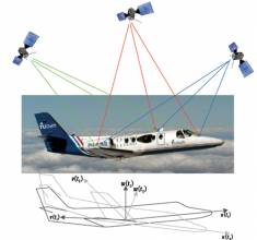
Integer carrier-phase ambiguity resolution is the key to fast and high-precision GNSS positioning and navigation. It is the process of resolving the unknown cycle ambiguities of the carrier-phase data as integers. Once this has been done successfully, the very precise carrier-phase data will act as pseudorange data, thus making very precise positioning and navigation possible.

Read More >

By Inside GNSS
January 24, 2011

GNSS Hotspots | January 2011

One of 12 magnetograms recorded at Greenwich Observatory during the Great Geomagnetic Storm of 1859
1996 soccer game in the Midwest, (Rick Dikeman image)
Nouméa ground station after the flood
A pencil and a coffee cup show the size of NASA’s teeny tiny PhoneSat
Bonus Hotspot: Naro Tartaruga AUV
Pacific lamprey spawning (photo by Jeremy Monroe, Fresh Waters Illustrated)
“Return of the Bucentaurn to the Molo on Ascension Day”, by (Giovanni Antonio Canal) Canaletto
The U.S. Naval Observatory Alternate Master Clock at 2nd Space Operations Squadron, Schriever AFB in Colorado. This photo was taken in January, 2006 during the addition of a leap second. The USNO master clocks control GPS timing. They are accurate to within one second every 20 million years (Satellites are so picky! Humans, on the other hand, just want to know if we’re too late for lunch) USAF photo by A1C Jason Ridder.
Detail of Compass/ BeiDou2 system diagram
Hotspot 6: Beluga A300 600ST

1. HAPPY BIRTHDAY!
Los Angeles, California USA
√ Congratulations to SVN 23, a GPS IIA satellite, for 20 glorious years. The GPS Directorate expects 12–18 months more of active duty from the overachieving space vehicle, which was expected to last only 7½ years. (Meanwhile, Europe’s first Galileo test satellite, GIOVE-A, was expected to last 27 months and is still cookin’ after five years.)

Read More >

By Inside GNSS
[uam_ad id="183541"]
January 21, 2011

Your Signal Is My Noise

Most people probably don’t associate engineers and linguistic virtuosity.

The attitude is unfair, of course, as with so many stereotypes.

And also untrue.

For example, as the number of existing or planned GNSS systems grew during the past few years, the expression “Your signal is my noise” has recurred in the engineering community with increasing frequency.

I consider that an elegant, if ominous, turn of phrase. A simple declarative sentence, pithy, with an ironic edge, yet almost lyrical.

Read More >

By Inside GNSS
January 9, 2011

Differences between Signal Acquisition and Tracking

Q: Why is acquisition of GNSS signals generally more difficult than tracking and what are the limiting factors?

A: A fairly good analogy of the difference between GNSS signal acquisition and tracking can be found in the rescue of victims of a sunken ship whose location is not accurately known. The first stage of the rescue attempt typically involves an aircraft flying a search pattern, which hopefully encompasses the location where the ship went down.

Read More >

By Inside GNSS

Wavelets and Notch Filtering

FIGURE 1: Touching wavelet spectra

For the complete story, including figures, graphs, and images, please download the PDF of the article, above.

The use of GNSS for safety critical applications is gaining interest, particularly amongst aviation users, who probably have the most demanding requirements. The GNSS frequency band containing the Galileo E5 and GPS L5 signals is designated as an aeronautical radio navigation service (ARNS) band, which enjoys legal protection from other services not allocated to this frequency on a primary basis.

Read More >

By Inside GNSS
December 2, 2010

GNSS Hotspots | December 2010

One of 12 magnetograms recorded at Greenwich Observatory during the Great Geomagnetic Storm of 1859
1996 soccer game in the Midwest, (Rick Dikeman image)
Nouméa ground station after the flood
A pencil and a coffee cup show the size of NASA’s teeny tiny PhoneSat
Bonus Hotspot: Naro Tartaruga AUV
Pacific lamprey spawning (photo by Jeremy Monroe, Fresh Waters Illustrated)
“Return of the Bucentaurn to the Molo on Ascension Day”, by (Giovanni Antonio Canal) Canaletto
The U.S. Naval Observatory Alternate Master Clock at 2nd Space Operations Squadron, Schriever AFB in Colorado. This photo was taken in January, 2006 during the addition of a leap second. The USNO master clocks control GPS timing. They are accurate to within one second every 20 million years (Satellites are so picky! Humans, on the other hand, just want to know if we’re too late for lunch) USAF photo by A1C Jason Ridder.
Detail of Compass/ BeiDou2 system diagram
Hotspot 6: Beluga A300 600ST

1. STORMY WEATHER
Belgium and Brazil

Read More >

By Inside GNSS
[uam_ad id="183541"]

Measuring GNSS Signal Strength

Q: What is the difference between SNR and C/N0?

A: GPS receivers built for various applications, such as handhelds, automobiles, mobile phones, and avionics, all have a method for indicating the signal strength of the different satellites they are tracking. Some receivers display the signal strength in the form of vertical bars, some in terms of normalized signal strength, and others in terms of carrier-to-noise density (C/N0) or signal-to-noise ratio (SNR).

Read More >

By Inside GNSS

Frank Czopek

Frank & Jeanine at the Wild Animal Park

SIDEBAR: Frank Czopek’s Compass Points

Frank Czopek and his brothers used to go to the 1970s Detroit version of Craigslist — Trading Times — to buy two or three non-functioning Chevrolet Corvairs (air-cooled rear engine-mounted) cars, at $25 apiece.

They hoped to turn the junkers into a single functioning automobile over a weekend. Unfortunately, the results did not last long; so, the process was repeated often. But they sure had fun!

Read More >

By Inside GNSS
October 1, 2010

GNSS Hotspots | October 2010

One of 12 magnetograms recorded at Greenwich Observatory during the Great Geomagnetic Storm of 1859
1996 soccer game in the Midwest, (Rick Dikeman image)
Nouméa ground station after the flood
A pencil and a coffee cup show the size of NASA’s teeny tiny PhoneSat
Bonus Hotspot: Naro Tartaruga AUV
Pacific lamprey spawning (photo by Jeremy Monroe, Fresh Waters Illustrated)
“Return of the Bucentaurn to the Molo on Ascension Day”, by (Giovanni Antonio Canal) Canaletto
The U.S. Naval Observatory Alternate Master Clock at 2nd Space Operations Squadron, Schriever AFB in Colorado. This photo was taken in January, 2006 during the addition of a leap second. The USNO master clocks control GPS timing. They are accurate to within one second every 20 million years (Satellites are so picky! Humans, on the other hand, just want to know if we’re too late for lunch) USAF photo by A1C Jason Ridder.
Detail of Compass/ BeiDou2 system diagram
Hotspot 6: Beluga A300 600ST

1. GARMIN RECALL
Olathe, Kansas USA

√ In late August, Kansas-based GPS consumer manufacturer Garmin International Inc. recalled 1.25 million Nuvi GPS units whose batteries can overheat and catch fire. In September, Nissan and Suzuki recalled Nuvi units in their vehicles. Check the special recall website to see if you are affected.

Read More >

By Inside GNSS

Launch Fever

It is not all about the satellites, of course.

And, despite the thrill of launches — the Fourth of July and every other national holiday celebration all grown up — it’s not about the rockets.

When evaluating the progress of GNSS programs, however, satellites and launches are a way to keep count — in fact, it is the way most of us do keep count.

By that measure, then, the numbers are adding up quickly.

Read More >

By Inside GNSS
September 15, 2010

A Search for Spectrum: GNSS Signals in S-Band, Part II

GNSS utilization of the S-band portion of the radio spectrum provides some challenges to designers of both GNSS navigation signals as well as signals used by other services, in terms of interference avoidance and signal power.

An important existing user of S-band spectrum is the Globalstar communications satellite system. The voice and data services provided by Globalstar employ the 2483.5–2500 MHz band for its satellite downlink communications to user terminals. Additionally, these satellites use multi-beam antennas to enable frequency reuse.

Read More >

By Inside GNSS
IGM_e-news_subscribe