A Comprehensive Reference for OPUS
CORS and OPUS for Engineers
Edited by Tomás Soler
PUBLISHED BY THE AMERICAN SOCIETY OF CIVIL ENGINEERS
CORS and OPUS for Engineers
Edited by Tomás Soler
PUBLISHED BY THE AMERICAN SOCIETY OF CIVIL ENGINEERS
1. AQUARIUS
Buenos Aires, Argentina and Vandenberg AFB, California, USA
What have we learned from the LightSquared fiasco?
Aside from the fact that someone gambling with other people’s money, with friends in high places benefiting from his largesse, can make the law stand on its head and our hair stand on end.
But then, we already knew that.
Just because the forces behind the broadband cellular company, Philip Falcone and Harbinger Investments, made their money by betting against the housing bubble doesn’t take away from the fact that they represent the same crew who helped take down the world economy in 2007.
By Inside GNSSThe gloves have come off now that test results show clearly the probable effects on GPS of LightSquared’s proposed wireless broadband network: widespread, debilitating interference to GPS receivers.
By Dee Ann DivisWorking Papers explore the technical and scientific themes that underpin GNSS programs and applications. This regular column is coordinated by Prof. Dr.-Ing. Günter Hein, head of Europe’s Galileo Operations and Evolution.
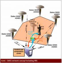
By Inside GNSSQ: What is a virtual reference station and how does it work?
A: To reach centimeter-level — or even better — accuracy of positioning typically requires use of precise dual-frequency carrier phase observations. Furthermore, these observations are usually processed using a differential GNSS (DGNSS) algorithm, such as real time kinematic (RTK) or post-processing (PP). Regardless of the specific differential algorithm, however, implicit in the process is an assumption that the quality of the reference station data is consistent with the desired level of positioning accuracy.
By Inside GNSSWashington View appears in each issue of Inside GNSS. It covers U.S. policy and program issues involving the Global Positioning System and other GNSSes. Reporting from Washington, D.C., columnist Dee Ann Divis has written about GNSS and the aerospace industry since the early 1990s in GPS World, Geo Info Systems, Jane’s International Defense Review, the Los Angeles Times, AeroSpace Daily and other publications.
By Dee Ann Divis1. DON’T BLAME GPS
Humboldt-Tolyabe National Forest, Nevada USA
√ In the Pacific Northwest, in-car navigators often indicate “short cuts” through wilderness mountains—with tragic results. One victim survived 49 days before rescue in May. (Reports blamed GPS – not digital maps or wireless communication.) GPS.GOV straightens out misperceptions, for those who need a guardian angel, but just get a signal.
Up here in the beautiful Pacific Northwest — yes, the sun is shining; hence, my enthusiasm — we have a wealth of wildlife. It goes nicely with the splendid landscape.
We have birds of all songs and colors. (Migratory Western tanagers passing through right now.) A selection of bears, mountain lions, the occasional wildcat. A surfeit of deer.
Even buffalo and grey wolves are making their comeback.
By Inside GNSSQ: How do you compute relative positions with GNSS?
A: GNSS is well recognized as an excellent means of computing position, but many people think that GPS only provides absolute position information. However, GNSS can also provide relative position information. In this column, we will look at some of the details of how this is done.
By Inside GNSSAfter a long series of fits and starts, the Department of Homeland Security is tackling the issue of interference to the GPS signal. The agency has launched a study to assess the risks to GPS service from a variety of sources — a study that, at least on paper, will lead to a plan to mitigate interference.
Unfortunately, the effort will not directly address the one potential problem consuming the thoughts of the GPS community — widespread receiver overload from the high-powered mobile broadband service proposed by the Virginia firm LightSquared.
By Dee Ann DivisWorking Papers explore the technical and scientific themes that underpin GNSS programs and applications. This regular column is coordinated by Prof. Dr.-Ing. Günter Hein, head of Europe’s Galileo Operations and Evolution.
By Inside GNSS1. NORTHERN LIGHTS
Northern Hemisphere
√ The sun has been in a feisty mood lately, with solar flares mid-February to mid-March. GNSS signals haven’t been affected, because these plasma ejections have magnetic fields that are parallel to Earth, instead of perpendicular to it. That could change suddenly, according to the Space Weather Prediction Center. (Meanwhile, the Northern Hemisphere has enjoyed brilliant auroras.)
By Inside GNSS