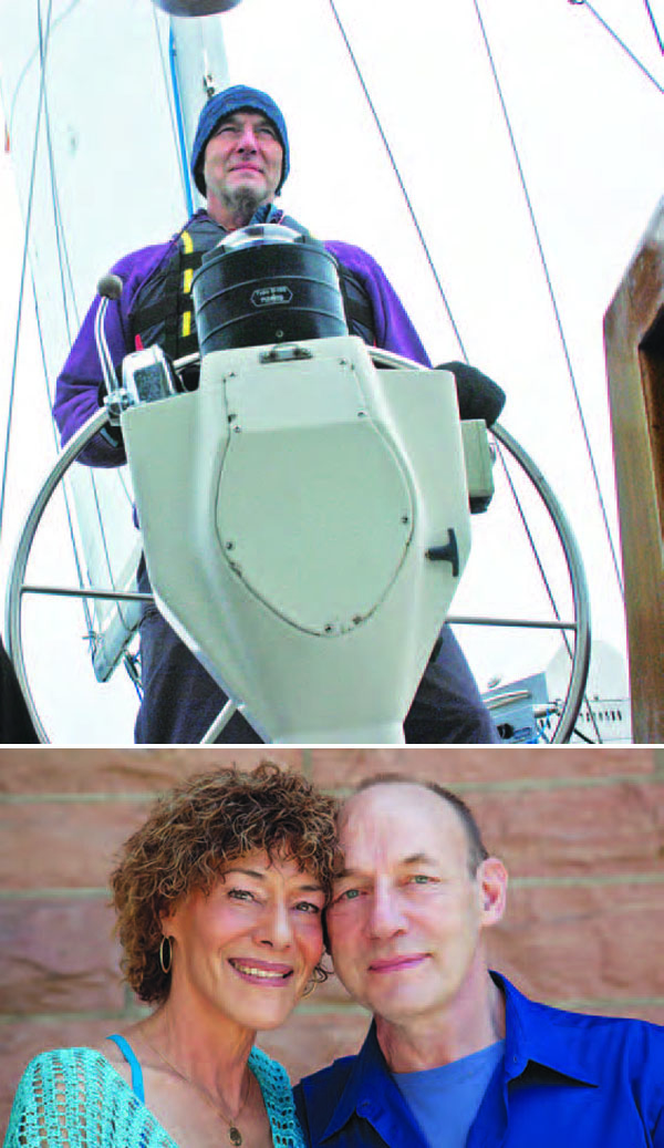
Elizabeth Rooney’s Compass Points
Elizabeth Rooney at home with Hana and JosephGNSS event that most signified to you that GNSS had “arrived”
Two events stand out:
By Inside GNSS
Elizabeth Rooney at home with Hana and JosephGNSS event that most signified to you that GNSS had “arrived”
Two events stand out:
By Inside GNSS
Editor’s Note: On November 19, Senator Roger Wicker (R-Mississippi), a member of the Senate Armed Services Committee, filed an amendment (No. 2185) to the FY 2014 National Defense Authorization Act (S. 1197),
Section 1082, that would limit the construction of satellite
positioning ground monitoring stations controlled by any foreign
government on U.S. soil. Such construction would require certification
Receiver (on the right) and antenna (on the left) comprised the on-board unit used in both data collectionsWorking Papers explore the technical and scientific themes that underpin GNSS programs and applications. This regular column is coordinated by Prof. Dr.-Ing. Günter Hein, head of Europe’s Galileo Operations and Evolution.
By Inside GNSSQ: How Does Non-Line-of-Sight Reception Differ From Multipath Interference?
A: It is well known that GNSS signals may be reflected by buildings, walls, vehicles, and the ground. Glass, metal, and wet surfaces are particularly strong reflectors.
By Inside GNSS
Main antenna on FOC Galileo satelliteSIDEBAR: Elizabeth Rooney’s Compass Points
Going for her first big job interview after college, Elizabeth Rooney admits she didn’t know what GPS was.
“It was 1995,” she says, “and I was going in to see about this job. I had been looking at some literature from the company I was interviewing with, and there it was, ‘GPS.’ I wondered what the letters meant when I saw them.”
By Inside GNSSSome of the specific technical issues behind the latest delay for Galileo’s first full operational capability (FOC) satellites have already been reported. The story, as it is told, generally starts with a late navigation payload delivery by British firm Surrey Satellite Technology to the German prime contractor, OHB. Next, OHB ran into issues with the payload and the platform, further stretching out the timeline.
By Peter Gutierrez
The GPS program is setting a new space-system standard for cyberdefense, and now the federal government is creating a framework to help operators of critical infrastructure that largely rely on GPS to do the same.
The need to raise the bar is clear. Malicious coders, often backed by hostile nation-states or criminal organizations, are using automated tools to continuously probe for weaknesses:
By Dee Ann Divis
One of 12 magnetograms recorded at Greenwich Observatory during the Great Geomagnetic Storm of 1859
1996 soccer game in the Midwest, (Rick Dikeman image)
Nouméa ground station after the flood
A pencil and a coffee cup show the size of NASA’s teeny tiny PhoneSat
Bonus Hotspot: Naro Tartaruga AUV
Pacific lamprey spawning (photo by Jeremy Monroe, Fresh Waters Illustrated)
“Return of the Bucentaurn to the Molo on Ascension Day”, by (Giovanni Antonio Canal) Canaletto
The U.S. Naval Observatory Alternate Master Clock at 2nd Space Operations Squadron, Schriever AFB in Colorado. This photo was taken in January, 2006 during the addition of a leap second. The USNO master clocks control GPS timing. They are accurate to within one second every 20 million years (Satellites are so picky! Humans, on the other hand, just want to know if we’re too late for lunch) USAF photo by A1C Jason Ridder.
Detail of Compass/ BeiDou2 system diagram
Hotspot 6: Beluga A300 600ST

1. EASY RIDER
Milwaukee, Wisconsin USA
√ Not only has century-old American motorcycle manufacturer Harley Davidson used consumer focus groups for the first time to develop its newest “hogs,” it has responded to customers with a voice-activated touch-screen GPS unit, the first on a production model. Now the Easy Riders don’t have to wend their way to trouble, they can ask their chopper where to go.
Ismael Colomina, wife Carmina, and children Jan and Eulalia on vacation in BrazilI Fell In Love With GNSS When . . .
“Two GNSS-related experiences really impressed me as a young professional and that I’ve never forgotten. The first involved adjusting a GPS-supported (GPS aerial control) aerial triangulation. By getting rid of most ground control points we managed to produce new results.
By Inside GNSSFirst I thought to title these comments, “Learn from the People,” but readers might have confused me with Chairman Mao. (I spent some time recently around the Yangtze River, although I didn’t take the opportunity to swim in it as the Great Helmsman did.)
In any case, my thoughts turned toward the masses and the mass market as a result of working with the authors of an article in this issue on cooperative authentication. They have extended a chain of innovative proposals drawing on the crowdsourcing concept of data sharing among nearby GNSS users or “peers.”
By Inside GNSS