Public Comment Open on ION’s GNSS Software Defined Radio Metadata Standard

The Institute of Navigation’s GNSS Software Defined Radio Metadata Standard working group is seeking public comment on the standard through December 31, 2017.
By Inside GNSS
The Institute of Navigation’s GNSS Software Defined Radio Metadata Standard working group is seeking public comment on the standard through December 31, 2017.
By Inside GNSS
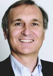
Bernhard Richter, Leica Geosystems GNSS business director
Enrico Salvatori, Qualcomm Europe
Carlo Bagnoli, STMicroelectronicsCarlo Bagnoli is Director of Infotainment BU System and Applications at STMicroelectronics. The company is a global semiconductor leader focusing on smart driving and the internet of things, creating intelligent and energy-efficient products that enable intelligent transport as well as smarter factories, cities and homes.
Within the infotainment business unit, Bagnoli and his team work to develop positioning receivers, broadcast receivers and communication processors for the automotive market. Doing so means gathering GNSS signals from far and wide.
By Inside GNSS
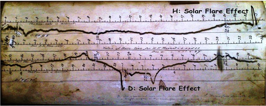
One of 12 magnetograms recorded at Greenwich Observatory during the Great Geomagnetic Storm of 1859
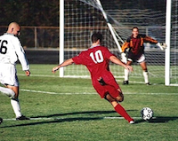
1996 soccer game in the Midwest, (Rick Dikeman image)
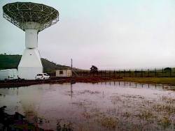
Nouméa ground station after the flood
A pencil and a coffee cup show the size of NASA’s teeny tiny PhoneSat
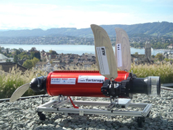
Bonus Hotspot: Naro Tartaruga AUV
Pacific lamprey spawning (photo by Jeremy Monroe, Fresh Waters Illustrated)
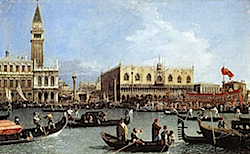
“Return of the Bucentaurn to the Molo on Ascension Day”, by (Giovanni Antonio Canal) Canaletto
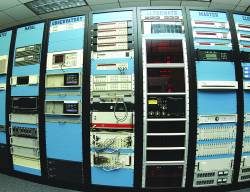
The U.S. Naval Observatory Alternate Master Clock at 2nd Space Operations Squadron, Schriever AFB in Colorado. This photo was taken in January, 2006 during the addition of a leap second. The USNO master clocks control GPS timing. They are accurate to within one second every 20 million years (Satellites are so picky! Humans, on the other hand, just want to know if we’re too late for lunch) USAF photo by A1C Jason Ridder.
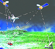
Detail of Compass/ BeiDou2 system diagram
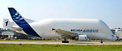
Hotspot 6: Beluga A300 600ST

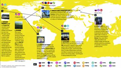
1. Sweet Wheels
Maringa, Brazil
√ The latest self-steering Volvo truck innovates the way Brazilian farmers handle their crops. The Swedish manufacturing company is on a mission to revolutionize the Brazilian sugarcane industry by providing a smart and crop-friendly solution.
Return to main article: "Feature Selection for GNSS Receiver Fingerprinting"
By Inside GNSS
Equations 1 – 7Working Papers explore the technical and scientific themes that underpin GNSS programs and applications. This regular column is coordinated by Prof. Dr.-Ing. Günter Hein, head of Europe’s Galileo Operations and Evolution.
By Günter W. Hein
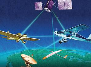
Two aircraft flying at the same altitudeFederal budgeteers have made clear their support for satellite navigation though problems with military space programs in general, and GPS programs in particular, have lawmakers working to shake up the Pentagon’s management structure and put limits on new federal business to contractors whose projects go awry.
By Dee Ann DivisA government report commissioned by Innovate UK, along with the UK Space Agency and the Royal Institute of Navigation, entitled “Economic impact to the UK of a disruption to GNSS”, comes in the wake of troubling incidents for GNSS operators, both the United States and Europe.
Last year a problem with the GPS satellite timing signal triggered alarms and caused an unknown number of outages, and in Europe earlier this year the fledgling Galileo signal crashed due to unspecified ground facility issues.
By Peter GutierrezQ: How is Public Safety reliant on GNSS and is this a concern?
A: Much like many industries and organizations, as the nature of Public Safety grows and evolves, its members have looked to leverage available technologies that help them achieve their goals. In this case, the goals are first and foremost Public Safety followed closely by Member Safety whether it be police, fire or others.
By Inside GNSS
One of 12 magnetograms recorded at Greenwich Observatory during the Great Geomagnetic Storm of 1859
1996 soccer game in the Midwest, (Rick Dikeman image)
Nouméa ground station after the flood
A pencil and a coffee cup show the size of NASA’s teeny tiny PhoneSat
Bonus Hotspot: Naro Tartaruga AUV
Pacific lamprey spawning (photo by Jeremy Monroe, Fresh Waters Illustrated)
“Return of the Bucentaurn to the Molo on Ascension Day”, by (Giovanni Antonio Canal) Canaletto
The U.S. Naval Observatory Alternate Master Clock at 2nd Space Operations Squadron, Schriever AFB in Colorado. This photo was taken in January, 2006 during the addition of a leap second. The USNO master clocks control GPS timing. They are accurate to within one second every 20 million years (Satellites are so picky! Humans, on the other hand, just want to know if we’re too late for lunch) USAF photo by A1C Jason Ridder.
Detail of Compass/ BeiDou2 system diagram
Hotspot 6: Beluga A300 600ST

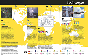
1. RESCUE DRONE
Noordwijk, Netherlands
√ Inspired by the refugee crisis, Dutch start-up Avy has been working on robust, long-duration drones capable of detecting people in distress and, if necessary, dropping life jackets, life buoys, food and medicine. The rescue drone can take off from a boat or the shore, carrying among other items, a cylinder that contains a large deployable rescue buoy, which not only can keep refugees afloat but indicates its location to boats in the vicinity.