signal Archives - Page 3 of 22 - Inside GNSS - Global Navigation Satellite Systems Engineering, Policy, and Design

signal

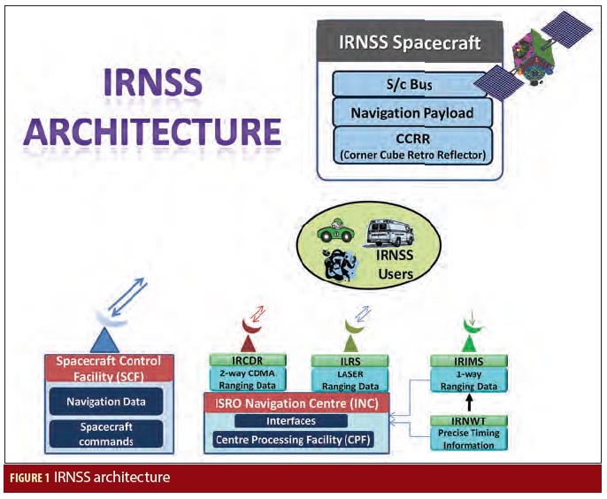
Measuring Navigation Payload Absolute Delay
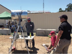
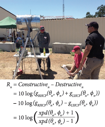
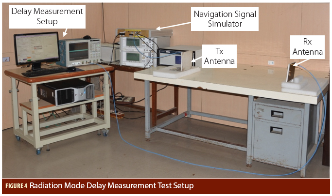
Figures and Tables

In satellite navigation, the user receiver finds its position by measuring its distance to satellites and knowledge of the satellite position. The distance is measured by ranging, i.e., finding the delay of the signal from the transmitter to the receiver. The delay will comprise of payload hardware delay and the geometric range delay. Hence, the payload delay of the signal from generation to radiation is very important and needs to be transmitted in navigation data. 

Read More >

By Inside GNSS
December 9, 2015

ION Southern California Section December Meeting

Torrance, CA

The Southern California Section of the Institute of Navigation’s December meeting will take place at the John Deere facility in Torrance, CA on December 15, 2015.

Dr. Chun Yang will speak at the meeting.  The title of the talk is Sharpening Peak Performance of GPS Signals. In this talk, the variable IF tracking architecture that improves the
peak performance will be presented together with possible implementation
schemes. Simulation results will be used for illustration and analysis.

Read More >

By Inside GNSS
[uam_ad id="183541"]
November 29, 2015

Failure to Communicate

For an organization with its name, the Federal Communications Commission (FCC) is a remarkably opaque public entity. 

Such is the case with the agency’s inaction on requests by foreign GNSS services to waive the so-called FCC Part 25 rules that require licensing of non-Federal receive-only Earth stations (e.g., GNSS receivers) operating with non-U.S. licensed space stations (i.e., satellites). 

Although at least one such request has reportedly been submitted, the FCC has not even acknowledged it, let alone moved to render a decision on the request. 

Read More >

By Inside GNSS
November 19, 2015

Code Shift Keying

Equations 1 – 10

The constant growth and evolution of the positioning, navigation, and timing (PNT) market generate demands for more and more added-value applications and services relying on GNSS signals, with expectations for improved accuracy and availability. Some services may also rely on added-value content other than navigation messages, for example, higher data volume with less latency, such as the data carried by satellite-based augmentation system (SBAS) services and the Galileo Commercial Service.

Read More >

By Günter W. Hein

How Important Is It to Synchronize the Code and Phase Measurements of a GNSS Receiver?

Q: How Important Is It to Synchronize the Code and Phase Measurements of a GNSS Receiver?

A: Precise timing lies at the heart of GNSS implementation and operation and is generally well understood in terms of synchronizing individual satellites and/or receivers. Recent results, however, have demonstrated that timing of code and phase measurements in a receiver can have significant implications for the timing community in particular.

Read More >

By Inside GNSS
[uam_ad id="183541"]
September 7, 2015

Alternative PNT

At one time, GPS was expected to supplant a wide range of navigation technologies in the world’s positioning, navigation, and timing (PNT) portfolio. But an unexpected thing happened along the way.

Read More >

By Inside GNSS

GPS Confidential

Ubiquitous location-aware mobile devices, mainly GPS-enabled smartphones, have led to a boom in location-based services (LBS), which have been revolutionizing businesses and lifestyles. Common uses of LBSs include asset tracking, location-based advertising, emergency roadside service, turn-by-turn navigation, and real-time traffic & road information sharing.

Read More >

By Inside GNSS

Urban Localization and 3D Mapping Using GNSS Shadows

It is by now well known that GNSS-based localization in built-up urban environments can be extremely inaccurate. This is a fundamental problem that hardware enhancements cannot solve.

A GNSS receiver estimates 3D location and timing from pseudoranges from four or more satellites, assuming that these pseudoranges correspond to direct line-of-sight (LOS) paths from each satellite. In urban canyons, however, the signal from a satellite to the receiver suffers from multipath propagation and shadowing.

Read More >

By Inside GNSS

Single Antenna, Dual Use

A GNSS single-antenna system can be compared to a single-pixel camera. Electromagnetic waves traveling 20,000 kilometers from every overhead direction can reach us. Yet once at the antenna, this diverse set of information is collapsed into a single magnitude and phase value, then sent off to the receiver so that value can be extracted.

Read More >

By Inside GNSS
June 29, 2015

First Position Fix with IRNSS

Figure 1

The Indian Regional Navigation Satellite System (IRNSS) is an Indian Space Research Organisation (ISRO) initiative to build an independent satellite navigation system that provides precise position, velocity, and time (PVT) to users across the Indian region.

The primary objective of IRNSS is to achieve position accuracy of 20 meters (2σ) for dual-frequency users over India and the primary service area (a region extending to about 1,500 kilometers or 930 miles).

Read More >

By Inside GNSS

ISGNSS and CGSIC 2015: International Symposium on Global Satellite Navigation Systems and Asia/Pacific Rim meeting of the CGSIC

Fushimi Inari Taisha, Kyoto, Japan

The 16th International Symposium On GNSS 2015 will be held November 16 – 19, 2015 at Miyakomesse in Kyoto, Japan.

ISGNSS 2015 will be co-located with the Asia and Pacific Rim meeting of the CGIC (Civil GPS Service Interface Committee) to help improve understanding of the world trends in developing and deploying GNSS. The program will include keynote addresses, oral presentations, interactive poster sessions, panel sessions, open interactive forums and a trade exhibition.

Read More >

By Inside GNSS
IGM_e-news_subscribe