October 29, 2021
New Teseo Family Module Integrates Inertial with Multi-Constellation GNSS for Automotive
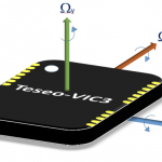
STMicroelectronics has introduced the Teseo-VIC3DA, the latest member of the Teseo module family. Teseo-VIC3DA combines ST’s high-performing Automotive Teseo III GNSS1 IC with the automotive 6-axis MEMS inertial measurement unit (IMU) and dead reckoning software to create a convenient, automotive-qualified navigation module.
By Inside GNSS