
On October 8 in the Arctic archipelago of Svalbard, a demonstration “accident” used the Galileo Return Link (RLS) Cospas-Sarsat beacon to stage a rescue of 200 passengers from a stricken cruise ship.
The International Cospas-Sarsat Programme is a satellite-aided search and rescue (SAR) initiative, dedicated to detecting and locating radio beacons activated by persons, aircraft or vessels in distress, and forwarding this alert information to authorities that can take action for rescue.
The system utilizes a network of satellites that provide coverage everywhere on Earth. Distress alerts are detected, located and forwarded to over 200 countries and territories at no cost to beacon owners or the receiving government agencies. Cospas-Sarsat was conceived and initiated by Canada, France, the United States, and the former Soviet Union in 1979.
At 08:00 AM local time, a simulated electrical malfunction caused a “fire” in the ship’s engine room that the crew could not extinguish. The fire knocked out the ship’s communication systems. The only solution available was the onboard Cospas-Sarsat Emergency Position-indicating Radio Beacon (EPIRB).
Since the Initial Service declaration in 2016, EU Space Programme has provided operational data to the international Search and Rescue system Cospas-Sarsat. Thanks to SAR/Galileo the “Search” part from the Search and Rescue is shorter, faster and more reliable.
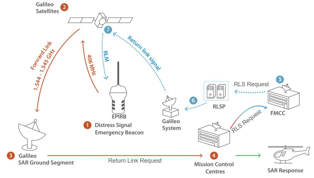
The ship’s EPIRB is compatible with the Galileo Return Link Service. The RLS is a unique feature provided by EU Space Programme that upon independent confirmation of the beacon location by Cospas-Sarsat, provides an automatic confirmation to the distress users that the emergency transmission has been received and that relevant SAR forces have been alerted. The SAR/Galileo system was designed in cooperation with the International Cospas-Sarsat system.
Sequence of demo events:
06:06:10 (1)- – Mayday, Mayday, Mayday! Captain requests EPIRB beacon activation
06:06:36 (1-2) – Beacon is switched on and distress transmission starts
06:07:26 (2-3) – First independent location and notification to Norwegian Joint Rescue Mission Control Center
06:08:16 (3-4) – Second independent location and confirmed position triggering the Return Link Message Request to Galileo.
06:08:39 (5) – Return Link Message (RLM_Request) request received from French Mission Control Center.
06:08:40 (6) – Return Link request processed and transmitted to be uplink into Galileo satellites GSAT-0212 available above the distress area.
06:08:56 (7) – Return Link Message received by the EIPIRB

In 2 min 20 seconds, the Galileo System provided the Return Link acknowledged the SOS call from the EPIRB, providing a location accuracy of around 730m. Such measurements confirm Galileo performance at extremely high latitudes.
The Search operation was further supported using Earth Observation Data from the Copernicus Programme. The usages span from classic satellite imagery of the suroundings of the event, to sea wave height, sea currents, icecap positioning and direction as well as and water temperature among others. In particular, the Barentswatch application is very used by the Arctic Search and Rescue organizations.
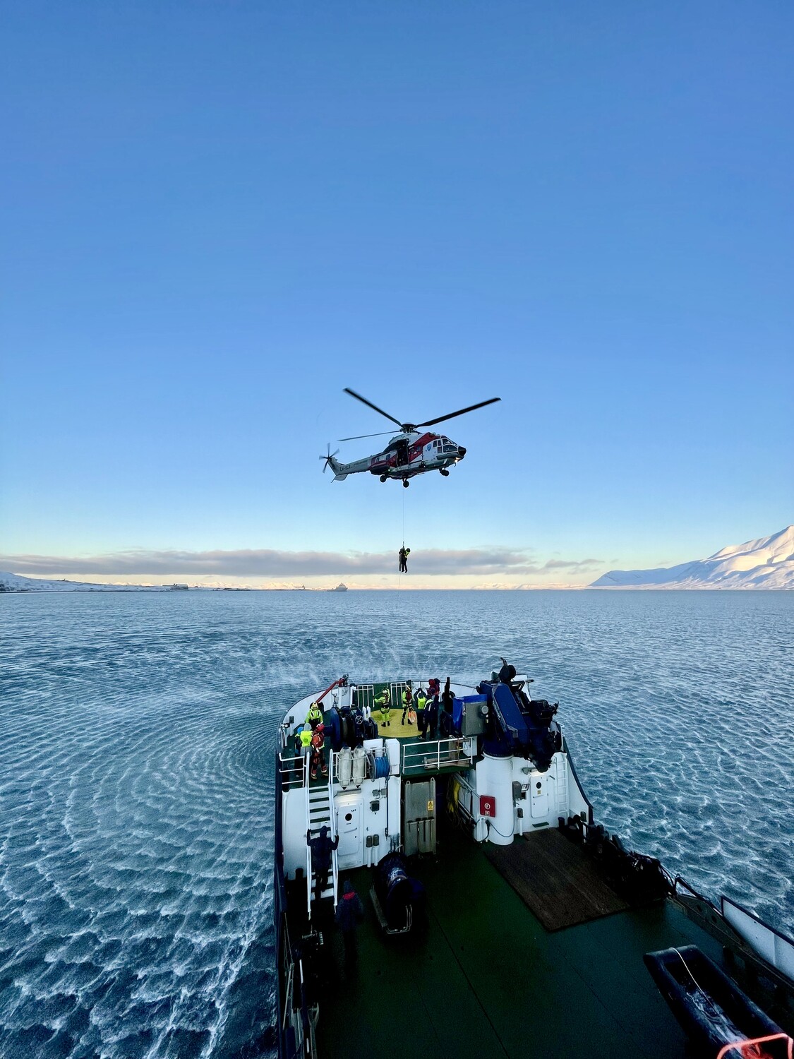 The fast and accurate response enabled the responsible Joint Rescue Coordination Center to quickly launch the rescue operation and scramble the required assets to commence the evacuation. 200 passengers were airlifted over a period of a few hours to an emergency camp.
Content for this news story came from an online article by Pol Novell, Galileo Operations Engineer. Further information is also available on the EUSPA website.


