GNSS (all systems)

November 13, 2017

Esterline CMC Electronics, NovAtel Partner on New Aviation Certified GNSS Receiver

Photo Credit: ssuaphotos/Shutterstock.com

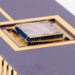
Esterline CMC Electronics and NovAtel Inc. just announced a new strategic partnership, extending their collaboration in Global Navigation Satellite System (GNSS) positioning technology that started in the late 1990s. The partnership will see NovAtel’s industry-leading GNSS measurement technology integrated into a new Esterline CMC-designed multi-constellation, multi-frequency (MCMF) chipset for certified aviation use.

Read More >

By Inside GNSS
[uam_ad id="183541"]

Lawmakers Begin Moving Military Space Management Out of the Air Force

Photo courtesy of GPS.gov.

House and Senate authorizers are forcing a reorganization of the Pentagon’s management of military space programs, giving authority to a soon-to-be-named official to prioritize space budgets across services and setting planning in motion for a possible new department. They also approved spending the full amounts requested for the military GPS programs and mandated that defense officials both test a backup to GPS and look at incorporating European and Japanese GNSS signals into military user equipment.

Read More >

By Inside GNSS
November 6, 2017

Google Releases its GNSS Analysis Tools

Google has announced that its GNSS Analysis Tools have now been released to the public. The GNSS Analysis Tool is a desktop application that takes in raw the GNSS Measurements logged from your Android device as input.

Last year in Android Nougat, Google introduced APIs for retrieving GNSS Raw measurements from Android devices. Recently, the company publicly released GNSS Analysis Tools to process and analyze these measurements.

Read More >

By Inside GNSS

Hudnut to Receive 2017 Ivan I. Mueller Award for Distinguished Service and Leadership

Kenneth Hudnut will receive the 2017 Ivan I. Mueller Award for Distinguished Service and Leadership in December. Photo courtesy of Kenneth Hudnut.

Kenneth Hudnut, a contributing writer and former columnist for Inside GNSS, will receive the 2017 Ivan I. Mueller Award for Distinguished Service and Leadership at the 2017 American Geophysical Union Fall Meeting, to be held December 11-15 in New Orleans, La. The award acknowledges “major achievements in service to and/or leadership within the field of geodesy.”

Read More >

By Inside GNSS
[uam_ad id="183541"]
October 23, 2017

Topcon Announces Upgrade to Smooth Ride Data Collection Software

RD-M1 Collect 2.0 includes updates designed to facilitate and optimize mapping of road conditions. Photo: Topcon.

Topcon Positioning Group recently announced an update to its data collection software for the Smooth Ride resurfacing workflow solution. RD-M1 Collect 2.0 includes updates designed to facilitate and optimize mapping of road conditions.  

The improvements feature an improved interface that is designed to simplify setup and automatically detect the position of the wheel sensor during data collection.

Read More >

By Inside GNSS
October 20, 2017

Sokkia Introduces New Radio Modem for GCX GNSS Receiver Line

Sokkia’s R4S-BT radio modem is designed to offer advanced radio connectivity with GNSS receivers. Photo: Sokkia.

Sokkia has unveiled a new radio modem designed to offer advanced radio connectivity with GNSS receivers — the R4S-BT. The UHF radio solution provides an external option for use with the Sokkia GCX receiver line.

Read More >

By Inside GNSS
October 13, 2017

Air Force Declares First Lockheed Martin GPS III Satellite “Available for Launch”

GPS III SV01 now awaits a call up to begin pre-launch preparations. Photo: Lockheed Martin.

Ushering in a new era of advanced Global Positioning System technology, the U.S. Air Force this week declared the first Lockheed Martin-built GPS III satellite “Available for Launch.”

The Air Force’s “AFL” declaration is the final acceptance of Lockheed Martin’s first GPS III Space Vehicle (GPS III SV01) prior to its expected 2018 launch. GPS III SV01 will bring new capabilities to U.S. and allied military forces, and a new civil signal that will improve future connectivity worldwide for commercial and civilian users.

Read More >

By Inside GNSS

GNSS Technologies and its Applications, GNSS-17

The Nehru Zoological Park is a zoo located near Mir Alam Tank in Hyderabad, Telangana, India. Wikimdeia Commons photo by Bharadwaj Kasula.

The Research and Training Unit for Navigational Electronics and the Department of Civil Engineering, Osmania University, Hyderabad are conducting a 3-day workshop on GNSS.

The main objective of this course is to introduce the basic concepts of GNSS, its applications and its limitations.
This basic course will cover the topics:
• Principle of operation of GPS or any GNSS system
• Architecture of variopus systems including GPS, GLONASS, Galileo, BeiDou and NavIC
• Errors in GPS or GNSS
• Principle of operation and architecture
• Signal structure of GNSSs, DGSPS, augmentation systems, WADGPS
• Applications of GNSS in the areas of Civil Engineering, Aviation, Remote Sensing, Geoinformatics, Forest, Atmospheric and Environmental fields
Participants
Expected participants are working engineers, scientists, academicians, research scholars and students interested to understand the mechanism of GNSS and its applications.

By Inside GNSS
1 93 94 95 96 97 159
IGM_e-news_subscribe