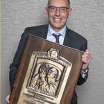
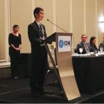
Redesign of Military Space Architecture Includes GPS
In testimony and reports U.S. military officials have been stressing for some time that the GPS constellation is a top target on the hit list of America’s space adversaries.
By Dee Ann Divis
In testimony and reports U.S. military officials have been stressing for some time that the GPS constellation is a top target on the hit list of America’s space adversaries.
By Dee Ann Divis
All the heavy-hitters showed up in late March for the 2019 Munich Satellite Navigation Summit, from the U.S. government’s GPS crew to BeiDou, GLONASS and Galileo, flanked by up-and-coming regional players, including Japan, India and new kid on the block Korea.
By Peter GutierrezEfforts in the realm of electric propulsion have been both steady and cutting-edge. Past, present, and future projects are discussed along with both realized and potential mission benefits arising from this recent technology.
Electric Propulsion (EP) is a class of space propulsion, which makes use of electrical power to accelerate a propellant by different possible electrical and/or magnetic means. The use of electrical power enhances the propulsive performances of the EP thrusters compared with conventional chemical thrusters. Unlike chemical systems, electric propulsion requires very little mass to accelerate a spacecraft.
By Günter W. HeinThe GPS community made real progress during 2018. The first GPS III satellite was launched, the contractor for the GPS IIIF satellites was chosen and work on the new ground system appeared to be on a good track. In addition, after years of waiting, two of three requested Galileo signals were approved for official use in the United States and Congress ordered the building of a backup system for GPS timing.
By Dee Ann DivisOfficials representing the European Union are now publicly advancing the use of EU space assets, including the Galileo satellite-based navigation system, for military purposes. Galileo has traditionally been touted as a purely civil, purely nonmilitary system, but times and circumstances are changing.
The theme of the EU Space Week session Security and Defense was established by the introductory text that appeared in the event’s program: “The development of the European space sector has, from the outset, been linked to security, either that of the Member States or the EU itself.”
By Peter GutierrezThinking Allowed
In the GNSS race launches are often quoted as the main event for the coming year — there won’t be another launch for Galileo until 2020. Despite this, in 2019 new capabilities are going to be introduced that will allow users to profit even more of the unique features offered by the Galileo system. As Galileo Galilei used to say “e pur si muove” (and yet it moves).
By Inside GNSSZheng Yao was born in Beijing and grew up in a house full of books. His parents provided the foundation but didn’t push him in a particular direction. When he was a teenager, a video game changed his course forever. Zheng found his own way in life, ultimately distinguishing himself as an academician, a top-flight GNSS engineer, and as a son, husband and father.
By Peter GutierrezOn October 3, 2018, the Geospatial Data Act of 2018 (GDA) was passed by Congress as part of the Federal Aviation Administration (FAA) Reauthorization Act of 2018. Two days later it was signed into law by the President. The GDA has been well received by the U.S. geospatial community. However, it will be several years before one can determine the impact that it will have on geospatial information management in the U.S.
By Ingo BaumannThe Smart Tachograph (ST), the new revision of the Digital Tachograph (DT), aims to improve safety in the transportation sector by monitoring the behavior of commercial drivers. For this purpose, data from several sensors, including a GNSS receiver, are recorded, processed and cross-validated. In this article, the motion conflict procedure adopted by the ST is reviewed and experimentally evaluated using data collected in light urban and highway environments.
By Günter W. HeinSince last reported in the November/December 2016 issue of Inside GNSS, significant progress has been made to extend the use of Global Navigation Satellite Systems (GNSS) for Positioning, Navigation, and Timing (PNT) in High Earth Orbit (HEO). This update describes the results of international efforts that are enabling mission planners to confidently employ GNSS signals in HEO and how researchers are extending the use of GNSS out to lunar distances.
By Inside GNSSAccurate and reliable timing and synchronization can be an enabler of diverse new applications in datacenters. Accurate clocks across different nodes make possible key functions like consistency, event ordering, causality and the scheduling of tasks and resources with precise timing. In this article the authors take a close look at scalable and traceable time for datacenters using GNSS and White Rabbit.
By Inside GNSSBLUEGNSS is a project developed in the framework of the Horizon 2020 (H2020) program involving four ANSPs of different European countries (Italy, Cyprus, Greece, and Malta) plus one industrial partner, IDS (Ingegneria Dei Sistemi). The project objective is to harmonize the implementation of PBN approach operations among the BLUE-MED FAB States. This article provides an overview of the phases required to reach this goal and focuses on GNSS performance assessment as recommended by ICAO.
By Inside GNSSSnapshot positioning is a technique for determining the position of a Global Navigation Satellite System (GNSS) receiver using only a very brief interval of the received satellite signal, where the sampling time can be more than 100 milliseconds (ms) or even down to as little as 2 ms. In comparison, a conventional GNSS receiver may require anywhere between a few and tens of seconds of signal tracking before it is able to compute its first position.
By Mark Petovello