February 5, 2021
Trimble GNSS/Inertial Gets Behind the Wheel for Autonomous Racing
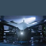
An international autonomous racing series with electric-powered vehicles will use Trimble’s Applanix POS LVX GNSS-inertial systems in all of its next-generation autonomous race cars in 2021, as part of an extensive technology and marketing partnership.
By Inside GNSS