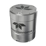
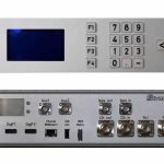
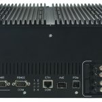
PNT Archives - Page 22 of 22 - Inside GNSS - Global Navigation Satellite Systems Engineering, Policy, and Design

PNT

November 30, 2017

Army Launches 5-Year PNT Technology R&D Program

The Army is kicking off a wide-ranging, five-year research effort to develop new position, navigation and timing (PNT) technologies for battlefield use.

The goal is to overcome technical barriers in a wide range of areas and military officials are offering to fund multiple, and even multi-phase, cost-plus-fixed-fee (CPFF) efforts to do that. The work may range from studies and analysis to development work that results in the production of a prototype-style deliverable or breadboard and/or a demonstration.

Read More >

By Dee Ann Divis
September 26, 2017

Ensuring PNT for All

Today’s headlines frame my thoughts about securing GNSS assets, which one expert has characterized as our “least visible and most vulnerable infrastructure.”

Read More >

By Inside GNSS
[uam_ad id="183541"]
June 13, 2017

Third Edition of GPS/GNSS Book Now Available from Artech House

Photo source: Artech House.

Artech House has announced the publication of Understanding GPS/GNSS: Principles and Applications, Third Edition by Elliott D. Kaplan and Christopher J. Hegarty. This thoroughly updated third edition of an Artech House bestseller brings together a team of leading experts providing a current and comprehensive treatment of GNSS that readers won’t find in other resources.

Read More >

By Inside GNSS
November 20, 2016

GPS PNT Enhances GOES-R Space Weather Satellite Mission

GOES-R primary capabilities. NOAA image

A United Launch Alliance (ULA) Atlas V rocket carrying the Geostationary Operational Environmental Satellite R-series (GOES-R) for National Aeronautics and Space Administration (NASA) and National Oceanic Atmospheric Administration (NOAA) lifted off from Cape Canaveral Air Force Station, Florida, yesterday (November 19, 2016) headed for geosynchronous orbit.

Read More >

By Inside GNSS
November 13, 2016

Navigating in Space

Figures 1 & 2

Spacecraft in low Earth orbit (LEO), at altitudes below 3,000 kilometers, remain within the main Global Positioning System (GPS) signals’ Earth coverage. Spacecraft employing GPS at these altitudes enjoy signal availability and navigation and timing performance emulating that of terrestrial users.

Read More >

By Inside GNSS
[uam_ad id="183541"]
March 18, 2016

GLONASS and PNT in Russia

The legal and regulatory framework of the Russian Federation covers not only the GLONASS system, but the country’s overall positioning, navigation and timing (PNT) system as well.

The term PNT is a synonym for navigation activities as defined in the Federal Law on Navigation Activities. The PNT system in the Russian Federation is defined as the combination of administrative and technical means that provide spatial and time data to all user groups, with GLONASS as a key element.

Read More >

By Ingo Baumann
November 14, 2012

Navipedia — The GNSS Wiki

Javier Ventura-Traveset introduces Navipedia at the Munich Satellite Navigation Summit on March 14, 2012. He is responsible for managing Navipedia’s development as well as GNSS education activities for ESA.

Working Papers explore the technical and scientific themes that underpin GNSS programs and applications. This regular column is coordinated by Prof. Dr.-Ing. Günter Hein, head of Europe’s Galileo Operations and Evolution.

In the last 30 years, satellite navigation applications have grown in number and kind, entire new systems have emerged, and existing systems have modernized.

Read More >

By Inside GNSS
1 20 21 22
IGM_e-news_subscribe