
January 30, 2024
Coping with Dynamics Using Bicomplex Numbers and Kalman Filter Tracking
A look at recent testing and the advantages of using KF tracking to process GNSS meta-signals.
By Daniele Borio and Melania SusiGlobal Navigation Satellite Systems Engineering, Policy, and Design
A look at recent testing and the advantages of using KF tracking to process GNSS meta-signals.
By Daniele Borio and Melania Susi
Qualinx, a company specializing in ultra-low power wireless tracking and connectivity semiconductors, has announced a partnership with the European Union Agency for the Space Programme (EUSPA). This collaboration, under the Fundamental Elements EU R&D funding mechanism, aims to develop a consumer-grade, low-power GNSS receiver for EUSPA’s GNSS authentication service.
By Inside GNSS
On January 18 2024, the 2023 update of the European Radio Navigation Plan was made available online in five languages. The publication is a European Commission Staff Working Document, written by The Directorate-General for Defence Industry and Space (DG DEFIS), in cooperation with the Joint Research Centre (JRC), the European Commission’s science and knowledge service.
By Inside GNSS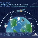
The Munich Satellite Navigation Summit, set to take place from March 20 to 22, 2024, has announced “GNSS Meets Friends in New Orbits – Potentials and Synergies!” as its theme. This event, which will be held both on-site and as a hybrid conference, is poised to delve into the evolving landscape of satellite navigation and its integration with other space-based technologies. Registration information for the in-person or virtual tracks can be found on the conference website.
By Inside GNSS
The Institute of Navigation (ION) has recognized distinguished professionals in the field of positioning, navigation, and timing (PNT) with its prestigious 2023 Annual Awards. The awards were presented during the International Technical Meeting (ITM) and Precise Time and Time Interval (PTTI) Systems and Applications Meeting, held in Long Beach, California, from January 22 to 25, 2024.
By Inside GNSS
Point One Navigation, a company specializing in precision positioning, has announced the expansion of its Polaris Real-Time Kinematic (RTK) location network to South Korea. This development aims to provide businesses and application developers in the region with centimeter-accurate location data for their projects.
By Inside GNSS
The IGNSS Association’s 2024 conference in Sydney, Australia is taking place from February 7-9 at the University of New South Wales (UNSW). With the theme of “Celebrating 50 Years of GNSS and Navigating the Next 50”, the conference will bring together experts, policy makers and emerging leaders in GNSS technology, products, and services to examine the latest advances, present cutting edge research and discuss policy, market development and infrastructure.
By Inside GNSS
The 14th Multi-GNSS Asia (MGA) Conference is taking place from January 30 – February 2 at Mae Fah Luang University, in Chiang Rai, Thailand, as well as online for virtual attendees. Multi-GNSS Asia (MGA) is an organization that promotes multi GNSS in the Asia and Oceania regions and encourages GNSS service providers and user communities to develop new applications and businesses.
By Inside GNSS
GMV and Astroscale UK have embarked on a new project under the European Space Agency’s (ESA) CREAM (Collision Risk and Automated Mitigation) cornerstone, with a focus on transforming satellite collision avoidance through the use of the Galileo Signal-in-Space (SiS) capabilities.
By Inside GNSS
BlueSpace.ai, a Silicon Valley-based company specializing in off-road and unstructured autonomy, made its debut at CES 2024 with the unveiling of its Assured Positioning, Navigation, and Timing (A-PNT) solution, showcasing how artificial intelligence (AI) can enhance navigation precision in GPS-denied and GPS-degraded environments for both manned and unmanned vehicles.
By Inside GNSS
Viasat, a global communications company (NASDAQ: VSAT), led a successful demonstration of the UK Satellite Based Augmentation System (UK SBAS) during a recent test flight. This demonstration, conducted as part of an ongoing trial funded by the Department for Transport through the European Space Agency (ESA), showcased the potential of UK SBAS to provide highly accurate GPS data, promising improved safety and operational efficiency.
By Inside GNSS
u-blox (SIX:UBXN), a global leader in positioning and wireless communication technology, has joined forces with Nordian, a US precision location technology company, to extend the coverage of the PointPerfect Global Navigation Satellite System (GNSS) correction service to Brazil. This collaboration brings an unmatched and affordable high-precision solution to the promising Brazilian market for GNSS applications.
By Inside GNSS
Septentrio has introduced the AntaRx smart antenna, catering to machine automation needs in industries such as construction, precision agriculture, and logistics. The smart antenna is housed in a rugged casing, designed to endure shocks and vibrations in challenging industrial environments. The multi-frequency receiver aims for high-accuracy RTK positioning down to the centimeter level.
By Inside GNSS