B: Applications

Enhancing the Future of Civil GPS: Overview of the L1C Signal

The Global Positioning System is undergoing continual modernization, providing ongoing improvements for users worldwide. Although various enhancements in system features have been under development since the mid-1990s, modernization first benefited civil users when Selective Availability — a security-motivated technique for “dithering” the open L1 signal to reduce positioning accuracy — was set to zero in May 2000.

The Global Positioning System is undergoing continual modernization, providing ongoing improvements for users worldwide. Although various enhancements in system features have been under development since the mid-1990s, modernization first benefited civil users when Selective Availability — a security-motivated technique for “dithering” the open L1 signal to reduce positioning accuracy — was set to zero in May 2000.

Subsequently, other improvements in accuracy have been obtained through enhancements to the capabilities and operation of the control and space segments, still based on the original set of GPS signals.

The launch of the IIR-14(M) (modernized replenishment satellite) in 2005 began a new era with transmission of the L2 civil (L2C) signal, along with the modernized military M-code signal. A third civil signal, called L5, will be transmitted from Block IIF satellites.

All the while, improvements in monitoring, satellite technology (for example, the on-board atomic clocks) and operations yield continuing increases in accuracy. The United States plans to continue providing these capabilities free of user fees. It will continue to complement this pricing policy by providing free and open signal descriptions and other technical information needed for development of receivers and services using civil signals.

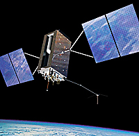
In the meantime, development of the next generation of satellites, called GPS III, and a modernized control segment (OCX) continues, which will lead to greatly enhanced capabilities beginning early in the next decade. An integral part of the GPS III capabilities being developed is a new civil signal, called L1C, which will be transmitted on the L1 carrier frequency in addition to current signals.

Approximately one year ago, the U.S. Air Force released the initial draft of Interface Specification IS-GPS-800, describing L1C. Novel characteristics of the optimized L1C signal design provide advanced capabilities while offering to receiver designers considerable flexibility in how to use these capabilities.

The development of L1C represents a new stage in international GNSS: not only is the signal being designed for transmission from GPS satellites, its design also seeks to maximize interoperability with Galileo’s Open Service signal. Further, Japan’s Quazi-Zenith Satellite System (QZSS) will transmit a signal with virtually the same design as L1C.

L1C has been designed to take advantage of many unique opportunities. Its center frequency of 1575.42 MHz is the pre-eminent GNSS frequency for a variety of reasons, including the extensive existing use of GPS C/A code, the lower ionospheric error at L1 band relative to lower frequencies, spectrum protection of the L1 band, and the use of this same center frequency by GPS, Galileo, QZSS, and satellite-based augmentation system (SBAS) signals for open access service and safety-of-life applications.

Other unique opportunities that the L1C design leverages include advances in signal design knowledge, improvements in receiver processing techniques, developments in circuit technologies, and enhancements in supporting services such as communications. The L1C design has been optimized to provide superior performance, while providing compatibility and interoperability with other signals in the L1 band.

L1C provides a number of advanced features, including: 75 percent of power in a pilot component for enhanced signal tracking, advanced Weil-based spreading codes, an overlay code on the pilot that provides data message synchronization, support for improved reading of clock and ephemeris by combining message symbols across messages, advanced forward error control coding, and data symbol interleaving to combat fading.

The resulting design offers receiver designers the opportunity to obtain unmatched performance in many ways.This article will give an overview of the L1C signal design, highlighting the features that will benefit receiver designers and, ultimately, end users. The following section provides background on L1C and its design process, from its beginnings in 2003.

Subsequent sections then provide an overview of the signal structure, details of the signal’s spreading codes and overlay codes, spreading modulation, data message structure, and encoding and decoding of message information.

Summary of Benefits
Although more complete details are provided in IS-GPS-800, we will outline the most significant characteristics here.

L1C has been designed with unique, innovative, and powerful new features to enhance its robustness for all users, especially in difficult environments.

The signal structure alone, with the spreading code and the overlay code, provides exact GPS time, modulo 18 seconds. Alignment to the spreading code provides bit synchronization and alignment to the overlay code provide frame synchronization, making these receiver functions simple and robust.

For high-precision (e.g., survey) use, the pilot carrier removes the half cycle phase ambiguity, and the larger RMS bandwidth of the new spreading modulation has the potential to improve tracking performance, especially multipath mitigation. With the combination of improved carrier tracking of the pilot component, segmentation of clock and ephemeris in the data message, and FEC design, an autonomous navigator can demodulate the satellite clock and ephemeris whenever the signal can be tracked.

The improved cross-correlation of the new codes will also improve the performance of high-sensitivity receivers. Performance will also improve as a result of the new message format that allows code combining across satellites for the TOI and code combining of the near constant sub-frame 2 ephemeris data across multiple frames. International collaboration and outreach have assisted in producing a truly international signal with capabilities that will serve users for decades to come.

For the full article, including figures, graphs, and additional resources, download the PDF above.

By
[uam_ad id="183541"]
March 2, 2007

More Perils for Galileo . . . and Other GNSS Dramas

A convergence of developments over the past few months has brought Europe’s Galileo program to the most critical passage of its history — at least, since final approval of the GNSS initiative by the European Space Agency (ESA) and the European Union (EU) in 2003 and 2004, respectively.

Read More >

By Inside GNSS
March 1, 2007

The Promise of MEMS to the Navigation Community

GPS clearly dominates the current market in positioning and navigation (POS/NAV). Besides being globally available, it provides the whole range of navigation accuracies at very low cost. GPS is also highly portable, has low power consumption, and is well suited for integration with other sensors, communication links, and databases.

GPS clearly dominates the current market in positioning and navigation (POS/NAV). Besides being globally available, it provides the whole range of navigation accuracies at very low cost. GPS is also highly portable, has low power consumption, and is well suited for integration with other sensors, communication links, and databases.

At this point in the development of navigation technology, the need for alternative positioning systems only arises because GPS does not work in all environments. Current GPS receiver chips are reaching a unit price of about $5, and the predictions are that this figure will drop to about $1 when, most likely, it will level off.

Module cost is not equivalent to system cost, but the recent development of receivers at a price of $100 shows clearly that module costs are an important factor, not only in consumer mass markets, but also for high-volume commercial products, such as asset and container tracking.

Even more important is the fact that with unit cost that low, GPS is becoming a commodity, comparable to a Sony Walkman, pocket calculators, or a digital wristwatch. Thus, personal GPS devices will drive the module market and provide navigation receivers of high versatility at even lower cost.

Considering these price trends, can any POS/NAV technology be competitive with GPS?

At this point the answer is clearly in the negative. Therefore, other navigation technologies would typically be developed for “non-GPS” environments, that is, for environments in which GPS does not function at all (underground, underwater, in buildings) or where it performs poorly (forested areas, urban environments). Although a substantial navigation market for operating in “non-GPS” environments exists, it is much smaller than the one predicted for GPS.

In the portion of the market where GPS is only available for part of the time, the question will be, “How much is the user willing to pay for a continuous navigation solution?” This obviously will depend on the specific application, and it might be possible that niche markets will develop around such applications.

In such applications, integrated solutions will be of high interest and may involve sensor integration as well as data base integration for techniques such as map matching. In those applications where GPS does not work at all, the search for cost-effective alternatives will continue.

One promising development is the emergence of micro-electromechanical systems (MEMS) technology (also known as micromachined technology). MEMS is an enabling technology with a massive global market volume worth $12 billion in 2004 and is expected to reach $25 billion in 2009 (Source: “NEXUS Market Analysis for MEMS and Microsystems III, 2005-2009”). This means that, overall, MEMS technology will be much larger than the market size of GPS at that time.

A small portion of this MEMS market will support inertial sensor technology. Yole development estimated that the world markets for MEMS-based inertial sensors have reached almost $0.7 billion in 2004 and will exceed $1 billion in 2008. The major growth opportunities will come from automotive and consumer application markets, with a steady growth of the industrial and defense business, too. (Source: World MEMS Inertial Sensor Markets, Research Report # YD4264, Yole Development, April 2005).

Since INS technology is capable of working in all environments where GPS has difficulties, MEMS inertial technology is seen as both a possible complement of GPS technology and a potential alternative to GPS is market volumes develop in the way anticipated. The idea of an “inertial measurement unit (IMU) on a chip” and unit cost as low as GPS modules are anticipated in the very near future.

(For the rest of story, tables, graphs and formulas, please download the complete article using the PDF link above.)

By
January 31, 2007

Trimble Acquires @Road, Spacient

Trimble of Sunnyvale, California, has entered into a definitive agreement to acquire publicly held @Road, Inc. of Fremont, California, and has purchased privately held Spacient Technologies, Inc. of Long Beach, California.

Read More >

By Inside GNSS

RTK Precise Positioning

Calgary, Alberta, Canada’s NovAtel Inc. offers a new real-time kinematic (RTK) positioning solution, known as AdVance RTK, designed to enhance the precision and performance of the company’s OEMV family of GNSS receiver boards.

Read More >

By Inside GNSS
[uam_ad id="183541"]

GPS Block III Contracts

The U.S. Air Force has awarded two $50 million contracts to Boeing and Lockheed Martin to execute a system design review for the next-generation GPS space segment program, GPS Block III.

The contracts come on the heels of both companies successfully completing system requirements reviews in November 2006. Those reviews, part of a $10 million follow-on order to a Phase A Concept Development Contract awarded in 2004, assessed Boeing’s and Lockheed’s ability to mitigate development and delivery risks associated with building the Block III satellites.

Read More >

By Inside GNSS
January 1, 2007

Rescue Mission: GPS Applications in an Airborne Maritime Surveillance System

Maritime search and rescue (SAR) operations do not fit the usual and customary operational modes for aircraft operations. Consequently, neither do their navigation and flight management system (FMS) requirements.

Maritime search and rescue (SAR) operations do not fit the usual and customary operational modes for aircraft operations. Consequently, neither do their navigation and flight management system (FMS) requirements.

SAR missisions are not based on schedules but rather on ad hoc events and flights. Once the mission control center receives word of an accident (ship disaster, aircraft crash, etc.), an aircraft receives a mission order and begins a high-speed ferry flight to the area of concern. After arrival in the area of the incident, the aircraft typically performs a low-altitude (500 to 1,500 feet), low-speed search flight to locate survivors and the vessel.

In executing this search, the crew employs a suite of surveillance radars, electro-optical sensor, and scanning and direction finding equipment to localize  transmissions of emergency beacons that may have been activated during the accident. Once the target (person, ship, aircraft) is found, the crew drops needed equipment, such as life rafts or pumps, out of the aircraft.

The target position and other details are reported to the mission control center in order to initiate further rescue activities. All of these activities require precise navigation and sensor control, which may be obtained by a number of GNSS/GPS applications on board the aircraft.

This article describes an airborne surveillance system, AeroMission, developed by Aerodata AG, and the GPS/inertial navigation system (INS) that supports its operation.

In addition to SAR missions, AeroMission is also suitable for maritime surveillance, border and anti-smuggling patrols, pollution detection and mapping, fishery control, offshore oil field monitoring, and research applications.

System Overview
AeroMission has been developed to provide high reliability, redundancy, and efficiency. It was designed using modular architecture and state of the art technology.

In supporting AeroMission, an integrated GPS/IMU navigation system — AeroNav — combines the GPS advantages of long-term stability and absolute accuracy with those of inertial navigation — short-term accuracy during phases of high dynamics in which GPS positioning may be lost or degraded.

A separate GPS/INS system also provides attitude reference by using strapdown algorithms providing position and velocity solutions. Turn rates and accelerations given by the IMU are corrected by the GPS pseudorange measurements. These corrections are calculated by a Kalman filter.

The basic system components include:
•    surveillance radar (using the separate GPS-supported INS)
•    forward-looking infrared (FLIR) sensor (using GPS services provided through AeroNav)
•    infrared/ultraviolet (IR/UV) scanner (using a dedicated GPS-supported INS)
•    Mission management and guidance system (using GPS services through AeroNav)
•    SAR Homing Device
•    HF, VHF, UHF, and satellite communication
•    Intercom including communication relay
•    Photo/video camera
•    Ergonomic operator work stations

Other sensors such as side-looking airborne radar or microwave radiometer can be integrated as options into the suite.

. . .

Sensor Suite
In addition to the navigation system, moving map display, system software, and databases, AeroMission incorporates a number of additional sensors to aid its surveillance and reporting functions.

  • Surveillance Radar . . .
  • Electro-optical/infrared sensor . . .
  • AIS and direction finding . . .

. . .

Mission Management
TheAeroMission management suite is an integrated solution that consists of equipment and software for sensor operation and control; sensor data gathering, storage, and evaluation; mission reporting, and communications control and recording.

. . .

Flight Deck Interface
The mission system has a number of interfaces to the flight deck in order to support the mission and decrease the work load of both the cabin crew and the flight deck crew.

. . .

System Qualification and Certification
The qualification and certification process for the project was quite challenging. All modifications of the airframe have been certified through a Supplemental Type Certificate (STC) approved by European Aviation Safety Agency.

. . .

Operational Experiences
During the test flights and also during the first 10 months of operations, AeroMission installed in a DO 328 aircraft has demonstrated its reliability and efficiency with an overall service availability of more than 99 percent . . .

For the complete story, including figures, graphs, and images, please download the PDF of the article, above.

By

GPS: Launches of Satellites and Institutional Initiatives

Successful launch of the second modernized Block IIR satellite, IIR-15(M2), on September 25 and scheduling of another IIR-M launch on November 14 underlines recent progress in the GPS program.

IIR-15(M2), also identified by its space vehicle number (SVN58) and pseudorandom code number (PRN31), will be placed into orbital plane A, slot 2. The U.S. Air Force has designated the satellite to be launched in November as GPS IIR-16/M3, PRN15/SVN55.

Read More >

By Inside GNSS

Correlators for L2C

The term “Correlator” is often used in discussions of GPS and GNSS receiver design. It has been used to describe devices as simple as a single exclusive OR gate through to complete “baseband” chips that include a microprocessor.

Most usually, and in this article, the term describes the hardware or software that produces all of the required correlation data for a single signal from a specific GNSS satellite signal. This is also sometimes termed a “channel.”

With the open GPS civil signal at the L2 frequency (L2C) now becoming available on Block IIR-M satellites, receiver designers have the opportunity to work with a markedly different GNSS signal resource. The first IIR-M spacecraft (designated SVN53/PRN17) was launched September 25, 2005, and the second is scheduled to go into orbit on September 14, 2006. (IIR-Ms also transmit the new GPS L1/L2 military (M-code) signal, but we will not treat this issue here.)

Against that historic backdrop, then, this article examines some of the novel elements of the L2C signal and its implications for GNSS receiver correlators. Our focus will be on a technically challenging aspect of receiver operation: initial acquisition of the signal and its processing by the correlator.

But first we will review some of the key functional aspects of GNSS correlators and some of the signal parameters that affect their operation.

. . . We can more easily explain the role of a correlator if we examine its two functions separately. In a GNSS receiver, correlation is used in two distinct activities:

Acquisition. Before the receiver knows whether it can receive a certain satellite’s signal, it must “search” for it using the correlation in an ordered but relatively indiscriminate way. Effectively, many correlation trials are run for each of many code delays and Doppler frequency offsets.

Tracking. Once acquired, the receiver must still despread the received signal in order to receive data and measure pseudoranges. Several correlators are usually used to keep the local code as closely aligned to the received code as possible. To do this, a “delay-locked loop” is used, with the correlators operating within the loops, some typically ahead of the received code (“early”) and some behind (“late”).

In other words, correlation is used both to “get” the signal and to “keep” it. These actions should be considered quite separately. In this article, we concentrate on the acquisition process.

. . . Various signal parameters affect correlation. These are listed for the three GPS signals in Table 1. Both L2C and L5 have dataless sub-signals which are time-multiplexed (CM and CL) and in quadrature (I5 and Q5), respectively. Both use longer codes than L1, while L5 has a higher chipping rate. L5 also has the added complication of Neuman-Hoffman codes, which will not be further discussed here.

. . . Correlation Signal “Shape” – the L1 civilian C/A-code signal is a single BPSK modulation. Despite the fact that the L2C signal is also BPSK, it introduces another layer of complexity by having the data-carrying and dataless signals multiplexed in time. Typically, the shorter (20-millisecond) data-carrying CM code will be acquired first, then the receiver would hand over to the longer (1.5-second) dataless CL code for tracking.

. . . The beauty of the exploitation of the circular convolution is that the code in the data does not need to be well aligned with the stored data— the whole point of acquisition, after all, is to perform this alignment. So, if the CM code was chopped up into pieces smaller than 20 milliseconds, this circular convolution would no longer reflect the time domain correlation, and a receiver would need to have many stored codes.

. . . Many GPS chipsets are optimized for operation in mobile telephone handsets and, as such, are aimed at minimizing the drain on handset batteries. For such applications, the large L2C acquisition overhead presents a serious problem . .

Conclusion
In this article, we have primarily examined the implications of signal acquisition for the new L2C signal. In a typical L2C-only receiver, significantly more effort is required to acquire the signal than is the case for L1 C/A code: more than 200 times higher in the hardware case and more than 500 times higher in the software case. However, because the long CL code does not carry any data, it can be used for the long integrations required for acquisition in a weak-signal environment.

For the complete story, including figures, graphs, and images, please download the PDF of the article, above.

Acknowledgments
The author wishes to acknowledge the useful suggestions made by Eamonn Glennon of Signav Pty Ltd.

By
September 1, 2006

BOC or MBOC? Questions and Answers

Global navigation satellite systems are all about timing. In a narrow sense, GNSS is technically a matter of how long the satellite signals take to reach a receiver. In a larger sense, it’s about designing global infrastructure systems that may not produce practical benefits for 5, 10, even 15 years or more.

During that time, a lot can happen. Technology changes. Electronics get more powerful and cheaper.

But GNSS equipment manufacturers and receiver designers live in the here and now. They face today’s challenges with today’s technology: how to receive signal indoors, under tree canopy, in urban canyons. How to get the most robust tracking capability out of a receiver — the most accurate, the most available capabilities.

And to accomplish these things at a price that prospective customers in the marketplace will see as offering true value.

Will the common civil signal be the binary offset carrier, or BOC(1,1) waveform as stated in a 2004 agreement between the United States and the European Union? Or, will it be the multiplexed BOC (MBOC) signal recommended by a technical working group set up under that agreement to examine further refinements to the design?

The signal decision involves benefit trade-offs for different types of GNSS receiver designs and will have widespread consequences for the products developed over the next 10, 20, or even 30 years.

Although the math and science underlying the discussion may seem esoteric, there’s nothing abstract or theoretical about the consequences of the decision. The selection of a common GPS/Galileo civil signal will profoundly shape the user experience, the engineering challenges, the business prospects and strategies of GNSS manufacturers and service providers, and even the political relations among nations for decades to come.

Our series started in the May/June issue with a “Working Papers” column that introduced the MBOC spreading modulation. Earlier this year, the GPS-Galileo WorkingGroup on Interoperability and Compatibility recommended MBOC’s adoption by Europe’s Galileo program for its L1 Open Service (OS) signal and also by the United States for its modernized GPS L1 Civil (L1C) signal. The Working Papers column discussed the history, motivation, and construction of MBOC signals. It then showed various performance characteristics that the authors believe demonstrate MBOC’s superior performance and summarized their status in Galileo and GPS.

The May/June column also noted, “The United States is willing to adopt for GPS L1C either the baseline BOC(1,1) or the recommended MBOC modulation, consistent with what is selected for Galileo L1 OS.” Given this impartial U.S. government position, Inside GNSS believed it would be appropriate and useful to ask a panel of GNSS industry representatives their thoughts on the subject of a common civil GPS/Galileo signal waveform.

In the July/August issue of the magazine, therefore, in an article introduced by Tom Stansell, nine technology specialists from leading GNSS manufacturers began the discussion of technical alternatives, implications for receiver design, and significance for the products that reach the marketplace.

This month four more GNSS receiver designers join the manufacturers dialog, bringing the total to 13 panelists representing the perspectives of 8 manufacturers — CMC Electronics, Japan Radio Company, NavCom Technology, Nemerix, NovAtel, Qualcomm, Rockwell Collins, and SiRF Technology — and 3 independent consulting engineers. Their biographies follow, along with their verbatim answers to questions posed by Inside GNSS.

(In the sidebar, “Old Questions, New Voices,” at the end of this article, we present the responses of our four latest panelists to the five questions answered in Part 1 of the series. The complete article, as well as the May/June “Working Papers” column, can be found on the Inside GNSS website at https://www.insidegnss.com/mboc.php.)

We also invited the authors of the original MBOC design recommendation to respond to the entire manufacturers dialog, an invitation that we made to the GNSS community in general — and one that still remains open. Their response immediately follows this article (see below). Javad Ashjaee, president and CEO of Javad Navigation Systems who has been designing GNSS receivers for 30 years, also submitted some comments on the panelists’ discussion, which appear in this section as well.

In Part 2 of the Manufacturers Dialog on BOC and MBOC presented here, the panelists discuss performance of narrowband and wideband receivers under weak signal and multipath conditions and offer their opinions on the best signal option.

The Questions and Answers

Q: Would you expect any performance difference for your products if MBOC code is transmitted instead of BOC(1,1)?

Fenton – Yes, depending on the exact MBOC option used, we would expect between 21 percent to 33 percent reduction in code tracking error due to the increased effective chipping rate and a significant improvement in the detection and correction of close-in multipath interference.

Garin – Compared to a theoretically achievable performance with BOC(1,1) only, we would lose performance. Compared to the competition who will have to deal with the same signals in space, we won’t be at a disadvantage.

Hatch/Knight – We expect a modest improvement in multipath mitigation under moderately weak signal conditions, such as under foliage.

Kawazoe – We do not expect any advantage from MBOC.

Kohli/Turetzky – The biggest difference we would see would be in the availability due to the lower signal strength. However, it’s the same for everyone and if the benefit of higher accuracy for some applications is deemed to be of higher importance, we can still build a very high performance receiver on the MBOC signal.

Sheynblat/Rowitch – It is difficult to quantify the impact on indoor and urban canyon positioning accuracy due to a loss of 1 dB of sensitivity. However, it is straightforward to conclude that for successive sensitivity losses in 1 dB steps, measurement yield will also decrease in corresponding steps, eventually falling below the threshold for a successful GPS fix. This has a noticeably negative impact on the user experience for consumer and business applications. As an example, in some indoor signal scenarios we have seen 1 dB of improved sensitivity deliver an additional 20 percent improvement in successful fix rate.

Stratton – As stated earlier, we expect that we would obtain lower levels of multipath under ideal conditions, but the broader impact in off-nominal conditions requires further study. We do not anticipate a difference in user operational benefit for either choice.

Studenny – We prefer high performance signals and simple receiver architectures. Please note that developing an aviation receiver that uses BOC or MBOC will require the same development funds. As far as MBOC goes, we would take advantages of it.

Weill – Let’s consider Galileo signals as an example. When multipath is present, an MMT-equipped wideband receiver using a Galileo BOC(1,1) pilot with a total signal (data + pilot) E/No of 45 dB-Hz-sec and a secondary path 6 dB below the direct path can theoretically produce a worst-case RMS range error of about 63 centimeters at a secondary path delay of about 1.5 meters (the RMS error is over random secondary path phases). This peak error is reduced to about 50 centimeters using a TMBOC-50 pilot, which is a 21 percent reduction. For both signal types the error falls off rapidly at increased secondary path delays. At a path delay of 10 meters these RMS errors decrease to 25 centimeters and 18 centimeters, respectively. At path delays above 20 meters the errors approach those of a multipath-free signal, about 14 centimeters and 9 centimeters, respectively (essentially reaching the Cramer-Rao bounds for error due to thermal noise). In this region the TMBOC-50 signal gives about 33 percent less RMS error than BOC(1,1).

Q: A narrower bandwidth receiver designed for BOC(1,1) will be able to use only about 87.9 percent of the total power in the GPS MBOC pilot carrier or 81.8 percent of the total power in the Galileo MBOC pilot carrier (TMBOC-50 version). Do you see this as a disadvantage in any applications, especially in products/services provided by your company? If so, which ones?

Fenton – In the case of the GPS or Galileo MBOC, the effect of a 12 percent (or 18 percent in the case of Galileo) loss of signal strength would result in a 7 percent and 11 percent increase in RMS tracking error respectively. For example, if the RMS code tracking error of a channel locked to a narrow-band BOC(1,1) signal was 30 centimeters, then the expected tracking errors of the same hardware locked to the respective MBOC signals would increase to 32.1 and 33.3 centimeters assuming all other variables remained the same. We do not see this as being a significant disadvantage. The lower signal level will also slightly extend satellite acquisition times and time to first fix.

Garin – The disadvantage will be minor, at this level, as the fading effects are much more important than the absolute signal power. On the other side, the advantage will be immaterial for our current market. Nevertheless, we support the introduction of MBOC, as the theoretical penalty is minor, and the practical one will be insignificant.

Hatch/Knight – It is not likely that our company will build a narrowband receiver.

Kawazoe – We expect 12.1 percent and 18.2 percent power loss will not cause any serious problems. However, we would like BOC(1,1) to be adopted rather than MBOC for simple and compact design of GPS receivers.

Keegan – Signal level is sensitivity, and sensitivity is a significant part of consumer GPS. So, I believe that this 0.6 dB (or 0.9 dB) is more of an issue with consumer sets than high precision sets. However, in current consumer applications there are many places where architectural improvements would increase the signal-to-noise ratio (SNR) by more that these amounts, such as better antenna technology, more optimum signal sampling (sample rate and quantization), closed loop processing, etc. However, every dB is important.

Kohli/Turetzky – In general, we fight for every tenth of a dB in every aspect of our system design. Giving up 1 dB in transmitted signal power is a concession, but will be mitigated by other processing gains. One dB will translate into additional penetration in a building. This can make a measurable difference in availability at the consumer level.

Stratton – It is not directly a disadvantage. We will produce receivers that utilize every waveform that adds value to our markets. The key factor for us is whether our users would achieve operational benefits by using modernized signals, and we do not perceive a difference in user benefit between these two alternatives.

Studenny – We develop wideband receivers and maximize performance as required. We would use all available signals in the most effective manner possible.

Weill – With today’s technology, a narrowband design is required in applications where the receiver must have low cost and low power consumption. If it must also be capable of operating in poor signal environments, the provider of such a receiver is likely to believe that every decibel counts and therefore be in favor of a BOC(1,1) signal with its lower RMS bandwidth making all of the signal power useable. On the other hand, I would argue that it will probably take a decade to make MBOC signals available, and in that time improved technology is likely to make low-cost, high bandwidth receivers a reality. One must also take into consideration that if satellites without MBOC signals are launched, it will be a long time until the next opportunity to improve signal characteristics.

Q: If your receivers predominantly are narrowband now, do you believe your customers would benefit from wider bandwidth receivers with better multipath mitigation capabilities? Why or why not?

Fenton – The customers of our narrowband receivers would benefit from multipath mitigation capabilities. However the priority of these customers is cost rather than accuracy. It is more important for them to have a lower unit cost than advanced multipath mitigation technologies. However due to Moore’s law, by the time these signals are available, the cost of adding the increased signal processing to achieve better multipath mitigation may be tolerable.

Garin – Our today’s typical user will marginally benefit from the widening of bandwidth, when it will be technically and commercially feasible, mainly in line of sight conditions, that still represents a non negligible percentage of the conditions.

Kawazoe – Our customers wouldn’t benefit from wider bandwidth because multipath error is reduced with dead reckoning sensors, and the largest position errors occur when only non-direct signals are received, such as in areas with tall buildings.

Keegan – The main drivers for Consumer (or narrowband) receivers are cost and power and not accuracy in all but the most demanding environments such as indoors or in urban canyons, in which case improved performance is a desire as long as it does not grossly impact cost or power. However, a multipath environment that could be mitigated by a wideband receiver using conventional multipath mitigation techniques is not the environment experienced indoors or in urban canyons since the signal being tracked is typically a non-line-of-sight multipath signal and not a direct path signal contaminated with multipath. I believe it is unlikely these consumer products will significantly benefit from conventional multipath mitigation techniques employing a wider bandwidth design.

Kohli/Turetzky – Most of our receiver are narrowband today and we have far more requests for narrower bandwidth than wider. The multipath benefit is outweighed by the susceptibility to interference in most consumer markets.

Sheynblat/Rowitch – Given that the current performance capabilities of GPS technology meet the needs of consumers and business users worldwide, cost reduction is the remaining critical element needed to achieve wider utilization of GPS and Galileo in the future. This view is shared by most mass-market product manufacturers in the location industry.

Weill – I believe that customers will undoubtedly benefit from wider bandwidth receivers and that receiver manufacturers will provide more of these products in the not-so-distant future. For example, a major application of narrowband receivers is consumer-level high-sensitivity assisted GNSS handheld receivers, often embedded in a cell phone. Using current technology, these receivers are narrowband in order to reduce cost and power consumption, but this exacerbates multipath errors, which cannot be reduced by differential corrections available in many assisted systems. Compounding the problem is the severe multipath often encountered in indoor and urban environments. Going to a wider bandwidth can significantly reduce these errors, especially in conjunction with newer multipath mitigation technology.

Q: If your receivers predominantly are narrowband now, do you believe your designs will migrate toward wideband receivers in the next 10 to 15 years? Why or why not?

Fenton – What’s limiting the choice of processing bandwidth is unit cost and power consumption. Generally, wideband receivers have more complicated ASIC designs with higher gate counts as compared with narrowband designs. The use of these large and more expensive ASIC components along with larger CPUs required for the multipath processing results in higher unit receiver costs to our customers. Moore’s law may reduce the cost of signal processing to an insignificant amount before these signals are available or during the lifetime of these signals. Larger bandwidths require higher sampling rates and clock rates to the digital sections. These higher rates result in higher power consumption of the receivers. If the customer’s top priority is low power consumption then this will limit the widening of the bandwidth. Traditionally, each generation of electronic components have become more power efficient, so processing wider bands in the future may not increase the power demands beyond tolerable limits.

Garin – Our designs will increase the IF effective bandwidth, first for more accurate measurements, and possibly to accommodate Carrier Phase for the mass market in the next 3-5 years.

Hatch/Knight – Future high performance GNSS receivers will trend toward wider bandwidths. Performance of advanced code and phase multipath mitigation techniques is limited by the composite bandwidth of the satellite and receiver filtering. Receiver bandwidth in most existing receivers truncates a portion of the satellite signal spectrum and thereby reduces the effectiveness of advanced code and carrier multipath mitigation techniques.

Kawazoe – There is a possibility to migrate toward a wideband receiver, but the cost reduction and the jamming robustness are the main requirements from our customer, so we suppose that low cost narrowband receivers will continue to be dominant.

Keegan – One must believe that in 10-15 years the vast majority of consumer GPS receivers will be embedded in mobile handsets. In this environment I don’t believe wideband receivers (as defined here as capable of tracking the BOC(6,1) component) will improve the performance sufficiently to warrant its migration to this market. Other technical drivers would have to change first; such as much better antenna technology that does not impact cost and/or force the user to orient the device and much better low cost interference rejection (filtering) technology. Unless these change, wideband receivers that only offer 1dB of improved sensitivity will not compete with the lower power and cost of narrowband receivers. Unless these also improve, wideband receivers that only offer less than 1dB of SNR improvement will not compete with the lower power and cost of narrowband receivers. I don’t see a benefit that will cause them to migrate to something that is inherently more costly and consumes more power.

Kohli/Turetzky – If it makes economic sense to develop a wideband receiver in the future, we would do so. However, in our current markets today, we do not see that migration.

Weill – I have little doubt that competitive forces for better positioning accuracy combined with enabling technology will result in a trend toward low-cost high bandwidth receivers for most applications, even those which currently use narrowband receivers.

Q: If your receivers now or in the future are wideband, do you now or would you in the future likely use a form of “double delta” multipath mitigation?

Fenton – Possibly. The advanced multipath processing technique used to take full advantage of the MBOC waveform requires increased software processing demands and is more burdensome to the host CPU. It is envisioned that we would offer a modified Double-Delta style tracking technique for those customers who do not wish to burden their CPU with increased processing requirements. However, due to Moore’s law, by the time these signals become available, the cost of processing the algorithms may not be an issue.

Garin – If the bandwidth was suitable and the patents had expired, we would use some form of double-delta correlator as an add-on, but not as the main mitigation technique. We believe that double-delta will be superseded by methods pertaining to estimation theory rather than reference or received signal shaping. There is a misperception that carrier tracking performance won’t be different between C/A code, BOC and MBOC. It is probably true for traditional carrier phase tracking techniques. I would like to emphasize that several Carrier Phase “offset tracking” techniques can capture part of the code multipath performance into carrier phase performance, and will benefit as well from better code multipath performance.

Hatch/Knight – Some future multipath mitigation techniques will combine edge differencing techniques like “double delta” with advanced mitigation techniques.

Kawazoe – We would like to use a new method for multipath mitigation, if we are able to invent it.

Keegan – Double Delta type correlators can help any receiver mitigate multipath contamination and would be a good improvement even for narrowband receivers that actually (closed loop) “track” the signal. Many of the current consumer receivers do not track very low level signals but make open loop measurements of range in these environments, in which case double delta type correlators really have minimal benefit since there is limited control of the actual “sampling point” of the received signal. Other than intellectual property (IP) issues, there is nothing right now to stop narrowband tracking receivers from benefiting from Double-Delta type correlators … though the benefit is not as great for a narrowband as compared to a wideband receiver.

Obviously, high precision survey type receivers will employ any and all available multipath mitigation techniques, with IP issues being the limit.

Kohli/Turetzky – SiRF has a number of patented multipath techniques that we would leverage to take advantage of any new signal structure.

Stratton – Our receivers utilize a variety of tracking architectures depending on the specific requirements. Current civil aviation regulations limit the manufacturer’s flexibility to implement multipath mitigation techniques, though “double delta” discriminators are permitted. These limitations are intended to ensure that augmentation systems meet integrity performance under off-nominal conditions (e.g., spacecraft or atmospheric anomalies). The regulations will need to be revisited prior to the certification of receivers using modernized signal waveforms.

Studenny – No, Double-Delta technologies have their own limitations and problems. Other technologies exist that are superior to Double-Delta. Vision is one example. We are working on in-house signal processing, but we are not ready for disclosure.

Weill – Double delta may be a reasonable choice for low-cost, narrow bandwidth applications using current technology.

Q: If your receivers now or in the future are wideband, do you now or would you in the future likely use a more modern form of multipath mitigation (e.g., Multipath Mitigation Technology (MMT) by Larry Weill, as used by NovAtel in their Vision Correlator)?

Fenton – Yes, NovAtel intends to use a modified MMT algorithm specifically designed to take full advantage of the MBOC signal structure and to provide our customers both code and carrier tracking performance at near theoretically maximum performance achievable. NovAtel has exclusive use and sublicensing rights to MMT for commercial GNSS applications and intends to look at sub-licensing opportunities for its Vision technology.

Garin – MMT and Vision have their respective merits in their own market segments, but definitely not in ours, and not in an hypothetical high accuracy mass market. Other generations of MP mitigation techniques are under study and will probably obsolete the current MP methods. I feel it would be short-sighted to try to evaluate today what will be the impact of MBOC on Multipath, looking only at the impact it will have on the methods published as of now. A narrower correlation peak is also of interest in carrier phase multipath mitigation.

Hatch/Knight – We will deploy a more modern form of both code and phase multipath mitigation and, of course, will attempt to patent our own techniques.

Kawazoe – We would like to use new multipath mitigation, if we will be able to invent one which does not conflict with all multipath mitigation methods patented before.

Keegan – Obviously, the highest precision survey receivers will employ any and all available multipath mitigation techniques, again with IP issues being the limit. However, these types of techniques require substantially more system resources than do correlator type mitigators, so only those receivers looking for the highest accuracy will employ them. Again, this is a customer requirement issue. Users that demand the highest accuracy will use receivers that employ the best multipath mitigation techniques. Others that don’t require the highest accuracy will use receivers that are lower cost and lower power. This is not a technology issue, it is a customer requirements issue. Millimeter accuracy for someone looking for a power pole is not worth any additional cost over sub-meter accuracy.

Kohli/Turetzky – We would look at all of our options of both internally developed and externally available techniques that would be appropriate for our market. Our multipath mitigation needs however are focused on urban canyon type multipath rather than improving centimeter levels of accuracy in open sky.

Stratton – Rockwell Collins is actively developing and fielding multipath mitigation technology, and we hold a number of patents in this area. As mentioned earlier, regulations tend to limit the use of proprietary techniques for safety critical (civil) operations.

Studenny – We either develop or use whatever technology that is appropriate for our business.

Weill – If I were a receiver manufacturer in an environment where there is competition for positioning accuracy, I would at least want to investigate some of the new multipath mitigation technologies currently being developed and to consider whether licensing arrangements would make sense if patents are in force.

Q: If your receivers now or in the future are wideband, what are the “real world” benefits you expect from having the MBOC waveform? Will accuracy be better? By how much and under what circumstances? Will performance be better under poor signal conditions? By how much?

Fenton – Although not fully analyzed, the expected benefit of the MBOC signal will come from the increased effective RF phase transition rate (the number of phase transitions per unit time). As pointed out above, the expected increase of effective signal-to-noise ratio of a tracking loop that takes full advantage of the MBOC signal structure is between 2 and 3.5 dB with respect to a BOC(1,1) signal. For example, if the RMS code error of a channel tracking the BOC(1,1) signal was 30 centimeters, then switching to an MBOC would result in reducing the RMS error to between 23 centimeters and 21 centimeters depending on the exact MBOC code chosen (a factor of between 21 percent and 33 percent improvement). Multipath mitigation technologies also benefit from an effective increase in code tracking signal to noise ratio. These algorithms will be able to detect the presence of multipath sooner with this increased signal gain and be able to provide more precise range and phase measurements in the presence of closer-in multipath interference as compared with BOC(1,1).

Garin – The wider bandwidth will benefit this incoming accurate mass market.

Hatch/Knight – The MBOC codes will improve the “noise” of the multipath corrections estimated by advanced mitigation techniques. They may not significantly improve the mean accuracy, particularly for stronger signals. The weak signal code tracking threshold for the advanced techniques will be improved by the ratio of MBOC edges divided by BOC edges, as discussed in the Part 1 article.

Kawazoe – The “real world” benefit would be a reduced multipath effect, and we would expect better accuracy in urban canyons. Under poor signal conditions we would not expect high sensitivity or high cross-correlation through MBOC.

Keegan – Since the most modern multipath mitigation techniques (not double-delta or equivalent) work better with more observations of the multipath and multipath is observable only at code transitions, I believe these modern multipath mitigation techniques will improve with more code transitions. So, the MBOC signal structure should improve the performance of all wideband receivers tracking the MBOC signal that employ these modern multipath mitigation techniques. The more difficult the multipath is to observe (e.g. with very short delays) the more the additional code transitions will help.

Kohli/Turetzky – For our customers, we would expect some very limited benefit in accuracy under a very narrow set of conditions. When we talk about poor signal conditions, we are talking about -160 dBm and lower.

Stratton – Accuracy will be better under ideal conditions, but we have not seen validation of the theoretical benefit under realistic conditions. The impact of off-nominal conditions on accuracy, particularly differential GNSS (augmentation systems), requires further study, including:

  • Impact of atmospheric propagation effects that distort split-spectrum signals, which may impact MBOC differently than BOC(1,1) or C/A;
  • Impact of spacecraft anomalies that potentially impact MBOC differently than BOC(1,1) or C/A;
  • Impact of RF and antenna characteristics that vary across the bandwidth (e.g., VSWR, group delay differential) and thus may impact MBOC differently than BOC(1,1) or C/A.

It is worth noting that GPS already provides a higher accuracy signal than MBOC – the L1 carrier phase. At this point we favor the adoption of the simpler alternative of BOC(1,1), at least until a broader consensus regarding the above issues is achieved. While it would be interesting to know the benefit of MBOC on airport surface operations, we have not identified any other potential operational benefit to choosing this waveform over BOC(1,1).

Studenny – We desire an L1 capability that matches the L5 capability and which supports the deployment of CAT-III precision approach. It’s not just the power, it’s cross-correlation, false self-correlation, and ability to resist multipath and RFI. A well-selected coding scheme minimizes all these things, and when we compare it with the L1 C/A and L5 signals, it’s these things that really stand out. Recall we desire to minimize hazardously misleading information (HMI) by selecting an appropriate code/signal, because HMI is the key to precision approach. One more thing – a great many commercial applications will depend on minimizing HMI – they just don’t know it yet. Why? Because the position fix will need integrity. I can envision lawsuits, court battles, and so on, when GPS position fixes are questioned. This is coming, the commercial low cost GPS manufacturers may not want to deal with this but may have to, especially if there will be large sums of money involved.

Weill – In the absence of multipath, a wideband receiver using a TMBOC-50, TMBOC-75, or CBOC-50 pilot instead of a BOC(1,1) pilot should have RMS range errors due to thermal noise that are respectively 33 percent, 26 percent, and 21 percent smaller than with a BOC(1,1) pilot, assuming equal received signal power. This relative performance advantage is essentially insensitive to C/N0.

Q: The newest multipath mitigation technology is effective when receiving signals directly from satellites, and MBOC helps most in low S/N conditions. For your applications, how frequently will a low S/N with directly received signals occur? What practical and measurable benefit will MBOC give your users?

Fenton – As mentioned, the MBOC helps most in poor signal conditions such as low elevation tracking or high multipath conditions. The presence of these conditions is highly dependent on the location of the receiving equipment. A well situated antenna with multipath resistant electronics will not see a high proportion of poor signal. However, a surveyor operating in an urban construction site, or a forest engineer walking through the bush will experience a very high proportion of poor and corrupted signal. The large majority of our GPS users are operating in challenging RF signal conditions and would benefit by various amounts from the MBOC signal structure.

Hatch/Knight – In our applications low signal conditions occur at the start and end of satellite passes or when our receivers are near foliage or buildings. Many European farms are small and are surrounded by hedgerows that cause loss of satellite tracking or multipath mitigation when the satellites are masked by the foliage. MBOC improves the use of very weak satellites, but the effectiveness of advanced multipath mitigation algorithms for signals masked by foliage is not yet known. The several extra dB of code edge power provided by MBOC may be useful in such environments, but the benefits can not be quantified without live tests of the signals and processing algorithms on foliage-attenuated signals. The extra multipath mitigation power provided by the MBOC signals will lower the noise and residual multipath for both code and carrier measurements, but the amount of improvement is small for typical satellites.

It is our opinion that the extra number of visible satellites provided by a GPS plus Galileo satellite constellation is far more beneficial than implementing MBOC. Extra satellites greatly reduce the importance of weak signals and increase the precision of navigation. Implementation of the MBOC signal structure will be very costly to our customer base. Our existing receivers can combine a BOC waveform with a PN code. MBOC requires time multiplexing two different PN code in a very specific manner, which requires redesign of the signal processing ASIC and increases the complexity of the code generator by perhaps one-third to one-half. One could also use a 12*1.023MHz memory code to represent the 6*1.023MHz BOC code + PN code. That requires 12 times the storage of the 1.023 MHz memory code. The proposed codes are up to four milliseconds in length (~50,000 bits per channel). This is a sizeable fraction of the ASIC logic required to implement a channel and is more memory than is available.

The extra edge power provided by the MBOC signal structure is meaningful for a very small fraction of the time and can not be attained without a redesign of the code generators in our receivers. This will necessitate replacement of all the receivers in our customer base. We do not think the perceived benefits of MBOC are worth the cost.

Kawazoe – We think it is rare that a low S/N with directly received signals would occur when GPS receivers are used for car navigation. It is seldom that MBOC will give some benefit.

Keegan – I don’t completely agree with the assertion that “MBOC helps most in low S/N conditions”. More code transitions helps in the observation of multipath, that is, the ability to distinguish the multipath from the direct path signal. As the multipath delay becomes smaller, the ability to distinguish and hence measure the multipath becomes problematic. More code transitions assist in this case even in high SNR conditions.

Kohli/Turetzky – The definition of “low S/N” is critical here. We live in the domain of –160 dBm signals, which are almost never direct.

Stratton – Civil aviation receivers must pass specific test criteria under standard interference conditions to provide a margin for the users against interference. The receiver’s ability to maintain carrier track is far more important to accuracy than raw code phase quality in these scenarios. The receiver’s ability to demodulate data in these scenarios is also more critical, since navigation data senescence is a requirement to use the augmentation system. The military user may benefit indirectly from a more jam resistant acquisition signal in cold-start cases; however, the power level devoted to the data channel is all that matters in these cases.

Studenny – In Commercial Aviation, the concern is the integrity in applications supporting all phases of flight including CAT-I/II/III precision approach. As we approach CAT-III precision approach, the bounding probability for a very small position-fix error in the vertical direction and horizontal plane has to be very large (in excess of 99.9999999 percent). Any benefit that the signal-in-space can provide to meet these kinds of requirements is welcome. To answer the question directly, please note that there are various task forces at RTCA, EUROCAE, ICAO, and elsewhere, that are attempting to precisely quantify the various error allocations due to the signal in space, the aviation receiver, the proposed augmentation system, and the aircraft and crew, for all phases of flight, and for precision approach in particular. Please refer to these task forces for more details.

Weill – The wider bandwidth of an MBOC signal will generally improve MMT multipath performance by the same amount relative to BOC(1,1) under all conditions. Even with a relatively weak direct path signal component, MMT can be effective if the application permits extending the observation time of the signal. This is because its performance in reducing multipath error improves proportionately with increases in the ratio of signal energy to noise power spectral density, or E/N0. (This is not the case for double-delta mitigation.) For example, if the direct path C/N0 is 15 dB-Hz (a very weak signal), 10 seconds of signal observation gives an E/N0 of 25 dB-Hz-sec, which is useable by MMT. In some applications 100 seconds of signal observation can bring E/N0 to 35 dBHz-sec to give even better performance. Consequently, MMT multipath mitigation can be effective in many cases when the direct path signal is attenuated by foliage or passes through walls. (Note that extended signal observation times with MMT are appropriate only for static applications.) Urban canyons present a more difficult problem if there is total blockage of the direct path component, but then it is unlikely that any method of receiver-based multipath mitigation will work. On the other hand, the future availability of many more satellites could provide enough unblocked direct path signals to obtain positioning enhanced by good multipath mitigation.

Q: As you know, the statistics of real-world multipath are difficult to assess. Based on your real-world experience, how important is effective multipath mitigation to the GNSS community, and specifically in what applications? How important is it to your company?

Fenton – Having good multipath mitigation technology benefits almost all applications. Very few applications have “ideal” antenna locations providing multipath free signals. Most real-world applications suffer from some amounts of multipath. The amount of benefit that the user sees from this technology is inversely proportional to quality of the RF signal received.

Garin – Multipath is in my opinion the “last frontier” in the pursuit of better navigation and positioning performance for the GNSS community at large. Building monitoring and surveying will be the principal beneficiaries. For the cell phone and personal navigation device we deeply do care about multipath, but the ultimate answer won’t come from a binary choice between MBOC or BOC, nor from any reference signal shaping technique. A new class of methods is about to emerge, some of them adapted from the wireless communications discipline.

Hatch/Knight – Multipath is one of the largest errors in short to medium baseline real-time kinematic (RTK) applications, which are a major portion of our business. Mitigation of multipath is very important to our business.

Kawazoe – We think an effective multipath mitigation is very important for all applications in urban canyons, such as for car navigation or walker’s navigation. It also is important for our company, because we produce many GPS receivers for car navigation.

Keegan – If multipath mitigation is defined as the mitigation of a multipath-contaminated direct path signal, then it is extremely important in High Precision Survey applications. The most difficult multipath is the multipath that is from a nearby reflector that changes very slowly, is difficult to observe, and appears as a measurement bias during a typical observation interval. The ability to observe this type of multipath is enhanced by increasing the number of code transitions that occur during the observation interval. While this type of multipath is also present in consumer hHandset) applications, its impact is less of a problem when the desired accuracy is measured in meters. However, when the dominant received signal is a multipath signal, as is the case in urban canyons and indoors, then the consumer receiver produces solutions with large errors. Mitigation of this type of multipath is more important for consumer chipsets than the mitigation of multipath-contaminated direct path signals, but I don’t expect MBOC to help with this problem.

Kohli/Turetzky – Multipath mitigation can be a clear differentiator in accuracy and our focus is getting the best possible accuracy in obstructed environments, given the constraints of cost, size, and TTFF for consumer applications. Our customers care about “consumer affordable” meter level accuracy to determine streets and house numbers not centimeter level accuracy.

Stratton – Having greater multipath-resistance is secondary in importance to having a robust and available signal with navigation data at sufficient power. During the development of the civil augmentation systems, multipath was seen as a significant issue, but methods were developed to mitigate multipath that were within the reach of current technology. For example, we use carrier smoothing (i.e., complementary filtering that takes advantage of the high accuracy of the L1 carrier phase) to mitigate multipath sufficiently to conduct CAT III landings if the augmentation system is located at or near the airport. In looking at precision approaches flown with this technology, we see no degradation in accuracy as the airplane approaches the runway environment. This is expected because of the frequency separation of the multipath resulting from the airplane’s motion.

Studenny – Multipath is an issue, especially for GBAS ground stations. It has to be minimized by whatever techniques are available. A signal with desirable code properties is a great starting point to minimizing multipath effects. The counter example is the L1 C/A code – it has poor multipath rejection properties and requires specialized signal processing to mitigate some of the multipath effects.

Weill – Effective multipath mitigation has always been regarded as important in high-precision applications, where in some cases careful measurements have shown that enough multipath exists to cause serious problems unless it is mitigated. It has also been demonstrated that receivers used indoors and in urban canyons often produce large errors due to multipath. Although in any given application it is difficult to reliably determine how often multipath is really a problem, a conservative approach uses effective multipath mitigation methods to instill confidence that the required level of positioning accuracy has been achieved.

Q: It is now known that signals with wider bandwidths improve theoretically achievable multipath performance. However, current popular mitigation methods (such as the double delta correlator) cannot take advantage of the higher frequency components of an MBOC signal. On the other hand, advanced techniques (such as NovAtel’s Vision Correlator) are emerging which approach theoretical bounds for multipath error using any GNSS signal regardless of bandwidth, and they are especially effective at reducing errors due to near multipath. In particular, multipath errors using the BOC(1,1) signal can be significantly reduced and MBOC does even better. In what applications, if any, would such improvements be useful to your company?

Fenton – Given that multipath is the biggest single source of error, improved multipath performance is critical for improved positioning in most high precision applications such as surveying and mapping, machine control, and precision guidance. In RTK applications, having precise pseudoranges reduces the convergence time to centimeter position estimates by providing smaller initial search volumes for the fixed integer ambiguity estimators. Not only does Multipath Mitigation Technology (MMT) provide cleaner measurements, it also provides signal quality estimations so that the position computation software can de-weight the poor quality measurements.

Garin – I have already stated earlier that the major improvement MBOC will bring is for surveying applications. It will be more a minor hindrance for the cell phone mass market and a minor limitation on weak signal capabilities. I don’t think that any incremental power improvement in the signal in pace will noticeably change the landscape of the indoor navigation market. It has been implied for a while that high customer demand for “always present” location availability will call for some kind of data fusion. In contrast, MBOC will be a boon for the high accuracy market, and it will engender new ideas as I have always witnessed every time a new concept was introduced in GNSS.

Hatch/Knight – Advanced multipath techniques that are equal or superior to the Vision Correlator will be a required feature of future high performance GNSS receivers.

Kawazoe – We think this would be a high-level and expensive GPS receiver.

Keegan – Since these new techniques require more processing and work better with higher sampling rates, they are only applicable to the highest precision sets. As processing becomes cheaper and higher sampling rates become the norm, this type of multipath mitigation will migrate to lower cost high precision GNSS sets, but I doubt that they will ever be part of consumer chipsets since they only provide mitigation of multipath that accounts for a few meters of code error and centimeters of phase error in relatively static situations.

Kohli/Turetzky – For our markets, near multipath is not the biggest source of error at the signal levels our customers are most interested in. Therefore, the multipath mitigation techniques we would use would potentially be different.

Stratton – Perhaps additional multipath resistance could become more significant in the future if GNSS is used in airport surface applications (i.e., when the airplane is moving slowly), but this requires further study and validation. On the other hand, a more complex signal structure may be more difficult to certify for safety-critical uses. It is not yet clear whether the certification risks associated with migrating to modernized signals will outweigh their potential benefits. This is analogous to the situation that exists today, with low-tech (but proven) instrument landing systems still being installed despite the availability of GNSS landing systems, which are dramatically more accurate from the pilot’s perspective.

Studenny – The preference is NOT to use unusual or complicated receiver technologies. It is also true that a well designed signed will not require such unusual technologies to reach the required performance levels. A well-designed, wide-band signal allows for simple receiver architectures and designs that achieve very high levels of performance. We believe that having an inadequate signal as a starting point and then attempting to extract performance through complicated receiver designs is the wrong approach.

Weill – It is now generally accepted that the real problem in most applications is close-in multipath, characterized by strong secondary signals from nearby reflectors (notably the ground) delayed by less than 10-20 meters. In this region the popular double delta correlator is not effective in suppressing multipath, so new mitigation techniques that solve this problem are certainly of interest.

Q: Would the additional capabilities provided by the MBOC code be useful in your products?

Fenton – Yes, the MBOC will provide additional accuracy and reduction in multipath interference.

Garin – In the medium to long term, 5-10 years, the mass market will migrate toward use of carrier phase. Then we will benefit from MBOC, as the surveying equipment manufacturers would today, because there will be market segment overlap.

Hatch/Knight – We expect a modest improvement in multipath mitigation under moderately weak signal conditions, such as under foliage.

Kawazoe – No. MBOC code is not useful.

Kohli/Turetzky – The capabilities of improved accuracy would have very limited benefit in our application.

Stratton – Having a more multipath-resistant civil signal is secondary in importance to having a robust and available signal with navigation data at sufficient power.

Studenny – Yes.

Weill – Yes. MMT can take advantage of the higher RMS bandwidth of an MBOC signal.

Q: If you could influence the governing bodies regarding the selection either of BOC(1,1) or of MBOC code, what would you recommend?

Fenton – Two fundamental limitations of accuracy are radio transmission bandwidth and the BPSK chipping rate. Since there is very little option of increasing the bandwidth, then increasing the effective BPSK chipping rate is the only option to increase the signal gain and therefore accuracy. I would recommend increasing the effective chipping rate as much as possible.

Garin – BOC(6,1) is in the domain of surveying applications. Because a very large majority of them need to have dual frequency processing capabilities and more available power to accommodate large bandwidths, we would recommend dedicating one non-L1C frequency channel to the exclusive use and benefit of the surveying community, with a larger bandwidth and, why not, exclusively transmitting BOC(6,1) codes. Short of this technically sound solution, we support MBOC for the benefit of the surveying community.

Hatch/Knight – We believe that MBOC may be useful for our applications, but the amount of benefit is unclear and is difficult to estimate theoretically. Support of MBOC will definitely increase receiver complexity. We do not think there is a strong and clear case for implementing MBOC

Kawazoe – We would like to recommend BOC(1,1).

Kohli/Turetzky – We would recommend BOC(1,1), but it’s really more of a preference. We are perfectly comfortable with MBOC, but we do see more benefit for mass market consumers from the higher power of BOC(1,1).

Sheynblat/Rowitch – Given that high cost, high precision GPS devices can afford to monitor multiple GNSS frequencies, employ higher complexity RF components, employ higher complexity processing algorithms, it would make sense to optimize the modernized signals for the low cost, mass market and let high cost receivers pursue the many other options available for improving precision. In summary, Qualcomm is in favor of the original BOC(1,1) proposal with no imposition of BOC(6,1) modulation.

Stratton – Greater public involvement will be needed to finalize the L1C definition. Perform further validation of L1C signal structure before adopting a finalized signal structure. The validation should include impacts to augmentation systems, integrity performance under off-nominal conditions and probable failures, and migration issues (user benefits).

Studenny – We would take advantage of the MBOC signal.

Weill – I would recommend that MBOC be selected. The reduction in power for narrowband applications is small. When MBOC signals finally become available, advances in receiver technology are likely to make low-cost wideband receivers a reality.

Summary and Conclusion

We received remarkable interest and cooperation from eight companies and two prominent consultants who are experts in multipath mitigation techniques. Undoubtedly, their willingness to commit such thoughtful and extensive replies to our questions underscores the importance of the issue.

Although the discussion reflects tendencies within the manufacturing community, our BOC/MBOC series was not intended to serve as a comprehensive poll of sentiments in the GNSS community at large. Instead, we wanted to link the efforts of GNSS signal experts with those of receiver manufacturers – to bring these two worlds closer together and explore how the movements of one affect the other.

Clear tendencies emerged from the panelists’ comments, reflecting separate perspectives of companies and engineers working with single-frequency/narrowband receiver designs and those building wideband, multi-frequency GNSS receivers.

Most of the panel members acknowledged the theoretical potential of the MBOC waveform to enable receiver designs that further reduce the effects of multipath beyond that available with BOC(1,1). Where they parted ways was over the question of the amount of practical benefit that would derive from this advantage. As one might expect, representatives of companies that serve the consumer electronics market generally preferred BOC(1,1) rather than MBOC — the opposite view of their wideband counterparts.

The discussion also highlighted differences of opinion over the likely trajectory of technology development, particularly on the question of whether that trajectory might — or might not — allow consumer-oriented GNSS products in the future to be able to affordably incorporate the benefits of MBOC.

MBOC supporters tended to believe that today’s narrowband receivers would migrate to wideband designs so that they could take advantage of the BOC(6,1) component. Most BOC(1,1) supporters were skeptical of that assessment and asserted that consumer receivers would probably remain narrowband.

There were two surprises, however. One of the consumer electronics companies acknowledged the disadvantage of MBOC for its current market but considered that to be minor compared with the potential benefit to the high-precision applications market and perhaps eventually to the consumer market itself.

The counter-surprise was that a company involved in very high precision applications recognized the potential benefit of MBOC to its applications and will use MBOC if provided. However, they judged the practical benefit to be minor and less important than the disadvantage of having a more complex receiver.

Useful conclusions can be drawn from this limited but focused survey.

1. An industry consensus does not exist regarding the relative merits or demerits of BOC and MBOC. The majority of consumer products companies, which expect to serve a billion users, want to avoid even a small loss of signal power and doubt that they ever will be able to use the high frequency component of MBOC. Most receiver designers targeting high-precision and safety-of-life applications are equally convinced that every increment of robustness and accuracy brings a critical benefit to their customers and, consequently, endorsed MBOC.

2. Quantifying the relative advantage of MBOC and BOC in practical user terms has been difficult, especially without signals in space to test user equipment under actual operating conditions. Consequently, the assessments of benefit have derived from lab tests and simulations.

Under a fairly severe multipath scenario, one panelist calculated that MBOC could reduce the worst-case RMS range error from about 63 centimeters with BOC(1,1) to about 50 centimeters with MBOC. On the other hand, another panelist argued that every decibel makes a difference, especially in E-911 type applications where availability can make a critical difference. Absent extensive field experience, the significance of both positions remains arguable.

3. Whichever choice is made, no killer reasons have appeared that will condemn either choice. The differences are subtle and both choices could be justified.

4. We sympathize with those making the decision in Europe. Either choice will be both praised and criticized.

Civil GNSS Signals at a Crossroads: An Afterword

In an effort to close the loop between receiver designers and signal experts, we invited additional comments on the discussion presented in the two-part article, “BOC or MBOC?”

We received responses from several U.S. members of the US/EU technical work group that recommended the multiplexed binary offset carrier waveform for the new GPS and Galileo civil signals. (They also were coauthors on the original Working Papers column that introduced the signal proposal in Inside GNSS’s May/June issue.) Javad Ashjaee, president and CEO of Javad Navigation Systems and a long-time designer of GNSS receivers, also provided a commentary of the discussion, which we present following the remarks of the U.S. signal team members.

As discussed in the introduction to Part 1 in the July/August issue of Inside GNSS, if MBOC is implemented, the United States and Europe may implement slightly different versions of MBOC, with different allocations of power on the pilot carrier. The comments from the U.S. working group members address the relative merits of MBOC and BOC(1,1) in general as well as the specific U.S. version of MBOC — time-multiplexed BOC.

Additional Comments on MBOC and BOC(1,1)

John W. Betz, Christopher J. Hegarty, Joseph J. Rushanan
The MITRE Corporation

As members of the United States team who worked with our European colleagues to design the MBOC spreading modulation, we respectfully offer the following comments on the article entitled “BOC or MBOC? Part 1,” published in the July/August issue of Inside GNSS.

This response is meant to provide additional information that complements the views presented in the introduction to the article and to explain the background of the GPS-Galileo Working Group A (WG A) Recommendations on L1 OS/L1C Optimization, which can be viewed at the GPS and Galileo signal specification websites, respectively, GPS: http://gps.losangeles.af.mil/engineering/icwg/ and Galileo: http://www.galileoju.com/page3.cfm. Our focus here is on the GPS L1C signal.

The MBOC modulation contains an additional high frequency component that produces a sharper correlation function peak — fundamentally improving its suitability for tracking. In particular, MBOC enables a receiver to better process against multipath errors, often the dominant source of error in navigation receivers.

Most modernized signals in GPS, Galileo, GLONASS, QZSS, and mobile telephony reflect this trend toward wider bandwidths and sharper correlation function peaks, because of the many benefits that accrue. Moreover, MBOC has the added advantage that it retains excellent interoperability with narrowband receivers.

Indeed, many of the favorable responses to MBOC in the July/August article were explicitly tied to statements that look ahead to when L1C will become operational late in the next decade and then be used for decades afterward in applications that we can scarcely fathom today. At least seven more cycles of Moore’s Law will have unfolded before initial operational capability of L1C, reflecting more than 100-fold improvement in digital processing capability.

As in the many other systems engineering tradeoffs involved in the design of L1C, pros and cons were carefully considered in making the recommendation on the spreading modulation. The full set of engineering data comparing TMBOC (the time-multiplexed BOC implementation for L1C) versus BOC(1,1) substantiates the net benefits in robustness and performance to all users whether or not BOC(1,1) or TMBOC is used.

For example, when narrowband GPS receivers track both C/A code and L1C transmitted from the same satellites, compared to using C/A code alone they obtain 2.7 dB more signal power with TMBOC or 2.9 dB more power with BOC(1,1). With either modulation, there is a significant benefit to narrowband receivers, and the difference between modulations yields an imperceptible difference in available power.

Figure 1 lists tradeoff factors considered in the L1C spreading modulation design; these supplement the subset of factors discussed in the introduction to the BOC or MBOC article. TMBOC’s relative advantages are shown as dB values to the right and BOC(1,1)’s relative advantages are shown as dB values to the left. (To view Figure 1, download the PDF version of this article using the link above.)

TMBOC’s benefits, such as reduced correlation sidelobe levels, apply to all receivers, with most value to those that must use weak signals. Observe that receivers need only employ bandwidths of roughly ±6 MHz to obtain the other benefits of TMBOC in signal tracking and multipath mitigation.

As indicated in our earlier article on MBOC in the May/June issue of Inside GNSS, the Galileo program has the lead in choosing a common signal modulation that will be used for decades by not only Galileo, but also GPS, QZSS, and possibly satellite-based augmentations systems, and other radio-navigation systems. We understand Galileo decision makers’ need to balance near-term programmatic issues against the longer-term investment in improved satellite-based navigation, and respect their decision process.

In conclusion, we sincerely welcome receiver manufacturers’ views on both BOC and MBOC. The challenge for all of us — signal designers, receiver designers and manufacturers, and decision makers — is to make this decision in the context of applications and receiver technologies that will be relevant later in the next decade and for decades to follow.

We believe the engineering tradeoffs reaffirm that TMBOC, like other aspects of L1C, will provide solid net benefits to future generations of satellite navigation users.

MBOC Is the Future of GNSS; Let’s Build It

Javad Ashjaee
Javad Navigation systems

All I can say is, I’m glad these guys complaining about MBOC weren’t the ones designing the GPS system — or the new common GPS/Galileo civil signal. What is their basic complaint about MBOC? That it adds complexity and power consumption. But 25 years ago, GPS user equipment weighed 150 pounds and a receiver cost $250,000. If they had based the system design on the state-of-the-art receivers at the time and tried to simplify the system design to accommodate them, they would have said, “We don’t need carrier phase or a second frequency.” They would have been thinking about receivers as if they were carrying an FM radio from those days around in their pocket.

But technology changes. Product design improves. How old is Moore’s Law [that says the complexity of integrated circuits, with respect to minimum component cost, doubles every 18 months], and yet it’s still going on. The same thing is repeating itself today.

In the early 1980s when we were building the first GPS receivers, we only had 8-bit microprocessors. Multiplying two floating point numbers together was a huge task. I had to write software to simplify the computation of the signals as much as possible, but I never complained about the GPS system design itself.

Now the technology has matured to the point that you see today — single-chip GPS receivers. And yet modern user equipment is based on this GPS system design of 30 years ago.

We should design the system and make it as good as we can. By the time it’s up and running, technology will have advanced a long way in the products that we are building.

Even with the current technology, however, what do the people who don’t want MBOC lose? One decibel. But the new satellites have 3 dB more than we have today.

On the other hand, what do we gain with MBOC? Maybe a little, maybe a lot, depending on who looks at it. MBOC gives us more things to work with. It may help us to get faster RTK by removing multipath in the automatic landing of an aircraft. The people worried about getting GPS signals further indoors are talking about users who may be sitting around drinking wine, not sitting in an airplane that’s landing in the fog. Even if there is an emergency indoor application, it most probably can wait a few more seconds to get a position fix or have a few more meters of error.

The chips that will be designed to fully use this new GNSS system will come 10 years from now. It’s a crime to say that we can’t build the best system for the future because today someone needs an extra bit of processing power.

One final note: my hat’s off to a dear, long-time friend, Tom Stansell, for a job well-done in having helped coordinate the BOC-MBOC discussion in Inside GNSS in such an unbiased even-handed way.

Javad Ashjaee, Ph.D., is the president and CEO of Javad Navigation Systems, San Jose, California, USA, and Moscow, Russia.

Old Questions, New Voices

Q: What segment of the GNSS market do your answers address? Describe your market, including typical products and the size of the market.

Kawazoe – Typical products are GPS receivers for car navigation. The total Japanese Car Navigation market was over 4 million units in 2005, and JRC sells about 1.8 million units per year.

Keegan – I have worked with companies in all Market areas from Consumer to High Precision Survey as well as Military.

Kohli/Turetzky – SiRF has a broad array of location and communication products at the silicon and software level that address mainstream consumer markets. Our main target markets are automotive, wireless/mobile phones, mobile compute, and consumer electronics. These markets have a potential size of more than a billion units per year. Although the consumer GPS market is growing very fast, the overall penetration of GPS in these markets is still quite low. Our technology is used in a range of market leading products including GPS-enabled mobile phones, portable and in car navigation systems, telematics systems, recreational GPS handhelds, PDA and ultra mobile computers, and a broad range of dedicated consumer devices. Our customers are global and we currently ship millions of units per quarter all over the world. We focus on providing best in class performance for consumer platforms (availability, accuracy, power, size) at a cost effective price.

Q: Which signal environments are important for your products: open sky, indoor, urban canyon, etc.?

Kawazoe – It is an urban canyon environment.

Kohli/Turetzky – There is not a single most important environment, our products are designed to operate across all environments. The biggest challenge for us and our “claim to fame” is our ability to make GPS work in obstructed environments. The consumer expectation is that location is always available and meeting this expectation is the focus of our innovations. Our technology is targeted to meet the difficult challenges of the urban canyon, dense foliage, and indoor environments.

Q: Which design parameters are most critical for your products: power, cost, sensitivity, accuracy, time to fix, etc.

Kawazoe – The most critical design parameter is cost. The next parameters are sensitivity and accuracy. Our main GPS receiver specifications are: power: 88 mA typical at 3.3 Volts, sensitivity: less than -135dBm, accuracy: 10 m 2DRMS typical, and time to fix: 8 sec. typical (hot start).

Kohli/Turetzky – We target different parameters for different target markets. In general, however, availability (a combination of sensitivity and time to first fix) with reasonable accuracy and power are more important than extreme accuracy.

Q: Do you really care whether GPS and Galileo implement plain BOC(1,1) or MBOC? Why?

Kawazoe – Yes. We prefer BOC(1,1) for easy implementation.

Kohli/Turetzky – We don’t have a strong opinion. We can see the benefits of both for different markets. Whatever is chosen, we will build the best receiver for our customers.

Q: Are the GNSS receivers of interest narrowband (under ±5 MHz) or wideband (over ±9 MHz)?

Kawazoe – Our receivers of main interest are narrowband because low cost and jamming robustness are most important for our major customers. Even so, some JRC receivers are wideband because accuracy is more important for these receivers.

Keegan – I have designed receivers that are narrowband (consumer) as well as wideband (Survey) receivers.

Kohli/Turetzky – Our customers have a definite preference for narrowband receivers because it makes their system design more robust to interference. As our receivers operate in harsh RF environments and can navigate at extremely low signal levels, keeping interference out lets them utilize our technology to its fullest. Interference in integrated products arises from LCDs, disc drives, and other RF links, and the interfering spectrum can be wideband.

Sheynblat/Rowitch – The receivers of interest are narrowband. Low cost GPS consumer devices do not employ wideband receivers today and will most likely not employ wideband receivers in the near future. Any technology advances afforded by Moore’s law will likely be used to further reduce cost, not enable wideband receivers. In addition, further cost reductions are expected to expand the use of positioning technology in applications and markets which today do not take advantage of the technology because it is considered by the manufacturers and marketers to be too costly.

By Alan Cameron
IGM_e-news_subscribe