GLONASS Suffers Temporary Systemwide Outage; Multi-GNSS Receiver Overcomes Problem (updated)
Just when they thought it was safe to go back into space . . . .
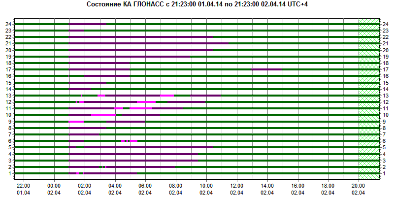
The Russian GLONASS system, which had appeared to be recovering from a series of organizational and technical problems in recent years, appears to have suffered a systemic disruption during the past 24 hours — beginning just past 1 a.m. Moscow time on April 2 (UTC+4) — 6 p.m. EDT on Tuesday (April 1, 2014).
By Inside GNSS