New Book, Basic GIS Coordinates, Third Edition, Now Available
Basic GIS Coordinates, Third Edition by Jan Van Sickle. Photo source: CRC PressCRC Press has released a new book Basic GIS Coordinates, Third Edition by Jan Van Sickle.
By Inside GNSSGlobal Navigation Satellite Systems Engineering, Policy, and Design
Basic GIS Coordinates, Third Edition by Jan Van Sickle. Photo source: CRC PressCRC Press has released a new book Basic GIS Coordinates, Third Edition by Jan Van Sickle.
By Inside GNSS SP90m Multi-frequency, Multi-Application GNSS Receiver. Photo source: Spectra Precision
 Spectra Precision has introduced its new SP90m multi-frequency and multi-application GNSS receiver. The Spectra Precision SP90m is described as a powerful, versatile, ultra-rugged and reliable GNSS positioning solution for a wide variety of real-time and post-processing applications.
By Inside GNSS Galileo support has been added to the VRS Now Correction Service. Photo courtesy of Trimble.
 Trimble announced that its Trimble VRS Now networks — powered by Trimble Pivot Platform software — can now process Galileo observation data in its network-modeled Virtual Reference Station (VRS) solution. As a true five-constellation technology using GPS, GLONASS, BeiDou, QZSS and now Galileo observations, Trimble VRS Now delivers even better real-time positioning performance for customers using Trimble networks throughout much of Europe, the company stated.
By Inside GNSS Maj. Gen. Roger Teague, the director of space programs in the Office of the Assistant Secretary for Acquisition. Photo courtesy of Air Force.
The White House is asking Congress to boost overall funding for the GPS program back over $1 billion, with the largest infusion of new money earmarked to cover the cost growth of the Next Generation Operational Control System (OCX).
If approved, overall spending on the GPS program would reach $1.09 billion in fiscal year 2018 (FY18) with funding for OCX surging to $510.94 million from the $393.27 million allocated by Congress for FY17.
By Dee Ann Divis Photo source: Artech House.
 Artech House has announced the publication of Understanding GPS/GNSS: Principles and Applications, Third Edition by Elliott D. Kaplan and Christopher J. Hegarty. This thoroughly updated third edition of an Artech House bestseller brings together a team of leading experts providing a current and comprehensive treatment of GNSS that readers won’t find in other resources.
By Inside GNSS TimeProvider 5000 IEEE 1588 Precision Time Protocol (PTP) grandmaster clock. Photo source: Microsemi Corp.TimeProvider 5000 IEEE 1588 Precision Time Protocol (PTP) grandmaster clock. Photo source: Microsemi Corp.
Microsemi Corporation announced the hardware on its TimeProvider 5000 IEEE 1588 Precision Time Protocol (PTP) grandmaster clock has been updated to support Internet Protocol version 6 (IPv6) and multi-GNSS constellations to ensure better reception and higher security in a wide variety of telecommunications network applications.
By Inside GNSS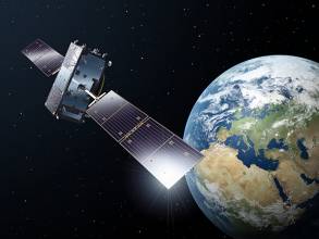
Two further satellites — increasing the total number to 16 — have formally become part of Europe’s Galileo satnav system, broadcasting timing and navigation signals worldwide while also picking up distress calls across the planet.
These are the 15th and 16th satellites to join the network, two of the four Galileos that were launched together by Ariane 5 last November, and the first additions to the working constellation since the start of Galileo Initial Services in December.
By Inside GNSS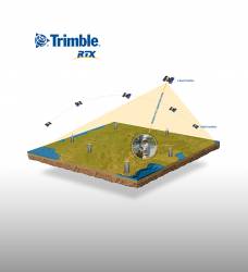 Trimble RTX-based correction services now support the Galileo constellation. Photo source: Trimble.
Trimble announced that its Trimble RTX-based correction services now support the Galileo constellation. As a true five-constellation technology that uses GPS, GLONASS, BeiDou, QZSS and now Galileo satellites, Trimble RTX is designed to deliver improved real-time positioning performance to its users worldwide.
By Inside GNSS
 One of 12 magnetograms recorded at Greenwich Observatory during the Great Geomagnetic Storm of 1859
 1996 soccer game in the Midwest, (Rick Dikeman image)
 Nouméa ground station after the flood
 A pencil and a coffee cup show the size of NASA’s teeny tiny PhoneSat
 Bonus Hotspot: Naro Tartaruga AUV
 Pacific lamprey spawning (photo by Jeremy Monroe, Fresh Waters Illustrated)
 “Return of the Bucentaurn to the Molo on Ascension Day”, by (Giovanni Antonio Canal) Canaletto
 The U.S. Naval Observatory Alternate Master Clock at 2nd Space Operations Squadron, Schriever AFB in Colorado. This photo was taken in January, 2006 during the addition of a leap second. The USNO master clocks control GPS timing. They are accurate to within one second every 20 million years (Satellites are so picky! Humans, on the other hand, just want to know if we’re too late for lunch) USAF photo by A1C Jason Ridder.
  Detail of Compass/ BeiDou2 system diagram
 Hotspot 6: Beluga A300 600ST

1. RESCUE DRONE
Noordwijk, Netherlands
√ Inspired by the refugee crisis, Dutch start-up Avy has been working on robust, long-duration drones capable of detecting people in distress and, if necessary, dropping life jackets, life buoys, food and medicine. The rescue drone can take off from a boat or the shore, carrying among other items, a cylinder that contains a large deployable rescue buoy, which not only can keep refugees afloat but indicates its location to boats in the vicinity.
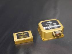 The VG380 vertical gyros modules. Photo source: MEMSIC Inc.
 MEMSIC Inc., with headquarters in Andover, Massachusetts, recently announced the addition of the VG380 to its portfolio of inertial modules. These new vertical gyros are designed to provide highly accurate pitch and roll (with respect to gravity), in both static and dynamic conditions. The static and dynamic accuracy is specified at +/-0.2 and +/-1.0 degrees (respectively) over the -40C to +85C temperature range.
By Inside GNSS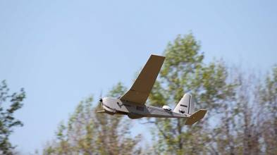
The Virginia firm that had been hoping to use satellite frequencies near the GPS band to support a terrestrial broadband network has changed its pitch to regulators. Ligado, previously named LightSquared, is working to convince the Federal Communications Commission (FCC) that its frequencies are the way to provide connectivity to the broad internet of things (IoT) including unmanned aircraft, driverless cars and other unmanned systems.
By Dee Ann Divis
The output value of BeiDou, China’s satellite navigation and location-based service industry, increased more than 22% year on year and has topped 211 billion yuan (about 30.8 billion U.S. dollars) in 2016, according to news reports on a recently released industry white paper.
By Inside GNSS The new GSS200D Interference Detector was developed as part of Spirent’s partnership with Nottingham Scientific Limited. Photo source: Sprirent.
Spirent Communications has announced a solution that enables the civil aviation industry to evaluate the growing threat of GNSS interference, jamming and spoofing. The new GSS200D Interference Detector was developed as part of Spirent’s partnership with Nottingham Scientific Limited.
By Inside GNSS