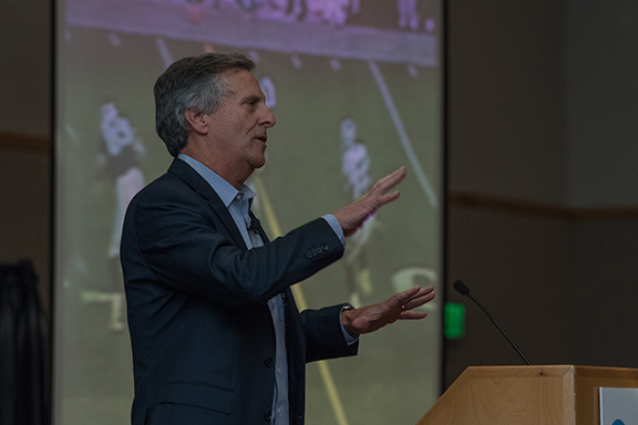
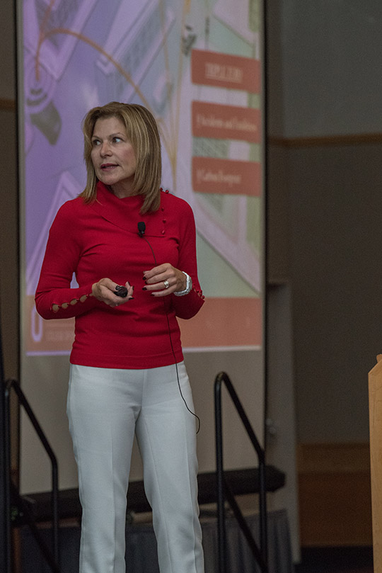
B: Applications

[uam_ad id="183541"]
March 28, 2016

Up in the AIRR

Anyone who has sat through several iterations of a slide presentation by the Federal Aviation Administration (FAA) can’t help but wonder if there isn’t a better way to do things.

As speakers flip through an exhaustively vetted series of PowerPoint slides, squeezing out a new bullet point or two from one version to the next six months later, watching paint dry seems like a more productive — and briefer — use of one’s time. The agency sometimes brings a whole new meaning to the concept of geological time.

Read More >

By Dee Ann Divis
March 27, 2016

Galileo & EGNOS Evolution

A global navigation satellite system seems like such solid thing, like the pyramids, perhaps, or a mountain. Permanent, fixed, immutable.

Nor is this surprising. After all, GNSS distinguishes itself from many other technologies of the moment by its grounding in a large and widespread infrastructure: a master control station, launch facilities, far-flung monitoring stations, the space segment with dozens of massive satellites that can operate 20 years or more as did a recently retired GPS Block IIA spacecraft.

Read More >

By Günter W. Hein
March 23, 2016

Mapping from UAVs

This webinar was presented on Thursday, April 7, 2016, as Inside GNSS continued its series of web seminars focusing on the rapidly expanding field unmanned aerial vehicles (UAVs) in a webinar sponsored by Applanix Corporation.

The recent adoption of UAVs for airborne mapping applications promises to greatly reduce the cost and complexity of collecting geospatial data and images for a broad range of applications.

Read More >

By Inside GNSS
[uam_ad id="183541"]
March 18, 2016

Sandy Kennedy: Here to Stay

>>Sandy Kennedy’s Compass Points

Sandy Kennedy grew up in Miami. Miami, Manitoba, Canada, that is — a town of 150 people with a school, a café, a defunct railroad station, and an ice skating rink.

Now she’s director and chief engineer in charge of receiver core cards at NovAtel Inc., a developer and manufacturer of high-precision GNSS products headquartered in Calgary, Alberta. It’s a long way from where she started, but then again, maybe not.

Read More >

By Inside GNSS

GLONASS and PNT in Russia

The legal and regulatory framework of the Russian Federation covers not only the GLONASS system, but the country’s overall positioning, navigation and timing (PNT) system as well.

The term PNT is a synonym for navigation activities as defined in the Federal Law on Navigation Activities. The PNT system in the Russian Federation is defined as the combination of administrative and technical means that provide spatial and time data to all user groups, with GLONASS as a key element.

Read More >

By Ingo Baumann

What are the fundamentals of an effective GNSS test plan?

Q. What are the fundamentals of an effective GNSS test plan?  

A. One aspect of GNSS development that engineers often find challenging is the lack of common testing standards and procedures. This can make life difficult for the engineer tasked with constructing a test plan for a new GNSS-enabled system. How much testing is proportionate, at which stages of development? What are the key performance parameters to measure? What apparatus is best suited to the application, and what are the appropriate pass/fail criteria?

Read More >

By Inside GNSS
March 17, 2016

RIN Event: The Future of GNSS

The Royal Institute of Navigation will host a one-day event on The Future of GNSS with speaker Prof. Terry Moore on April 21, 2016 at the Warsash Maritime Academy in Southampton, England.

The speaker will outline the future of GNNS and its systems, anticipated changes and the impact of these developments.

This meeting which is joint with the NI and UK Hydro Society will be followed by the RIN Solent branch AGM.

This event is free. Prior booking not required, guests are welcome.

Read More >

By Inside GNSS
March 16, 2016

Air Force Considers Shifting GPS III Ground Control to Enterprise Ground Services

As the contractor for the new GPS ground system works its way through a make-or-break 90-day evaluation period, the U.S. Air Force (USAF) is weighing whether it should look at leapfrogging past that program and shifting control of the newest GPS satellites to a new common ground system for Air Force space assets.

The Next-Generation Operational Control System or OCX, currently under development by Raytheon, is essential to integrating the GPS III satellites into the U.S. GNSS constellation and operating them at their full potential.

Read More >

By Inside GNSS
IGM_e-news_subscribe