Ultra-Small M-Code Military GPS Receiver Emerges at JNC-ION
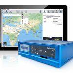
BAE Systems, Inc. unveiled its ultra-small MicroGRAM-M GPS receiver compatible with next-generation M-Code military GPS signals that are resistant to jamming and spoofing.
By Inside GNSSBAE Systems, Inc. unveiled its ultra-small MicroGRAM-M GPS receiver compatible with next-generation M-Code military GPS signals that are resistant to jamming and spoofing.
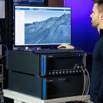
By Inside GNSSNextNav announced that it has successfully demonstrated the timing precision and resilience of its terrestrial position, navigation, and timing (PNT) system, TerraPoiNT, in a recent evaluation by the Science & Technology Directorate (S&T) of the Department of Homeland Security (DHS).
By Inside GNSSThe Defense Innovation Unit (DIU) of the Department of Defense (DoD) sought in mid-August commercial solutions to counter growing GNSS spoofing operations.
By Inside GNSSGPS + inertial + camera + LiDAR + baro-altimeter = a very precise measurement, right? Not when the respective sensor output timings lack proper synchronization. Only when each piece of data carries an accurate timetag can they together enable optimal performance in multi-sensor fusion systems.
By Inside GNSSSpirent Federal Systems, a provider of PNT/GNSS test equipment, announced plans to fully validate the inertial interface between Spirent GNSS simulators and both Northrop Grumman legacy and modernized inertial systems under the EGI-M program.
By Inside GNSSHoneywell unveiled a new rate sensor specifically intended to help small satellites navigate increasingly crowded orbits above the Earth’s surface.
By Inside GNSSDeepwave Digital has release a new Artificial Intelligence Radio Transceiver (AIR-T) Edge Series model, the AIR8201.
By Inside GNSSGeoOptics Inc. has upgraded its CICERO constellation of Earth-observation satellites to include advanced GNSS Reflectometry (GNSS-R).
By Inside GNSSTrimble announced enhancements to its Trimble RTX correction services. Improvements in the high-accuracy correction service include convergence time reductions, more reliable and robust signals, and an easier workflow for surveyors.
By Inside GNSSIn-flight refueling requires sustained minimal separation between paired aircraft with little room for error. In or near combat zones, wide-area GPS-denial or spoofing means that an GPS-independent system must be available. Regardless of the selected sensor package, a common set of properties must be satisfied to facilitate mid-air docking: a high degree of accuracy, precision, and integrity.
UrsaNav and ADVA have conducted an enhanced long-range navigation (eLoran) field trial using UrsaNav’s eLoran receiver and ADVA’s Oscilloquartz grandmaster clock technology. The successful demo showed that eLoran offers a robust and reliable backup for GPS and other GNSS and could be used to provide an assured position, navigation, and timing (PNT) service.
By Inside GNSSThe addition of alternative sensors such as cameras, magnetometers, and small ranging radios increases the likelihood of a mismodeled and/or faulty sensor, affecting the accuracy and performance of the overall navigation solution. Unlike two-sensor systems such as GPS-inertial integration, systems of three or more sensors present the problem of ambiguity as to which sensor is adversely affecting the solution. This presents the need for a robust framework that can maintain navigation integrity despite the additional sensor modalities.
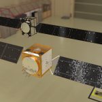
Testing of the first Galileo Second Generation (G2) hardware has begun, with versions of the satellites’ navigation payloads and antennas undergoing evaluation to check whether they meet the ambitious performance levels set for the coming generation of Europe’s GNSS.
By Inside GNSS