
ION Pacific PNT Conference 2017
Waikiki BeachUPDATED: March 21, 2017
The Institute of Navigation’s 2017 Pacific PNT Conference will take place May 1-4, 2017 at the Marriott Waikiki Beach in Honolulu, Hawaii.
By Inside GNSSGlobal Navigation Satellite Systems Engineering, Policy, and Design
Waikiki BeachUPDATED: March 21, 2017
The Institute of Navigation’s 2017 Pacific PNT Conference will take place May 1-4, 2017 at the Marriott Waikiki Beach in Honolulu, Hawaii.
By Inside GNSS Monterey Bay, California.
The Institute of Navigation’s 2016 International Technical Meeting (ITM) will take place January 25-28 at the Hyatt Regency Monterey in Monterey, California.
The abstract submission deadline has passed.
Discounted Registration and hotel reservations end January 3, 2016. PTTI registration includes access to the International Technical Meeting (ITM).
By Inside GNSS Munich, Germany
The Munich Satellite Navigation Summit and exhibition will take place at the Residenz Muenchen in Munich, Germany on March 1 – 3, 2016.
Register here.
The theme for this year’s summit is “GNSS: Creating a Global Village”.
By Inside GNSS
 Michael Sanjume, deputy chief of the GPS Directorate User Equipment Division
The Air Force may dial back plans to accelerate its military receiver program, possibly reversing an earlier decision to combine development and production steps as a way to meet a congressional procurement deadline.
By Inside GNSS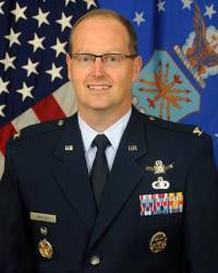
With experience in satellite procurement, user equipment development and working with Congress, Col. Steven Whitney may be just the chief the GPS Directorate needs.
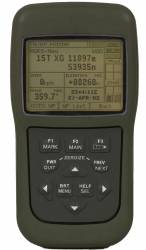
By Inside GNSS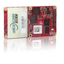 Unicore UR380 GNSS Receiver with UB380
Unicore released UB380 GPS/GLONASSS/BDS high precision board at ION GNSS+ 2015, held this week in Tampa, Florida.
UB380 is a 384-channel, multi-GNSS receiver that supports GPS, GLONASS, and the BeiDou Satellite System (BDS) based on Unicore’s multi-GNSS system on a chip. The receiver board can support GPS L1, L2, and L5; GLONASS L1, L2; and BDS B1, B2 and B3.
By Inside GNSS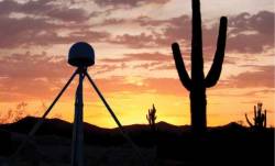
UNAVCO has announced the selection of Septentrio to be the preferred vendor of next-generation GNSS reference stations for the Geodesy Advancing Geosciences and EarthScope (GAGE) Facility. The preferred vendor status is valid through the duration of the GAGE Facility Cooperative Agreement with the National Science Foundation (NSF).
 Rockwell Collins DAGR. From Wikimedia Commons
The GPS Directorate wants industry to more quickly develop innovative user equipment that integrates both the modernized GPS signals and signals from international constellations like Galileo.
“In the future,” said the organization’s new director, Col. Steve Whitney, “it’s going to be important that our industry partners and the Directorate investigate ways to pull in these new signals — and that includes some of the non-GPS signals — into our user equipment.”
By Inside GNSS
 One of 12 magnetograms recorded at Greenwich Observatory during the Great Geomagnetic Storm of 1859
 1996 soccer game in the Midwest, (Rick Dikeman image)
 Nouméa ground station after the flood
 A pencil and a coffee cup show the size of NASA’s teeny tiny PhoneSat
 Bonus Hotspot: Naro Tartaruga AUV
 Pacific lamprey spawning (photo by Jeremy Monroe, Fresh Waters Illustrated)
 “Return of the Bucentaurn to the Molo on Ascension Day”, by (Giovanni Antonio Canal) Canaletto
 The U.S. Naval Observatory Alternate Master Clock at 2nd Space Operations Squadron, Schriever AFB in Colorado. This photo was taken in January, 2006 during the addition of a leap second. The USNO master clocks control GPS timing. They are accurate to within one second every 20 million years (Satellites are so picky! Humans, on the other hand, just want to know if we’re too late for lunch) USAF photo by A1C Jason Ridder.
  Detail of Compass/ BeiDou2 system diagram
 Hotspot 6: Beluga A300 600ST

1. I LOVE MY JOB BUT…
Bakersfield, California USA
 Falls Church, Virginia, c. 1861
NavtechGPS Fall Mission Critical GNSS Training Seminars 2015 will take place at the Westin Tysons Corner Hotel in Falls Church, Viginia (Washington, D.C. area), November 2-6, 2015.
Special hotel rate if booked by October 12, 2015.
Course 556 starts on November 2, 2015. Courses 122 and 346 will start on November 3, 2015.
By Inside GNSS
A new federal watchdog report released yesterday (September 9, 2015) questions the outlook for the still-developing GPS ground control system saying the Pentagon may not fully understand the true cause of ongoing problems in a program where further delays “may likely pose significant risks to sustaining the GPS constellation and delivering GPS capability.”
By Inside GNSS

The incorporation of GNSS and inertial technologies is helping drive an explosion of systems development and applications of unmanned systems. On Tuesday, September 29, Inside GNSS and NovAtel will present a FREE 90-minute web seminar showcasing some of these applications, including the use of remote sensing technologies to assess pest populations in commercial crops and to conduct infrastructure inspections, with the aid of air and ground vehicles.
Register now for Tuesday, September 29, 2015: 9 am PDT
By Inside GNSS
Federal officials have released a draft of their plan to determine the amount of interference satellite navigation receivers can tolerate from users in neighboring frequencies. The tests, proposed after the Federal Communications Commission (FCC) froze a controversial wireless broadband system, would accelerate research on GNSS receivers that process signals from multiple satellite constellations.
By Inside GNSS