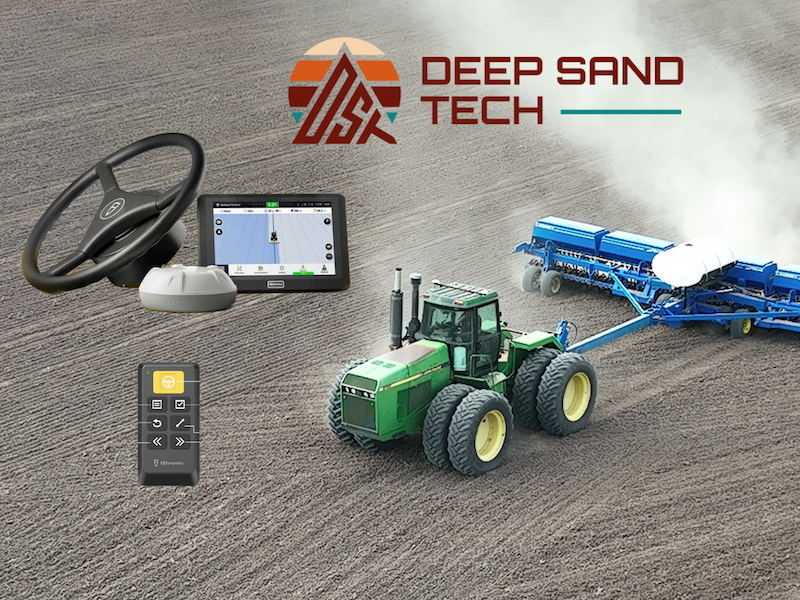
The GEODNET Foundation and Deep Sand Technology (DST) are working together to advance precision agriculture in rural North America.
Combining GEODNET’s high reliability data service with DST’s affordable automated tractor solutions for both new and older equipment, the companies have announced the availability of a GEODNET-compatible RTK base-station that supports centimeter-accurate operations without a UHF radio link, according to a news release. The solution will help farmers improve efficiency and yields while also reducing input costs.
GEODNET is a blockchain-based decentralized network of high-precision multi-band GNSS base stations that offers affordable GNSS corrections. Since the official launch in 2022, the network of Web3 GNSS base stations has grown to more than 3,600 worldwide, becoming a reliable solution for RTK applications in more than 1,800 cities in more than 100 countries. The goal is to have between 50,000 and 100,000 base stations by 2026.
This latest partnership will help quickly expand access to affordable high-accuracy RTK-based GPS in key U.S. agricultural and rural areas, advancing precision agriculture as well as other applications such as advanced cruise control systems in passenger cars, automated highway trucking operations, and eco-friendly electric robotic lawnmowers.
Farmers often opt to use less accurate and less repeatable WAAS signals to avoid the costs that come with RTK network fees and base stations, DST CEO Joey Koebelen said, according to the release. The company, which offers autosteering and GPS guidance, has been looking for an affordable, easy option that provides farmers with the RTK accuracy they need for automation, eliminating steering overlap and opening the door to other farming applications. GEODNET’s affordable, accurate RTK does that.
A look at GEODNET
So how does GEODNET work? The decentralized GEODENT takes a community approach to corrections, making it more affordable. Station owners set up a Satellite Mining station and are rewarded in the project’s native Polygon token, GEOD, which trades every day, GEODNET Foundation Creator Mike Horton said. When new stations join the blockchain, they prove their location using a published algorithm.
As data from the network is paid for and used by end-users, this “burns up” mined tokens. Tokens are purchased back with cash and sent to a one-way safe on the blockchain. This buyback and burn mechanism is at the core of how the network functions economically.
Horton describes GEODNET as “a very open, flexible system.” Anyone who wants to be part of the network can set up a station, use the network or build on top of the network. And because it’s all bound together by blockchain, there isn’t a company in control behind the scenes. It’s a true community approach, with everything connected through a protocol that all systems adhere to. Users can add stations to areas that don’t have any or much coverage or tap into existing stations in their area with a subscription.
“The token is how people exchange value in the ecosystem, and that’s the part that’s radical,” Horton said in an Inside GNSS article. “But it’s a way to create independent operations and allow businesses to make use of GEODNET data by also contributing. It’s like a cycle. The more people put up stations, the more successful the network becomes, and the more people then want to put time and energy into the ecosystem.”
Other use cases
Drones, robotic vehicles, augmented reality and IoT/mobile devices are other applications that can leverage GEODNET for centimeter-level location accuracy. Agriculture, of course, is a big one, particularly in Romania where some of the first base stations were established. Marius Negreanu, one of the owners of Romania based distributor EuGeo, is among those using the service there for agriculture-related applications rather than the government owed ROMPUS that only has about 50 stations.
Negreanu sells affordable autonomous tractor kits to farmers, he said, and is using the kits as a bridge to promote the network. An antenna that links to the closest GEODNET station is part of the kit that turns a manual tractor autonomous. This is something more farmers in Romania are becoming open to, as they realize the centimeter precision such kits provide lead to a larger harvest and less field consumption.
The DST collaboration is another example of how GEODNET is benefiting agriculture.
“With farm operations facing limited labor resources and rising input costs,” Horton said, “emerging technologies, such as those provided by GEODNET and Deep Sand Technology, are key to keeping healthy, affordable food on the table.”


