Scientific Systems has announced the advancement of ImageNav™, an image-based navigation software designed for use in environments where GPS signals are compromised.
With over a decade of development and funding exceeding $45 million, ImageNav™ offers a robust alternative to traditional GPS navigation for military operations, particularly in contested environments where electronic jamming poses a threat to GPS reliability.
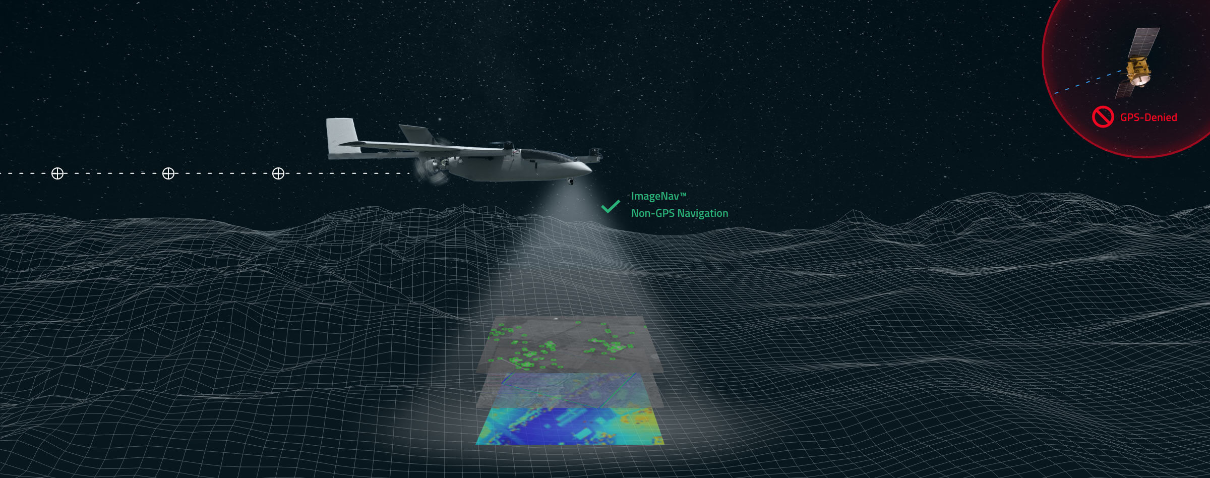
The need for such technology has become increasingly critical in light of enhancements to electronic warfare capabilities, with instances of GPS signal disruption impacting military assets. ImageNav™ addresses this vulnerability by providing precise navigation for a wide range of systems, including weapons, aircraft, and uncrewed aircraft systems (UAS), without reliance on GPS signals.
Utilizing an onboard electro-optical (EO) or infrared (IR) digital camera, ImageNav™ employs a trio of algorithms to analyze captured images and correlate them with stored terrain and image references. This process enables both absolute and relative navigation position updates, offering an innovative solution to maintain navigation accuracy even in GPS-denied scenarios. The technology’s ability to run entirely “at-the-edge” allows for integration into air platforms as a software upgrade or as part of a self-contained hardware payload, minimizing size, weight, and power requirements.
Tom Frost, Senior VP of the Products Division at Scientific Systems, highlighted the importance of ImageNav™ as a solution for air vehicles to generate accurate position fixes in challenging operational environments. The technology’s development comes at a crucial time, with recent reports underscoring the urgency of establishing reliable non-GPS guidance systems in the face of successful GPS jamming efforts.
Scientific Systems is actively pursuing the integration of ImageNav™ onto GPS-guided munitions and UAS, enabling their effective operation in environments where GPS access is denied. Recent testing has demonstrated the technology’s capability to navigate without GPS, hitting targets within required performance parameters.


