Uncategorized

May 17, 2014

Satellite Outages Afflict GLONASS

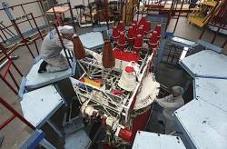
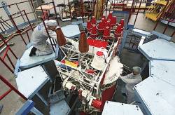
Working on a GLONASS-M satellite at Reshetnev ISS

The Russian GLONASS system, which had appeared to be recovering from a series of organizational and technical problems in recent years, suffered two major disruptions during April.

Read More >

By Inside GNSS
May 6, 2014

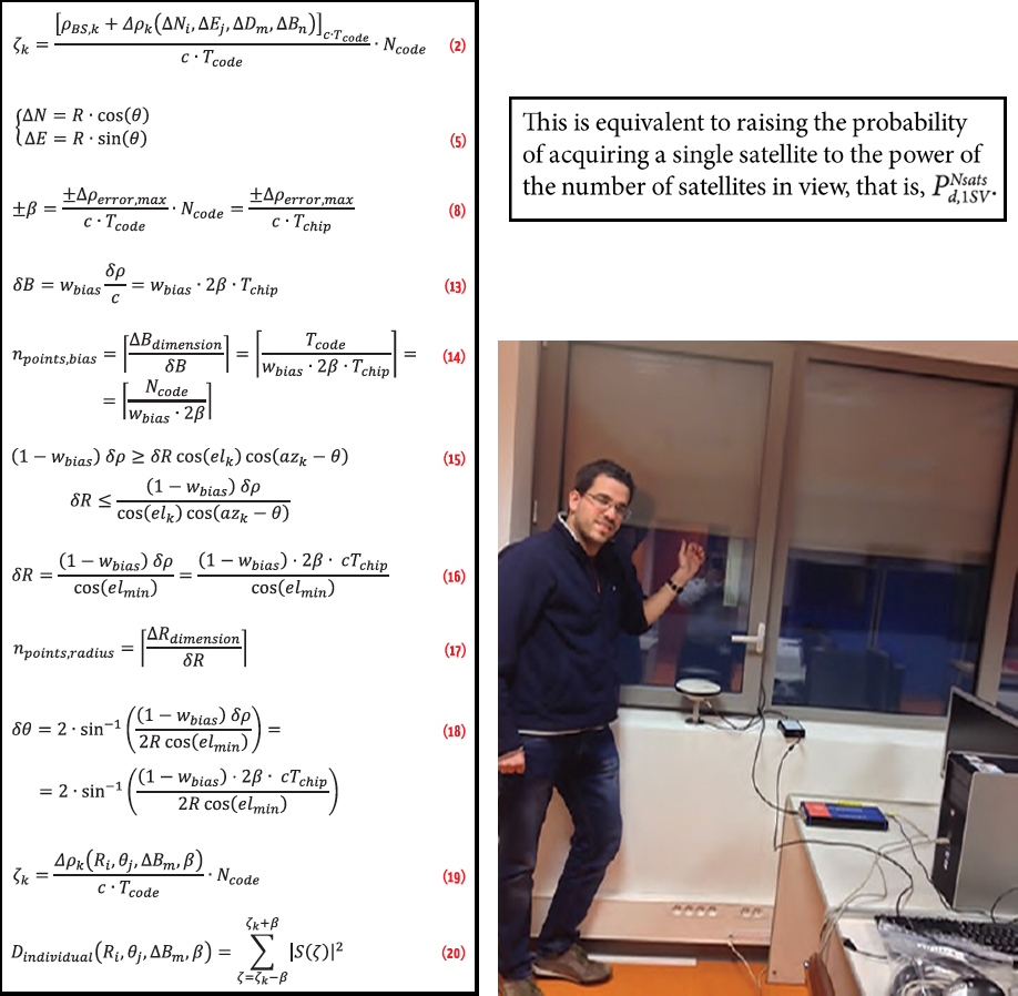
Collective Detection of Multi-GNSS Signals

Clockwise from left: (a) article equations, (b) the probablility of acquiring a single satellite to the power of the nyumber of satellites in view, (c) Indoor scenario of signal collection at ISAE navigation lab, Toulouse

Working Papers explore the technical and scientific themes that underpin GNSS programs and applications. This regular column is coordinated by Prof. Dr.-Ing. Günter Hein, head of Europe’s Galileo Operations and Evolution.

Read More >

By Inside GNSS

How do you compute a relative position using GNSS?

Q: How do you compute a relative position using GNSS?

A: In many applications the absolute position of an object is less important than the relative position to other objects in the vicinity. An obvious example is a collision avoidance system, wherein the proximity of nearly vehicles is much more important than whether the vehicles are located on street “X” or “Y.”

Read More >

By Inside GNSS
[uam_ad id="183541"]

Michel Monnerat: Out of Africa — GNSS

SIDEBAR: Michel Monnerat’s Compass Points

“I was born in Arles, in the south of France,” says Michel Monnerat, “but I left France before my first birthday. We moved many times, from place to place.”

Monnerat’s father worked for a civil engineering company, specializing in maritime works — harbor construction, coastal protection, and such. His family lived in Ivory Coast, Cameroon, and Tunisia, but Monnerat spent most of my early life in Lomé, the capital city of Togo.

Read More >

By Inside GNSS

It’s Spring, and EGNOS Is in the Air

Europe has been talking up its European Geostationary Navigation Overlay Service (EGNOS, for short) — and why shouldn’t it? Talking about Galileo doesn’t get satellites off the ground. EGNOS, on the other hand, is up and running, and has been since 2009. If the object is to build confidence in European savoir faire, why not talk about a real success like EGNOS?

Read More >

By Peter Gutierrez

DoD Condenses Acquisition Strategy to Speed M-Code Units

A shift in the Air Force’s acquisition plan should shave a year off the time needed to finish development of new M-code–equipped receivers and potentially inspire more commercially flavored innovation — and perhaps even the entry of new vendors.

The new approach enables the Pentagon to fulfill a congressional mandate to buy only M-code receivers after fiscal year 2017 and could help convince the user community, jaded by previous delays, to speed adoption of the more resilient devices.

Read More >

By Dee Ann Divis

Location Authentication

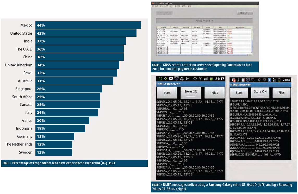
Table 1, Figures 2 & 3

Smartphone apps represent the most prominent market for GNSS. No other device or community of users has achieved a larger growth and market penetration in the period 2008–2013.

Apple introduced the first GPS capability on a smartphone in June 2008 with the iPhone3, and one year later Samsung introduced its Samsung Galaxy, incorporating the first GPS receiver for this brand.

Read More >

By Inside GNSS
[uam_ad id="183541"]

GNSS Hotspots | March 2014

One of 12 magnetograms recorded at Greenwich Observatory during the Great Geomagnetic Storm of 1859
1996 soccer game in the Midwest, (Rick Dikeman image)
Nouméa ground station after the flood
A pencil and a coffee cup show the size of NASA’s teeny tiny PhoneSat
Bonus Hotspot: Naro Tartaruga AUV
Pacific lamprey spawning (photo by Jeremy Monroe, Fresh Waters Illustrated)
“Return of the Bucentaurn to the Molo on Ascension Day”, by (Giovanni Antonio Canal) Canaletto
The U.S. Naval Observatory Alternate Master Clock at 2nd Space Operations Squadron, Schriever AFB in Colorado. This photo was taken in January, 2006 during the addition of a leap second. The USNO master clocks control GPS timing. They are accurate to within one second every 20 million years (Satellites are so picky! Humans, on the other hand, just want to know if we’re too late for lunch) USAF photo by A1C Jason Ridder.
Detail of Compass/ BeiDou2 system diagram
Hotspot 6: Beluga A300 600ST

1. WHAT’S LOVE GOT TO DO WITH IT? 
Detroit, Michigan USA 

Read More >

By Inside GNSS
GPS Modernization Stalls

With the optimism of college-bound seniors touring the Ivy League, GPS managers have been weighing options to dramatically change the GPS constellation. Now, after studying the costs, considering the benefits, and assessing the funding climate, officials have made the starkly fiscal decision to stick close to home and take a few extra years to finish. 

Read More >

By Dee Ann Divis

New GNSS Signals

A. J. Van Dierendonck

The world’s GNSS systems are entering a phase of transformation — modernization of existing systems (the U.S. Global Positioning System and Russia’s GLONASS) and development of new systems (China’s BeiDou and Europe’s Galileo) that benefit from the lessons learned from the original GNSSs.

Notable among the modernization initiatives is an interest in implementing new satellite signal designs. These include the GPS L5, L2C, and L1C signals as well as those signals designed for Galileo and BeiDou. GLONASS designers are also working on modernized signals.

Read More >

By Inside GNSS
1 28 29 30 31 32 82
IGM_e-news_subscribe