How do you trust centimeter level accuracy positioning?
Q: How do you trust centimeter level accuracy positioning?
By Inside GNSSGlobal Navigation Satellite Systems Engineering, Policy, and Design
Q: How do you trust centimeter level accuracy positioning?
By Inside GNSS

Unicore Communications, Inc. offers the UM220-INS, a BeiDou/GPS+inertial MEMS dual system inertial navigation module for in-dash automotive navigation and high-end navigation, and the UB280, a BeiDou/GPS dual-System dual-antenna high precision heading board for precise RTK position and heading.

Available now, the XDL Rover 2 is equipped with Bluetooth wireless communication for ease in configuration and operation, including use with Android devices in the field. UHF data can be transmitted via Bluetooth to a paired host device for operational efficiency.
By Inside GNSS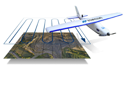
Topcon Positioning Group has released two unmanned aerial systems (UAS) for mapping — the Sirius Pro and Sirius Basic. Both systems are designed to produce accurate solutions for the automated mapping of a wide range of sites — regardless of terrain — including construction sites, mines and quarries, and for use in land surveying, power line and pipeline inspection as well as precision agriculture field mapping.
By Inside GNSS
The high-precision GNSS industry should expect to see industry consolidation and a scramble for new markets and innovations as prices for high-end chips and modules continue to slide, experts told attendees at a ION GNSS+ panel discussion in Tampa, Florida, last week (September 11, 2014).
The falling prices could strain R&D budgets, they noted, but could also create opportunity as high-end receivers come within reach of emerging industries like self-driving cars, unmanned aerial vehicles, and are even incorporated into consumer products.
By Inside GNSS
Trimble Dimensions, the 2014 International User Conference, will take place at the Mirage and Treasure Island hotels in Las Vegas, Nevada from November 3 through 5.
Online registration is now open. The deadline for abstracts has passed.
By Inside GNSS
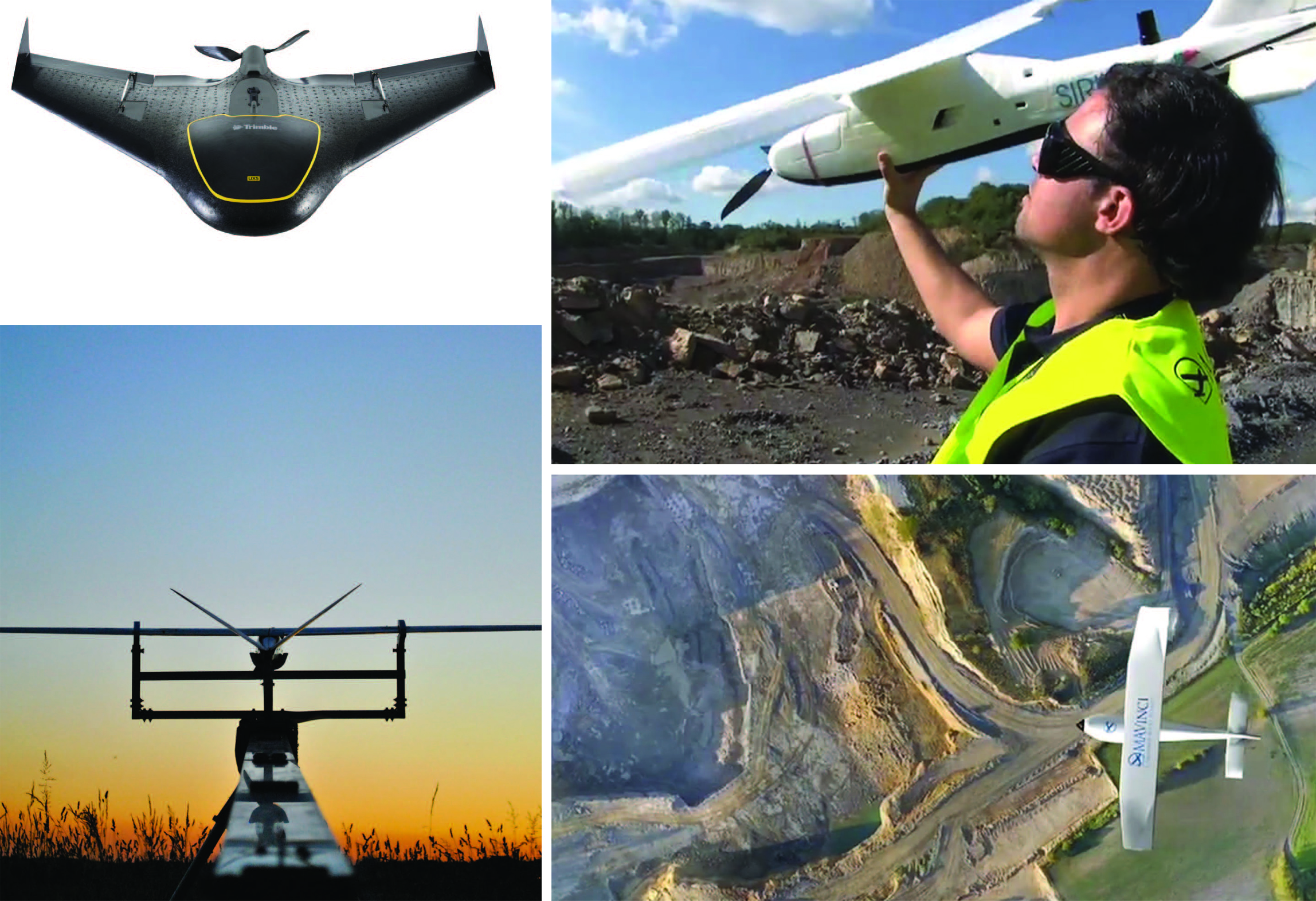 Clockwise from top left: Belgium’s Trimble UX5; MAVinci unmanned autonomous microplane is ready to take off for a land survey mission; MAVinci autonomous micro air-vehicle surveys an open mining site; A Delair-Tech UAV sits poised on its stand
To say that the European unmanned aerial vehicle (UAV) industry has drawn a crowd may be understating things. According to Paris-based UAV International, the non-profit association representing European UAV manufacturers, the European Union (EU) counts more than 1,000 “approved and authorized” civil UAV operators within its borders. Others put that number at closer to 1,400.
By Inside GNSS
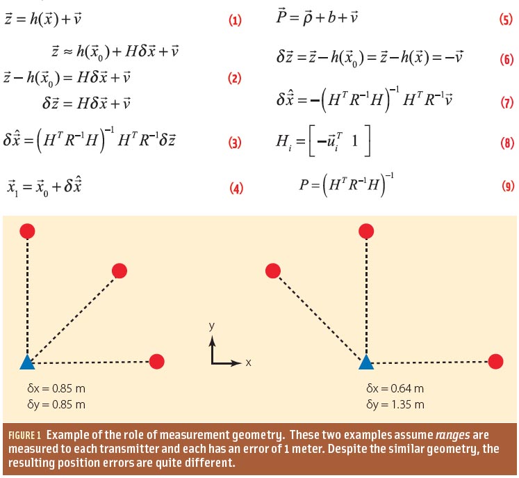
Q: How do measurement errors propagate into GNSS position estimates?
A: Not surprisingly, GNSS positioning accuracy is largely dependent on the level of measurement errors induced by orbital inaccuracies, atmospheric effects, multipath, and noise. This article discusses how, specifically, these errors manifest as position errors.
By Inside GNSS
In the past 20 years GPS has simultaneously revolutionized both our modern infrastructure (by providing real-time navigation, mapping, and timing support) and our geodetic/surveying capabilities (by providing millimeter/centimeter-level positioning). At this point, most of the GNSS innovations we expect to see in the next decade will come from calculating positions more accurately and faster, while expanding from GPS to use of all available GNSS signals.
By Inside GNSS Students conduct the “drop, cover, hold on” safety procedure during an earthquake preparedness drill. Photo Credit: Jessica Robertson, USGS
Updated National Seismic Hazard Maps released by the U.S. Geological Survey (USGS) on Thursday (July 17, 2014) indicate a higher level of earthquake risk for the West Coast and some areas of the Midwest and East Coast then previously thought.
By Inside GNSS
Two powerful lawmakers are weighing rewriting the rules for the way frequencies are allocated as part of an overhaul of the nation’s telecommunications laws. The effort, which is likely to see legislation drafted next year, is considering options such as flexible licensing and receiver standards that could directly affect the GPS community.
By Inside GNSS
This one-day seminar on Reference Frames, Positioning and Navigation will be held on September 3, during the Nordic Geodetic Commission (NKG) General Assembly, which runs from September 1 through 4 at Chalmers Technical University in Gothenburg.
By Inside GNSS
Federal aviation officials appear to be moving quickly to defuse mounting pressure for the commercial use of unmanned aircraft, clarifying their authority over such aircraft and starting the public process for licensing small firms for limited operations.
The Federal Aviation Administration (FAA) has taken a tough stance in its interpretation of the legal uses for model aircraft published on June 23 in the Federal Register. The issue surged into the national spotlight when the agency failed to win a legal challenge over its authority to regulate such devices.
By Inside GNSS