New Book, Basic GIS Coordinates, Third Edition, Now Available
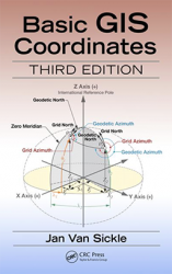
Basic GIS Coordinates, Third Edition by Jan Van Sickle. Photo source: CRC PressCRC Press has released a new book Basic GIS Coordinates, Third Edition by Jan Van Sickle.
By Inside GNSSGlobal Navigation Satellite Systems Engineering, Policy, and Design
Basic GIS Coordinates, Third Edition by Jan Van Sickle. Photo source: CRC PressCRC Press has released a new book Basic GIS Coordinates, Third Edition by Jan Van Sickle.
By Inside GNSS The event’s venue is Hotel The Ashok, Nitti Marg, New Delhi (http://www.theashok.com).
The 38th Asian Conference on Remote Sensing (ACRS-2017) will take place in October at New Delhi, India. The main theme of the conference is Space Applications: Touching Human Lives. The venue is Hotel The Ashok, Nitti Marg, New Delhi. Delhi is connected to all major cities, and the venue place is at the heart of the Delhi City.
By Inside GNSS
Submit your abstract today for the ION International Technical Meeting (ITM) and the Precise Time and Time Interval (PTTI) Systems and Applications Meeting. The co-located conferences will take place January 29 – February 1, 2018 at the Hyatt Regency Reston in Reston, Virginia.
Abstracts are due October 10, 2017.
By Inside GNSS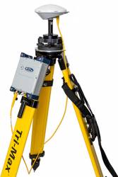 SP90m Multi-frequency, Multi-Application GNSS Receiver. Photo source: Spectra Precision
 Spectra Precision has introduced its new SP90m multi-frequency and multi-application GNSS receiver. The Spectra Precision SP90m is described as a powerful, versatile, ultra-rugged and reliable GNSS positioning solution for a wide variety of real-time and post-processing applications.
By Inside GNSS
Organized by the European Space Agency (ESA), Technical University of Valencia (UPV) and Val Space Consortium (VSC) the 6th International Colloquium Scientific and Fundamental Aspects of the Galileo Program will take place at the Technical University of Valencia, in the Politechnic City of Innovation building, inside the main campus of the university (Campus de Vera). This venue is located in the north of Valencia, very near the seashore. The event takes place just a short ride from the historic center of the city, the museums and other places of interest.
By Inside GNSS “Airborne” by Christopher Klein was built in 2008 for The Linde Group’s headquarters, the Angerhof, in Munich. Wikimedia Commons photo by Martin Falbisoner.
The International Symposium on Precision Approach and Performance Based Navigation (ISPA) is seeking contributions in a variety of related fields, and the abstracts are to be submitted electronically by July 31, 2017.
By Inside GNSS
The European Space Agency (ESA) has signed a contract with Thales Alenia Space for an upgrade of EGNOS, Europe’s satellite-based augmentation system (SBAS).
Designed by ESA and being exploited by Europe’s GNSS Agency (GSA) the European Geostationary Navigation Overlay Service (EGNOS) improves the precision of U.S. GPS signals over most of the European territory, while also providing continuous and reliable updates on the “integrity” of these GPS signals.
By Inside GNSS Inside the ESA pavilion – Access to space. ESA photo.
The European Space Agency (ESA) is seeking ideas for innovative future navigation concepts and products from European industry and academia, and these ideas can come together at the ESA pavilion at the Paris Air & Space Show. There attendees can talk with the team overseeing the new program seeking to drive Europe’s state-of-the-art in finding one’s way.
By Inside GNSS
YellowScan has again put everything together to offer attendees two very particular days in the beautiful area of Southern France. This year’s International User Conference will take place on June 29-30 in Montpellier, France.
The event, also sponsored by Applanix and Inside Unmanned Systems, will include demos and conferences about YellowScan’s lightweight integrated LiDAR Systems and their technical specifications, the UAVs used for LiDARs, the data processing and analysis, and industry case studies, what’s new and what’s coming at YellowScan.
By Inside GNSS
Two further satellites — increasing the total number to 16 — have formally become part of Europe’s Galileo satnav system, broadcasting timing and navigation signals worldwide while also picking up distress calls across the planet.
These are the 15th and 16th satellites to join the network, two of the four Galileos that were launched together by Ariane 5 last November, and the first additions to the working constellation since the start of Galileo Initial Services in December.
By Inside GNSS
The output value of BeiDou, China’s satellite navigation and location-based service industry, increased more than 22% year on year and has topped 211 billion yuan (about 30.8 billion U.S. dollars) in 2016, according to news reports on a recently released industry white paper.
By Inside GNSS The new GSS200D Interference Detector was developed as part of Spirent’s partnership with Nottingham Scientific Limited. Photo source: Sprirent.
Spirent Communications has announced a solution that enables the civil aviation industry to evaluate the growing threat of GNSS interference, jamming and spoofing. The new GSS200D Interference Detector was developed as part of Spirent’s partnership with Nottingham Scientific Limited.
By Inside GNSS
The growing demand for precise location information, in combination with the ongoing evolution of GNSS technology, means that today’s GNSS market is bigger than ever. In the recently released European GNSS Agency (GSA) 2017 GNSS Market Report —the fifth edition of the agency’s popular report — it indicates the global GNSS market is expected to grow from 5.8 billion devices in use in 2017 to an estimated 8 billion by 2020.
By Inside GNSS