Global Navigation Satellite Systems Engineering, Policy, and Design
Global Navigation Satellite Systems Engineering, Policy, and Design


Q: How do you use GNSS to compute the attitude of an object?
By Inside GNSS
After several years of shifting plans the competition to build the next tranche of GPS III satellites is poised to start, though the context in which that contest will take place has changed markedly from when planning first began.
By Dee Ann Divis
 Bernhard Richter, Leica Geosystems GNSS business director
 Enrico Salvatori, Qualcomm Europe
 Carlo Bagnoli, STMicroelectronics
Multinational semiconductor and telecommunications company Qualcomm is a world leader in the design and marketing of 3G, 4G and next-generation wireless technologies. Headquartered in San Diego, California, Qualcomm has been widening its footprint in the Europe, Middle East and Africa (EMEA) region, with a core focus in Europe.
“We expect to grow Qualcomm’s presence in Europe, becoming a major EU (European Union) player in the digitization of European industries,” said Qualcomm senior vice president and president of Qualcomm Europe, Enrico Salvatori.
By Inside GNSS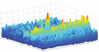
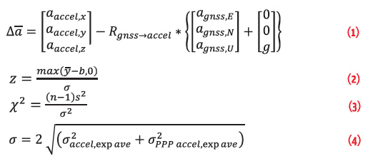
 Equations
GNSS is the technology of choice in most applications due to its dedicated infrastructure, Earth coverage, medium to high accuracy, and large market penetration. Most of the applications, including those we download on our smartphones, are in the category of Location Based Services (LBS). However, there are many other services and businesses that rely heavily on GNSS performance and reliability. For instance, Intelligent Transportation Systems (ITS) make extensive use of GNSS technology and this dependence will only grow in the future.
By Inside GNSS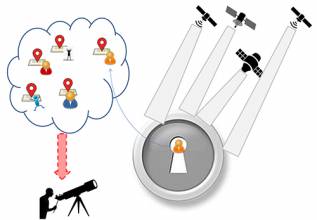
 Table 1
Working Papers explore the technical and scientific themes that underpin GNSS programs and applications. This regular column is coordinated by Em. Univ.-Prof. Dr.-Ing. habil. Dr. h.c. Guenter W. Hein.
This is the first article in a series. For Part 2: Hybrid- and Non-GNSS Localization, see here.
By Günter W. Hein
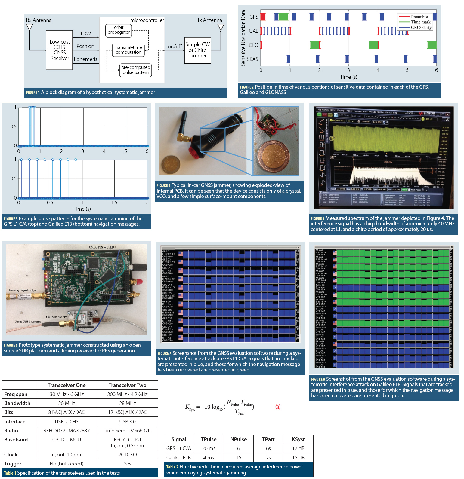 Figures 1 – 8, Tables 1 & 2, Equation 3
The vulnerability of GNSS to various forms of malicious interference have been widely discussed in recent years, and have considered a wide range of both real and potential attacks. Some of these have included extensive studies of commercially available jamming devices, while others have considered the more comprehensive case of spoofing, where the interference takes the form of genuine GNSS signals (For details, see papers listed in Additional Resources, including M. G. Amin et alia).
By Inside GNSSThe maritime sector drives the global economy, with ships transporting more than 80% of world trade. Ships and ports have come to rely on global navigation satellite systems (GNSS) for a huge array of applications relating to position, velocity and precise universal and local time.
By Ingo Baumann
Bernhard Richter, Leica Geosystems GNSS business directorEnrico Salvatori, Qualcomm EuropeCarlo Bagnoli, STMicroelectronicsCarlo Bagnoli is Director of Infotainment BU System and Applications at STMicroelectronics. The company is a global semiconductor leader focusing on smart driving and the internet of things, creating intelligent and energy-efficient products that enable intelligent transport as well as smarter factories, cities and homes.
Within the infotainment business unit, Bagnoli and his team work to develop positioning receivers, broadcast receivers and communication processors for the automotive market. Doing so means gathering GNSS signals from far and wide.
By Inside GNSS
 One of 12 magnetograms recorded at Greenwich Observatory during the Great Geomagnetic Storm of 1859
 1996 soccer game in the Midwest, (Rick Dikeman image)
 Nouméa ground station after the flood
 A pencil and a coffee cup show the size of NASA’s teeny tiny PhoneSat
 Bonus Hotspot: Naro Tartaruga AUV
 Pacific lamprey spawning (photo by Jeremy Monroe, Fresh Waters Illustrated)
 “Return of the Bucentaurn to the Molo on Ascension Day”, by (Giovanni Antonio Canal) Canaletto
 The U.S. Naval Observatory Alternate Master Clock at 2nd Space Operations Squadron, Schriever AFB in Colorado. This photo was taken in January, 2006 during the addition of a leap second. The USNO master clocks control GPS timing. They are accurate to within one second every 20 million years (Satellites are so picky! Humans, on the other hand, just want to know if we’re too late for lunch) USAF photo by A1C Jason Ridder.
  Detail of Compass/ BeiDou2 system diagram
 Hotspot 6: Beluga A300 600ST

1. Sweet Wheels
Maringa, Brazil
√ The latest self-steering Volvo truck innovates the way Brazilian farmers handle their crops. The Swedish manufacturing company is on a mission to revolutionize the Brazilian sugarcane industry by providing a smart and crop-friendly solution.

The Next Generation Air Transportation System (NextGen) is setting no records in government efficiency or speed. So, it’s time for the Federal Aviation Administration (FAA), Congress, and partner agencies to change the verb tense and transform NextGen into an operational ThisGen.
By Inside GNSS