Survey and Mapping Archives - Page 7 of 27 - Inside GNSS - Global Navigation Satellite Systems Engineering, Policy, and Design

Survey and Mapping

April 3, 2017

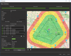
SBG Systems to Unveil Qinertia INS/GNSS Post-Processing Software at Ocean Business

Qinertia INS/GNSS post-processing software. Photo source: SBG Systems.

Rueil-Malmaison, France-based SBG Systems will unveil Qinertia, its in-house post-processing software, at the Ocean Business show, April 4-6 at Southampton, U.K.

After the survey, this full-feature software is designed to give access to offline real-time kinematic (RTK) corrections, and process inertial and GNSS raw data to further enhance accuracy and secure the survey.

Read More >

By Inside GNSS
April 1, 2017

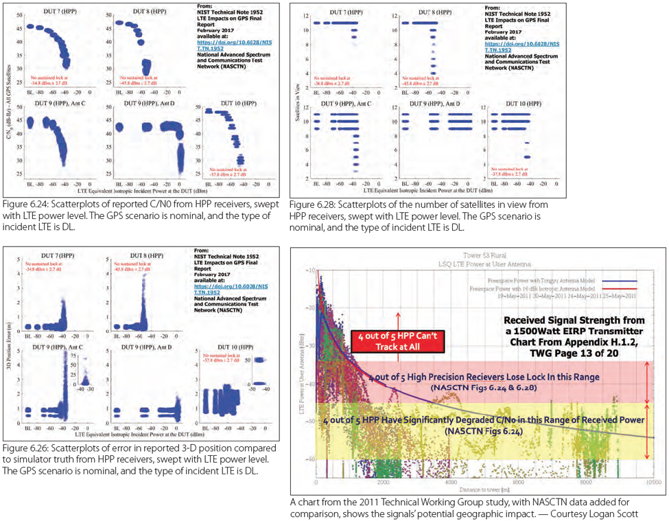
Ligado Test Results Roll In

Figures and Charts

The GPS community and Virginia-based Ligado are weighing new and upcoming test results as the standoff over interference with satellite navigation services enters its seventh year.

The dispute centers on the company’s now modified proposal to build a terrestrial wireless network supported by frequencies originally allocated for satellites. Though there had been a move some years earlier to augment the satellite services with ground stations the company’s first plan envisioned some 30,000 high-powered ground terminals.

Read More >

By Dee Ann Divis
[uam_ad id="183541"]
March 31, 2017

Swift Navigation, Carnegie Robotics Partnership to Yield High-Precision GNSS, Inertial Technology Products

Swift Navigation CTO Fergus Noble, left, and Carnegie Robotics CTO Chris Osterwood, right. Photo source: Swift Navigation.

A partnership between Swift Navigation and Carnegie Robotics announced this week is expected to yield a line of navigation products for autonomous vehicles, outdoor robotics and machine control.

San Francisco-based Swift Navigation is a startup building centimeter-accurate GPS technology designed to power a world of autonomous vehicles, while Carnegie Robotics, located in Pittsburgh, Pennsylvania, provides advanced robotics sensors and platforms for defense, agriculture, mining, infrastructure and energy applications.

Read More >

By Inside GNSS
March 29, 2017

Ligado Plans GPS Augmentation Service

Photo source: Dee Ann Divis.

Ligado, which has been in a standoff with the GPS community over interference issues for more than six years, is developing a new high-precision location (HPL) augmentation system for GPS.

The new HPL service will use real-time kinematic- (RTK-) based solutions for augmentation of high-precision receivers, said Tamara Casey, Ligado’s chief technology officer, during Satellite 2017.

Read More >

By Inside GNSS

Sokkia Introduces New GCX3 GNSS Integrated Receiver

GCX3 GNSS integrated receiver. Photo source: Sokkia.

Livermore, California-based Sokkia has introduced the latest addition to its GCX line of GNSS integrated receivers — the GCX3 — featuring advanced constellation tracking, open format software compatibility, and longer range base-to-rover communication.

Read More >

By Inside GNSS
March 23, 2017

NovAtel Releases Firmware Version 7.200 for OEM7

NovaTel’s 7.200 firmware for its next generation of receivers including the OEM729 Multi-Frequency GNSS Receiver.

NovAtel Inc. recently announced the release of the 7.200 firmware for its next generation of receivers, the OEM729, OEM719 and OEM7700, and with the release introduced new positioning functionality including the Interference Toolkit. The 7.200 software interface is backwards compatible with the OEM6 family software with the addition of the following key features:

Read More >

By Inside GNSS
[uam_ad id="183541"]
March 8, 2017

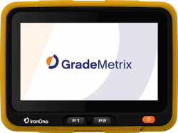
Hemisphere GNSS Introduces IronOne Rugged Display & Computer

IronOne Rugged Display & Computer. Photo source: Hemisphere GNSS, Inc.

Scottsdale, Arizona-based Hemisphere GNSS, Inc. introduced its IronOne Rugged Display & Computer for machine control applications at this week’s CONEXPO-CON/AGG 2017 in Las Vegas, Nevada.

Purpose-built for harsh machine control environments, IronOne meets IP67-standard certification and uses an 8” sunlight-readable LCD display. IronOne adds another system component and empowers heavy equipment manufacturers to deliver their own machine control and guidance solutions to their customers.

Read More >

By Inside GNSS
February 13, 2017

Emlid Launches Reach RS RTK GNSS Receiver

Emlid, based in Hong Kong, has introduced the Reach RS, a rugged, battery-powered real-time kinematic (RTK) GNSS receiver. The Reach RS enables centimeter-accurate positioning for survey, mapping, agriculture and drones, and is designed to provide an economical solution, according to the company.

Read More >

By Inside GNSS
February 8, 2017

Topcon Launches MR-2 GNSS Modular Receiver System

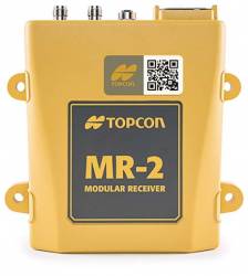
MR-2 GNSS modular receiver system. Photo source: Topcon Positioning Group.

Topcon Positioning Group has announced the launch of the MR-2, a new modular GNSS receiver system. According to the company, the system combines all current and planned constellation tracking with a comprehensive set of communication interfaces to service any precision application requiring high performance RTK (real-time kinematic) positioning and heading determination.

The MR-2 can perform as a mobile RTK base station, marine navigation receiver, mobile mapping device and as a GNSS receiver for agricultural, industrial, military, or construction applications.

Read More >

By Inside GNSS
1 5 6 7 8 9 27
IGM_e-news_subscribe