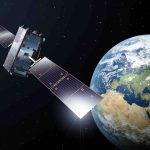
B: Applications Archives - Page 18 of 151 - Inside GNSS - Global Navigation Satellite Systems Engineering, Policy, and Design

B: Applications

March 30, 2022

Europe Initiates Ambitious SBAS Expansions: Dual-Frequency Multi-Constellation Signals Coming to EGNOS

The European Geostationary Navigation Overlay Service (EGNOS) will soon launch a new maritime solution that will make legacy and costly coastal ground-based augmentation systems redundant. Meanwhile, the next generation EGNOS V3, featuring dual-frequency, multi-constellation (DFMC) services, is set to come online by 2028, once GPS L5 is declared operational.

Read More >

By Peter Gutierrez

Deus in the Machina: Machine-Learning Corrections for Improved Position Accuracy

A novel method for improving the positioning accuracy of GNSS receivers exploits a machine learning (ML) algorithm. The ML model uses the post-fit residuals, which are readily available after the position computation from the position, velocity and timing (PVT) engine, adoptable by existing receivers without requiring any modification. The performance of this method, demonstrated using data collected with mass-market receivers as well as a Google public dataset collected with Android smartphones, shows the practicality of the concept.

Read More >

By Inside GNSS
March 29, 2022

Q: What is the future of autonomous vehicles?

The concept of autonomous driving has generated a lot of interest and attention in the past decades as it is believed to provide numerous benefits for individuals and society: increased road safety, reduced traffic congestion, accidents and death, and saving time and pollution on commuting. There is a lot of ongoing work on this topic, much research and many experiments have been conducted on how to make cars learn the environment, make human-like decisions and drive on their own.

Read More >

By Inside GNSS
[uam_ad id="183541"]

Multiple Imaging Radars Integrate with INS/GNSS via AUTO Software Reliable and Accurate Positioning for Autonomous Vehicles and Robots

Difficult GNSS environments and adverse weather conditions require a fusion of many sensors to maintain lane-level accuracy for autonomous platforms, without incurring high costs that would inhibit widespread adoption. Radars are an attractive option in a multi-sensor integration scheme due to being robust to adverse weather and insensitive to lighting variations.

Read More >

By Inside GNSS
March 10, 2022

Signal Authentication, 5G and a Whole Lot of SatNav Trouble

The following is a partial transcript of a talk given to the National PNT Advisory Board Executive Committee (PNTAB ExCom) on December 9, 2021. It connects GNSS signal authentication, by both Galileo’s OSNMA and the proposed GPS Chimera signal, with developing PNT capabilities in 5G telecom technology, and further, with software-defined radio (SDR) capabilities aboard some GNSS satellites that could place GPS in the second tier.

Read More >

By Inside GNSS
[uam_ad id="183541"]
March 7, 2022

Washington View: 5G, PNT, and Air Safety

A  deadlock over 5G implementation, and the potential hazards the technology would create for air traffic safety, has been at least temporarily resolved. Not all questions have been answered nor problems eliminated, however. And while radio altimeters do not use GPS or GNSS technology, they are definitely PNT devices, and this situation could create precedents for ongoing and future conflicts between telecom and PNT use of the finite radio spectrum.

Read More >

By Dawn M.K. Zoldi (Colonel, USAF, Ret.)
March 1, 2022

Real-Life Testing: Part 2 – Operational Test Phase

Skin in the Game – Engineers Subject Themselves to Sensor Fusion

Two Hexagon I NovAtel employees and a reporter sacrificed their bodies in the name of science by riding in the jump seat of an Aero Albatros fighter training jet during the L-39 demonstrations. Here, we get the perspectives of those brave souls and the mastermind behind the unique human aspect of this experiment.

Read More >

By Dawn M.K. Zoldi (Colonel, USAF, Ret.)
February 24, 2022

Software-Defined GNSS Receiver Goes Open Source

The Finnish Geodetic Institute (FGI) of the National Land Survey of Finland announced the release of its software-defined receiver as open source for the international GNSS community. The GSRx software receiver has been extensively used as a research platform for the last decade in different national and international R&D projects to develop, test and validate novel receiver processing algorithms for robust, resilient and precise position, navigation and timing (PNT).

Read More >

By Inside GNSS
1 16 17 18 19 20 151
IGM_e-news_subscribe