How do you trust centimeter level accuracy positioning?
Q: How do you trust centimeter level accuracy positioning?
By Inside GNSSGlobal Navigation Satellite Systems Engineering, Policy, and Design
Q: How do you trust centimeter level accuracy positioning?
By Inside GNSS

Unicore Communications, Inc. offers the UM220-INS, a BeiDou/GPS+inertial MEMS dual system inertial navigation module for in-dash automotive navigation and high-end navigation, and the UB280, a BeiDou/GPS dual-System dual-antenna high precision heading board for precise RTK position and heading.

Available now, the XDL Rover 2 is equipped with Bluetooth wireless communication for ease in configuration and operation, including use with Android devices in the field. UHF data can be transmitted via Bluetooth to a paired host device for operational efficiency.
By Inside GNSS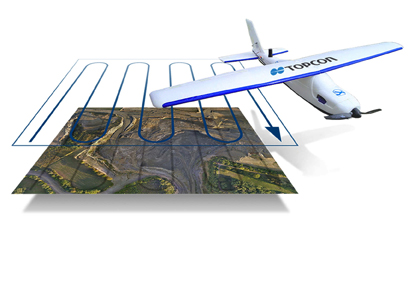
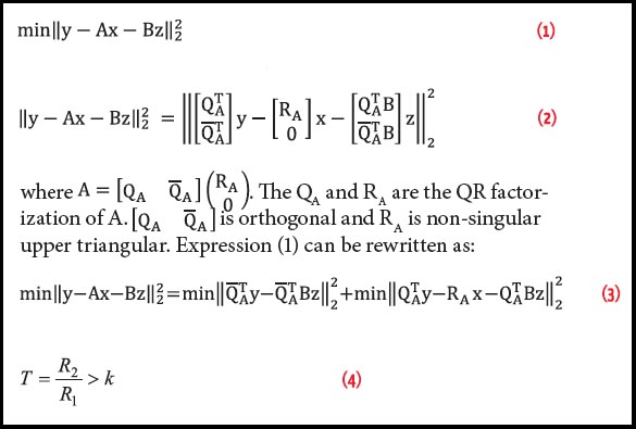
Topcon Positioning Group has released two unmanned aerial systems (UAS) for mapping — the Sirius Pro and Sirius Basic. Both systems are designed to produce accurate solutions for the automated mapping of a wide range of sites — regardless of terrain — including construction sites, mines and quarries, and for use in land surveying, power line and pipeline inspection as well as precision agriculture field mapping.
By Inside GNSS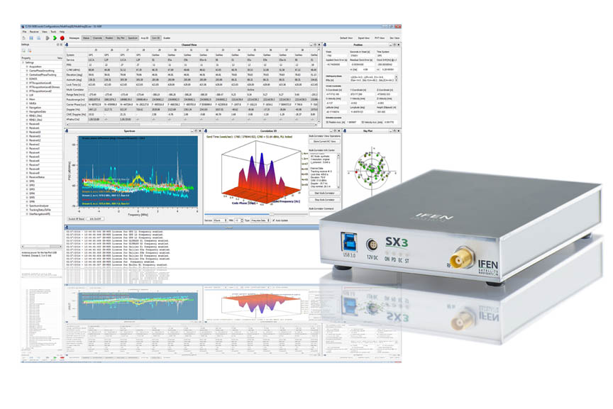 IFEN SX3
IFEN introduced its new SX3 GNSS software receiver, a major upgrade of the company’s SX-NSR, last week at the ION GNSS+ conference in Tampa, Florida. Redesigned hardware frontends feature four wideband RF frequency bands that can be split into a maximum of eight sub-bands per unit. At the same time the bandwidth has been expanded to a full 55 megahertz, offering additional signal power especially in the Galileo E5 band.
By Inside GNSS
The high-precision GNSS industry should expect to see industry consolidation and a scramble for new markets and innovations as prices for high-end chips and modules continue to slide, experts told attendees at a ION GNSS+ panel discussion in Tampa, Florida, last week (September 11, 2014).
The falling prices could strain R&D budgets, they noted, but could also create opportunity as high-end receivers come within reach of emerging industries like self-driving cars, unmanned aerial vehicles, and are even incorporated into consumer products.
By Inside GNSS

Working Papers explore the technical and scientific themes that underpin GNSS programs and applications. This regular column is coordinated by Prof. Dr.-Ing. Günter Hein, head of Europe’s Galileo Operations and Evolution.
By Inside GNSS Orbits of the fifth and sixth Galileo satellites launched together on August 22, 2014, in red, compared to their intended position, in dashed green, and the position of the four IOV satellites launched in 2011 and 2012 in solid green. This view looks down over Earth’s South Pole, helping to illustrate how the two satellites’ orbital inclination relative to the equator is less than was intended ESA illustration.
The European Space Agency (ESA) released dramatic illustrations today (September 16, 2014) of the orbital locations of the two errant Galileo spacecraft launched on August 22, the intended orbit, and the locations of four In-Orbit Validation (IOV) satellites.
By Inside GNSS
Two European proposals to allow pseudolites in the protected frequencies used by GPS and Galileo could soon be adopted, creating a potential interference risk to GNSS receivers and hampering efforts to protect satellite navigation spectrum, experts say.
By Inside GNSS Gen. John Hyten. USAF photo
As the new commander of Air Force Space Command (AFSPC) Gen. John E. Hyten is responsible for all the service’s space programs including the Global Positioning System.
By Inside GNSS The Antiquarium in the Residenz München
The Munich Satellite Navigation Summit will take place at the Residenz Muenchen in Munich, Germany on March 24 – 26, 2015.
The theme for this year’s summit is “Future of PNT – A Glance into the Crystal Ball”.
The technical program includes plenary discussions and updates on the main activities in worldwide satellite navigation systems, including:
By Inside GNSS
Trimble Dimensions, the 2014 International User Conference, will take place at the Mirage and Treasure Island hotels in Las Vegas, Nevada from November 3 through 5.
Online registration is now open. The deadline for abstracts has passed.
By Inside GNSS
 The Capitole of ToulouseToulouse, France
The 2014 International Technical Symposium on Navigation and Timing will be held at the ENAC premises (Bellonte Amphitheater) in Toulouse, France on November 17 – 18, 2014. The objective of the symposium is to gather experts and innovators that will present their views/work on specific navigation- and/or timing-related topics, with an emphasis on technical aspects.
Online registration is open.
By Inside GNSS