March 28, 2015
Successful Galileo FOC Launch Brings Relief to Europe’s GNSS Program
European space officials and engineering teams heaved a collective sigh of relief as the second attempt to launch a pair of full operational capability (FOC) Galileo satellites appears to have succeeded yesterday (March 27, 2015).
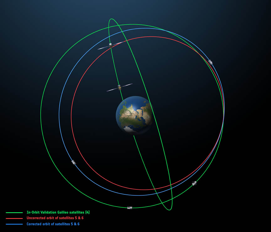
The EU’s Galileo satellite navigation system now has eight satellites in orbit, including four in-orbit validation (IOV) satellites launched in 2011 and 2012 and the first two FOC spacecraft placed into an anomalous orbit last August.
By Inside GNSS