agriculture

May 24, 2011

Hemisphere Reports Revenue Jump, Profit for Q1 2011

Steve Koles, president & CEO, Hemisphere GPS

Hemisphere GPS, Inc., has reported revenue growth of 41 percent and a return to profitability in the first quarter of 2011 for the three months ending March 31.

For the quarter, the Calgary, Alberta, Canada–based company generated $21.2 million in total revenues, compared to US$15.1 million in the first quarter of 2010. Revenues from all market segments increased in the first quarter of this year.

Read More >

By Inside GNSS
April 12, 2011

Geneq Announced Dual-Frequency RTK GPS, OmniSTAR HP Receivers

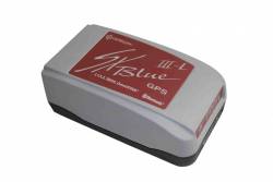
Geneq SXBlue IIIL

Geneq Inc., a Montreal, Quebec, Canada, manufacturer, has introduced two new GPS products.

The SXBlue III-L is a compact GPS L1/L2 receiver in the world designed for use with OmniSTAR’s HP service to attain decimeter accuracy worldwide. Targeted at GIS mapping/surveying applications, the receiver measures 14 x 8 x 5.6 centimeters (5.57 x 3.15 x 2.22 inches) and weighs 517 grams (1.14 pounds) including battery.

Read More >

By Inside GNSS
[uam_ad id="183541"]
March 16, 2011

Trimble to Acquire Fugro’s OmniSTAR DGPS Service

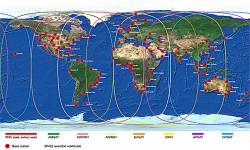
Omnistar DGPS world map

Trimble announced on March 16 that it has entered into a definitive agreement to acquire certain assets related to the OmniSTAR GNSS signal corrections business from Fugro N.V.

The acquisition is expected to significantly expand Trimble’s worldwide ability to provide correction services for a broad range of land-based applications in addition to OmniSTAR’s current focus in agriculture. Fugro’s offshore marine business is unaffected.

Read More >

By Inside GNSS
February 16, 2011

Hemisphere GPS: China OEM Alliance, New GPS Compass Products

H102 GPS Compass

Hemisphere GPS has announced an OEM alliance with a Chinese manufacturer of agricultural, construction, and power machinery equipment as well as the release of two compact GPS compass products.

The Calgary, Alberta, Canada–based company’s alliance with YTO Group Corporation, headquartered in Luoyang City, China, is part of Hemisphere GPS’s to expand its operations in the international realm.

Read More >

By Inside GNSS
January 11, 2011

Topcon and DICKEY-john Form Alliance Around Ag System Development

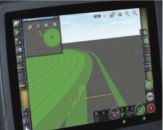
Topcon X30 controller

Topcon Positioning Systems (TPS) and DICKEY-john Corporation, an agricultural systems and machine control manufacturer based in Auburn, Illinois, have formed a strategic relationship in the agriculture industry.

Headquartered in Livermore, California, TPS recently unveiled its System 350 machine control system, which employs the company’s new X30 control console and its AGI-3 receiver for autosteering.

Read More >

By Inside GNSS
October 30, 2010

Asia Multi-GNSS Demonstration Project Schedules Second Workshop in November

Organizers of an ambitious project in the Asia/Oceania region demonstrating the benefits and opportunities for using multiple GNSS systems are moving ahead in their effort to design and implement a five-year campaign.

The 2nd Asia Oceania Regional Workshop on GNSS will be held in Melbourne, Australia, on November  21–22, in the two days before the Asia-Pacific Regional Space Agency Form (APRSAF) annual meeting in the city.

Read More >

By Inside GNSS
[uam_ad id="183541"]
August 2, 2010

Hemisphere Launches GPS Vector II OEM Board

Hemisphere GPS has announced its Crescent Vector II OEM board and a series of related Crescent Vector II GPS compass products.

The new OEM board, targeted for system integrators, brings a series of new features to the company’s patented Crescent receiver technology, including heave, pitch, and roll output; more accurate timing, lower phase noise, and an improved accelerometer.

The Crescent Vector II design provides precise heading and positioning accuracy even while a mobile platform is motionless.

Read More >

By Inside GNSS
March 31, 2010

GNSS’s Contribution to Albion’s Utopia

City of the Future (Philip Hone Williams, eyewoo.com)

A 77-page report outlining UK’s Space Innovation and Growth Strategy 2010 to 2030 concludes with a vision of life 20 years from now, aided by advanced space technologies. This excerpt is reproduced verbatim from The Space IGS Main Report.

Read More >

By Inside GNSS
March 26, 2010

Elizabeth Cannon: Geomatics Innovator

UPDATE: On March 24, 2010, Elizabeth Cannon was appointed president of the University of Calgary. Scheduled to take office on July 1, she is the first woman to hold the position.

If anyone can synchronize micro-satellites to fly in formation, it’s Elizabeth Cannon – geomatics engineer extraordinaire, leading researcher, technology transfer virtuoso, dean of the University of Calgary’s Schulich School of Engineering in Canada’s engineering capital.

And, not least, a mentor to many — including a number of bright women engineering students who will benefit from the strategies Cannon is developing to increase their numbers in science and industry.

Cannon’s trademark is taking an inexpensive device that already exists and finding a new use for it that raises the bar for accuracy in navigation. For example, Cannon’s imaginative use of equipment available on most new cars — odometers, gyros, and the steering angle sensor—produced a patent-pending system that can be used to automatically avoid collisions and improve control of vehicle stability

At 45, she has transformed technologies in ways that reach almost everyone.

From the moment she first encountered GPS as a summer student at Calgary’s Nortech Surveys in 1983, Cannon was hooked on the concept of using signals from space to precisely measure things on the ground. Since then, her self-described “addiction to accuracy” has spurred development of novel satellite-based positioning methods, software, and applications including indoor location, automobile positioning systems, precision farming, and remote sensing.

“Ten years ago, I don’t think I would have predicted where we are today,” Cannon says. “What’s exciting is you’ve got the GPS signals being enhanced, new signals being transmitted from space via GALILEO and the enhancement of GLONASS, and now the Chinese are developing a system.”

Inventor

Cannon’s ability to move discoveries from lab to market has resulted in two patents (and one more pending) plus a state-of-the-art product line that includes coauthoring nine GPS software packages used by more than 200 agencies worldwide.

Commercialized by a university subsidiary, University Technologies International (UTI), these innovations already have returned significant licensing income to the University. What’s more, many of Cannon’s graduate students are recognized as co-inventors and share in the financial benefits from licensing fees.

Three recent projects provide a window on the scope of Cannon’s research enterprise

Precise vehicle positioning system. Cannon’s team used GPS/INS with built-in onboard sensors on a passenger vehicle to achieve centimeter accuracies in urban and suburban areas.

“This a major challenge given the tough environment and the need for lower-cost sensors,” she says. “We have developed a real-time system that can deliver centimeter-level accuracies with GPS outages up to 10-20 seconds.”

Cannon’s imaginative use of built-in equipment (odometers, gyros, and the steering angle sensor) produced a patent-pending system that has been transferred to industry for market development.

Assisted GPS Under Various Aiding Scenarios. At the other end of the spectrum, Cannon’s group has looked at assisted GPS, in which various siding parameters were provided to a high sensitivity GPS receiver, in order to determine the impact of different parameters on acquisition and tracking performance.

“What really counts is being able to track signals in weak signal environments, around trees or indoors,” Cannon says. “We are looking at information that can be provided to your GPS unit through the cellular network.”

Simulator and field tests are being performed using hardware support from SiRF Technology, a prominent GNSS innovator in creating technologies that confer “location awareness” or “location intelligence” to a wide range of consumer products.

Formation Flying of Micro-satellites Using GPS. Initially, Cannon’s lab used their software simulation environment to test the use of carrier phase GPS for inter-satellite positioning and formation flying. Now the focus has shifted to using a hardware simulator to develop algorithms and test the system under various operating conditions.

“You want to have a certain configuration with a certain spacing from one another, to the centimeter or sub-centimeter level,” Cannon explains. “The next ultimate goal is to use it in space.”

When that breakthrough is achieved, the way will open for new applications that can be expected to drive GNSS-assisted technologies to even higher levels of precision and accuracy. Possible benefits include improved methods of tracking global climate change. How long will it take? “We’re probably a couple of years away,” Cannon says.

The work is being done in conjunction with the Space Flight Laboratory at the University of Toronto’s Institute for Aerospace Studies.

A Natural Scientist

Born to parents with science backgrounds, Cannon’s affinity for mathematics and the sciences was unfettered from the start. As a junior high student in Charlottetown, the seaside capital of Prince Edward Island, Cannon knew science was her calling.

When she discovered GPS, Cannon’s course was set. She quickly earned three degrees in geomatics engineering at the University of Calgary. Her international reputation as a top GPS trainer and researcher was cemented long before she defended her doctoral thesis.

Change Agent

To date, Cannon’s impact on life as we know it encompasses four broad areas extending well beyond her contributions to satellite navigation research and development. In broad brush strokes, she is recognized internationally for

  • Helping shape the research agenda through directorships and memberships in key corporate, research and scientific organizations.
  • Spearheading progress at the international level through her leadership roles in the U.S.-based Institute of Navigation (ION).
  • Developing successful strategies for increasing the number of women at all levels of academics and industry, and
  • Communicating the value of research, and of science and technology in general, to society.

In fact, the list of honors recognizing the excellence of Cannon’s research, teaching, and service covers three pages, single-spaced, in eleven-point type.

She is a Fellow of the Royal Society of Canada and the Canadian Academy of Engineering, She was listed as one of Canada’s “Top 40 Under 40” in 1998. She is the Schulich School of Engineering’s first female dean.

But one award in particular signals the history-making caliber of Cannon’s work: in 2001 she became the first woman to receive the Institute of Navigation’s most prestigious honor, the Johannes Kepler Award.

A Willing Role Model

Less than five percent of Canada’s engineering students were women when Cannon earned her first bachelor’s degree in mathematics at Acadia University in 1982. Though the percentage of women studying engineering has grown to 18 percent in Canada, equalizing the gender balance remains a top priority.

In the United States, the National Science Foundation’s updates on the status of women lump engineers together with all women in science, including the physical, mathematical, computer, environmental, life, and social sciences and psychology. Even with the inclusion of a number of disciplines where women are better represented, the most recent figures show women holding just 28 percent of U.S. faculty positions and 18 percent of full professor posts for engineering and science combined.

These comparatively low numbers are prompting U.S. lawmakers to consider whether cultural factors are continuing to dampen the advancement of women in these areas. In Russia and China, for example, women comprise a much higher percentage of engineers and scientists.

”When you go into a field, you are there because you want to be there, but others look at you and expect you to be a role model,” Cannon says. It is an expectation that she has embraced as passionately – and pragmatically – as she does the pursuit of accuracy in navigation.

“Making sure young women know what the opportunities are and helping them make informed choices is what it’s about,” she says. “I enjoy that, because it’s a way of giving back.”

A Life in Balance

If multi-tasking were an Olympic sport, Cannon would be the odds-on favorite for the gold medal. How does she manage?

“It’s a balancing act,” she acknowledges. “I’m very fortunate that my husband is extremely supportive. We’re really a team, and we’ve tried to integrate our children into what we do.”

Looking ahead, Cannon sees no end to the stream of innovation arising from satellite navigation.

“GPS is still magical in that it keeps us intrigued,” she says. “The demands on technology to provide accuracy anywhere, at low cost, under a huge range of operating conditions, presents never-ending challenges to research and creativity.”

Cannon’s Coordinates
Latitude = 51° 04’ 47.83343”
Longitude = 114° 08’ 01.85354”
Height = 1118.592 m

COMPASS POINTS

Engineering Specialties
Algorithm and software development, system integration

Her Compass Points

  • My husband, Gérard Lachapelle, who also works in GNSS
  • Our two kids – Sara and René
  • My network of wonderful women friends
  • Time alone to reflect and recharge

Favorite Equation
The Kalman filter update equation:
x+ = x + K(z – Hx)
where
x+ state vector after update
x predicted state vector
K Kalman gain matrix
z measurement vector
H design matrix

When She Fell in Love with GNSS
1984. I was working on some of the early GPS carrier phase software developed by Ben Remondi and Clyde Goad at NGS. This was a great experience as so few people were working at this level of accuracy at that time. There was lots to learn and you had a sense that GPS was poised to become something really big!

GNSS Event That Most Signified That GNSS Has “Arrived”
When my friends brag about having GPS in their Blackberries!

Engineering Mentor
My mother, who was a science graduate and became a high school math and science teacher.

Influences of Engineering on Her Non-work Life
Being at a university where I am dean of engineering, it actually consumes my life!

Popular Notions About GNSS That Most Annoy
That it works anywhere to a centimeter!

Favorite Non-GNSS Activities
Running and reading.

What is the next “big” thing?
New signals in space that will drive performance and new applications.

Human Engineering is a regular feature that highlights some of the personalities behind the technologies, products, and programs of the GNSS community. We welcome readers’ recommendations for future profiles. Contact Glen Gibbons, glen@insidegnss.com.

By
February 15, 2010

1 Antenna, 3 Dimensions

SNUGL team members: From left to right, Byungjoon Park (BJ Hobby Craft), Jihoon Kim, Prof. Changdon Kee, Am Cho, Bosung Kim, Dongkeon Kim, Noha Park, Sanghoon Jeon, and Donghwan Bae

GPS has been widely used as a navigation sensor for numerous applications including unmanned aerial vehicles (UAVs). Many researchers have devoted considerable efforts to expand the role of GPS in guidance, navigation and control to determining an aircraft’s attitude. That would enable us to use a GPS receiver as a sensor for an automatic control system as well as a navigation sensor.

Read More >

By
December 2, 2009

Trimble Dimensions China User Conference 2009

Trimble will hold its first user conference in China on December 15-17 at the Jiuhua Resort and Conference Center in Beijing. It will cover civilian technology only.

The theme "Exploration Has No Boundaries," draws comparisons between 15th century navigator Zhenghe, the 2008 space mission Shenqui, and the use of positioning technology to steer exploration.

Trimble head Steve Bergland will deliver one of the conference keynotes.

Read More >

By Inside GNSS
IGM_e-news_subscribe