Aerospace and Defense

Officials Delay First GNSS Authorization Request; Light-Squared Tries to Leverage Issue

The U.S. stance on satellite navigation has long supported international cooperation and a degree of interoperability. In 2010 the Obama administration even adopted a space policy that said foreign satnav services could be used “to augment and strengthen the resiliency of GPS.”

That was easier in the abstract, however, when the only fully functional GNSS was GPS. Now, with other GNSS services coming online, American officials want to think things through again.

Read More >

By Dee Ann Divis
July 15, 2015

10th GPS IIF Satellite on Its Way to Orbit

The U.S. Air Force and its mission partners successfully launched the 10th Boeing-built GPS IIF satellite aboard a United Launch Alliance Atlas V from Cape Canaveral Air Force Stations today (July 15, 2015).

The spacecraft is destined for plane C/slot 3 of the GPS constellation

The launch almost coincided with Friday’s 20th anniversary of the declaration of full operational capability (FOC) for the GPS constellation, which occurred on July 17, 1995.

Just two GPS IIF satellites remain to be launched — Atlas V rockets will be used to launch both.

Read More >

By Inside GNSS
July 10, 2015

GPS Directorate Gains New Leader

Colonel Steve Whitney was sworn in Wednesday (July 8, 2015) as the director of the Global Positioning Systems (GPS) Directorate, Space and Missile Systems Center, Air Force Space Command, Los Angeles Air Force Base, California.

Read More >

By Inside GNSS
[uam_ad id="183541"]

Software-Defined GNSS Simulator: A Step Forward

A few studies (by universities and industry) have shown the feasibility of simulation of real-time digital intermediate frequency (IF) signals based on a graphics processor unit (GPU). And a couple of articles have also demonstrated use of a universal software radio peripheral (USRP)–based software-defined radio (SDR) as a simulator (in playback mode) in real test environments.

Read More >

By Inside GNSS

First Position Fix with IRNSS

The Indian Regional Navigation Satellite System (IRNSS) is an Indian Space Research Organisation (ISRO) initiative to build an independent satellite navigation system that provides precise position, velocity, and time (PVT) to users across the Indian region.

The primary objective of IRNSS is to achieve position accuracy of 20 meters (2σ) for dual-frequency users over India and the primary service area (a region extending to about 1,500 kilometers or 930 miles).

Read More >

By Inside GNSS
May 20, 2015

Estimating the Short-Term Stability of In-Orbit GNSS Clocks

Global navigation satellite systems provide position, velocity, and time (PVT) solutions to users whose receivers calculate position based on one-way ranging from satellites. As is well-understood, a key step in the positioning process involves a determination of the difference between the time of signal transmission identified in the satellite’s broadcast navigation message and the time of its reception by user equipment.

Read More >

By Inside GNSS
[uam_ad id="183541"]
May 6, 2015

Lockheed Completes Integration of First GPS III Spacecraft

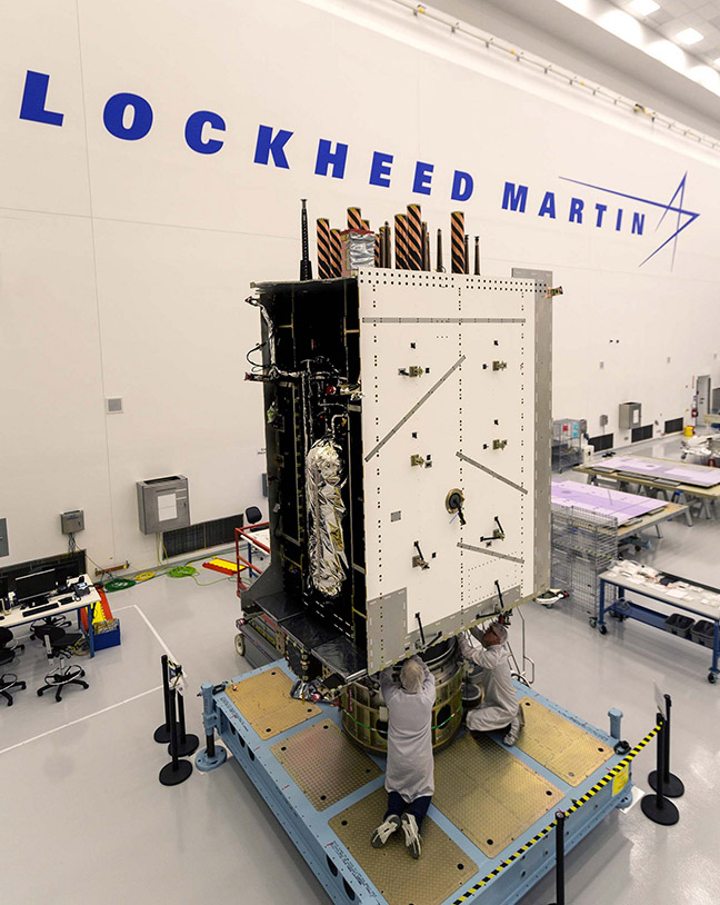
Lockheed Martin has finally been able to announce victory in its effort to complete integration of the first GPS Block III satellite.

Integration took place last month at the company’s GPS III Processing Facility near Denver, Colorado, bringing together the system module — which includes the navigation payload that performs the primary positioning, navigation, and timing mission — the functional bus containing the electronics that manage all satellite operations, and the propulsion core that enables the satellite to maneuver for operations on orbit.

Read More >

By Inside GNSS
April 21, 2015

FAA Awards New GPS WAAS Contract to Raytheon

The Federal Aviation Administration (FAA) has awarded a $103-million contract to the Raytheon Company to maintain the GPS Wide Area Augmentation System (WAAS).

The company will develop a payload to be incorporated into a new geostationary satellite and two associated ground uplink stations to support the WAAS system within U.S. airspace. WAAS improves real-time GPS accuracy from 10 meters to about two meters by transmitting differential corrections as well as integrity messages and an additional ranging signal.

Read More >

By Inside GNSS
1 37 38 39 40 41 60
IGM_e-news_subscribe