Senate Proposal Could Gut Research into GPS-Aided Crash Avoidance

Tied up in the long-running fight over reauthorizing the Highway Trust Fund is funding for a program to develop GPS-enabled crash avoidance technology for vehicles.
By Inside GNSS
Tied up in the long-running fight over reauthorizing the Highway Trust Fund is funding for a program to develop GPS-enabled crash avoidance technology for vehicles.
By Inside GNSSThe U.S. Air Force has awarded Lockheed Martin a $68 million contract to provide mission readiness, launch, early orbit checkout, and on-orbit operations engineering support for the first two GPS III space vehicles.
Under the contract, Lockheed Martin will provide technical support to the Air Force’s 2nd Space Operations Squadron (2SOPS) and monitor the health and performance of the first two GPS III satellites from launch through their 15-year operational design lives.
By Inside GNSS
The Federal Aviation Administration (FAA) has announced the award of a contract that will help accelerate the development of GNSS-based procedures under the agency’s Next Generation (NextGen) air traffic management program.
By Inside GNSS
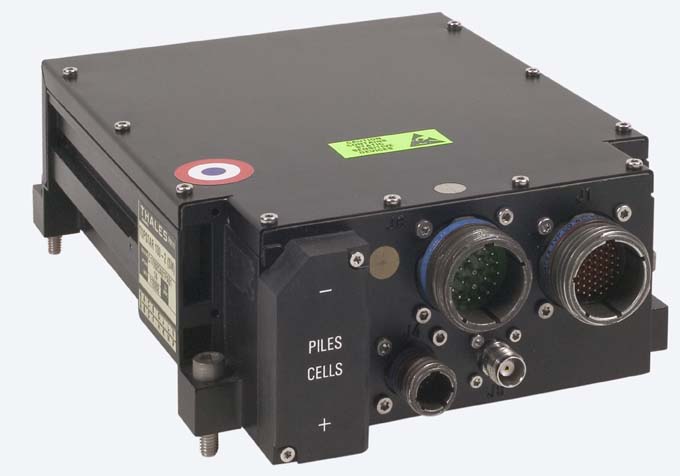
Thales TOPSTAR 100 receiverFrench manufacturer Thales, the only non-U.S. company to offer GPS SAASM (Selective Availability Anti-Spoofing Module) receivers, is working on next-generation receivers for commercial aviation and military markets that will incorporate new signals and multiple GNSS systems.
Since the late 1990s, the company has delivered between 8,000 and 10,000 avionics installations in military and civil domains, according to Pierre Bouniol, GNSS Products Department manager, including multi-mode GPS receivers in stand-alone and enclosure configurations.
By Inside GNSS
NovAtel Inc. today (May 30, 2012) announced the development of their OEM625S Selective Availability/Anti-Spoofing Module (SAASM) GNSS receiver, the first product emerging from a collaborative effort with L-3 Interstate Electronics Corporation (IEC).
The OEM625S, which becomes available for purchase in the third quarter of this year, will combine a commercial dual-frequency NovAtel GNSS receiver with an L-3 IEC XFACTOR SAASM in a single card solution, reducing overall size and power requirements for end customer applications.
By Inside GNSSAs Desi Arnaz often said to Lucille Ball during an “I Love Lucy” episode on TV, “You’ve got some ’splaining to do.”
I refer, of course, to the untoward and unexpected initiative by the British Ministry of Defense (MoD) to patent the technical innovations that underlie the planned next generation of civil GNSS signals.
By Dee Ann DivisReturn to main Washington View article: "USPTO Nears Approval of Troubling British Patent on New GPS Civil Signal"
By Dee Ann Divis
A number of GNSS experts from the United States, Denmark, Norway and China will lead a weeklong workshop on the future of satellite-based positioning technologies from August 27 through September 2 at the Slettestrand Holiday Center in North Jutland, Denmark.
The topics range from GNSS basics and Intelligent Transportation Systems to new GNSSes, new receivers and indoor navigation as well as environmental monitoring and arctic navigation. The event is organized by Stanford and Aalborg universities.
By Inside GNSS
EQUATIONS 1 -11GLONASS currently uses a frequency division multiple access (FDMA) technique to distinguish the signals coming from different satellites in the Russian GNSS constellation. The GLONASS L1 and L2 bands are divided into 14 sub-bands, and each satellite transmits in one of these.
The sub-bands are identified by frequency numbers k, from -7 to 6. The GLONASS L1 and L2 carrier frequencies, in hertz, at a frequency number k are defined by:
FIGURE 2: Example of a national geoid (upper diagram) and a correction surface for the transformation from the new orthometric height system to the old height system (lower diagram). Country is Switzerland. Geoid undulations range from 45 to 55 meters in ETRS89 and from -5 to +5 meters in the national System CH1903+. Lower diagram: Correction surface to transform from the new orthometric height system (LHN95) to the old height system LN02 with corrections from -0.10 to 0.55 meters.Q: How do GNSS-derived heights differ from other height systems?
A: Height estimation using GNSS always seems to be trickier than horizontal coordinate estimation.
Why?
On the one hand, the GNSS technique has error sources that are more critical in the vertical direction. Height estimates are weaker because of a combination of satellite geometry, the presence of strong correlations to other parameters, such as atmospheric delays, and the antenna phase center model applied during data analysis.
By Inside GNSSWorking Papers explore the technical and scientific themes that underpin GNSS programs and applications. This regular column is coordinated by Prof. Dr.-Ing. Günter Hein, head of Europe’s Galileo Operations and Evolution.
By Inside GNSSAn increasingly urgent call to certify performance of Global Positioning System (GPS) receivers is being heard from several sectors of the national political and business landscape. This issue has arisen now as a direct result of the LightSquared initiative that has generated so much attention over the last 18 months.
Instead of diving into those issues directly, however, a little historical perspective is in order first — and it’s amazing in itself that a technology as new as GPS in the public eye would actually have a history to reflect upon, but it does.
By Inside GNSS