The Digital TV Case
Working Papers explore the technical and scientific themes that underpin GNSS programs and applications. This regular column is coordinated by Prof. Dr.-Ing. Günter Hein, head of Europe’s Galileo Operations and Evolution.
Global Navigation Satellite Systems Engineering, Policy, and Design
Working Papers explore the technical and scientific themes that underpin GNSS programs and applications. This regular column is coordinated by Prof. Dr.-Ing. Günter Hein, head of Europe’s Galileo Operations and Evolution.
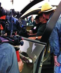 Mike Rowe, host of the Discovery Channel series Dirty Jobs, gets behind the wheel with MVSC’s HUD system at the Makers Faire in San Mateo, California. MVSC CEO Chris Grabowski sits in the passenger seat; CTO Tom Zamojdo is in straw hat. Photo by Valerie Hall.
A San Francisco Bay Area company — Making Virtual Solid–California (MVSC), which snared a trio of awards in a global GNSS competition for its novel approach to driver assistance, is still in early phases of development.
The origins of the company, however, go back more than 40 years to the Cold War era when its principals, Chris Grabowski and Tom Zamojdo, were studying physics and theoretical mathematics at the University of Warsaw, Poland.
But more about that later — first, the news.
By Inside GNSS
NavtechGPS will offer its 2012 East Coast GNSS technical seminars at the Doubletree Annapolis in Maryland, USA from June 18 through June 22.
The seminar instructors are Penny Axelrad, John Betz, Chris Hegarty, Alan Pue and James Sennott.
For more than 25 years, NavtechGPS has provided GPS/GNSS applications solutions for military and research customers, with product choices from more than 30 manufacturers, and has organized basic and advanced GNSS seminars for engineers and technical professionals all over the United States.
By Inside GNSS
NavtechGPS will offer its 2012 West Coast GNSS technical seminars at the Doubletree Mission Valley Hotel in San Diego, California from March 26 through March 30.
The seminar instructors are Penny Axelrad, John Betz, Chris Hegarty, Alan Pue and James Sennott.
By Inside GNSS
Although a Department of Homeland Security (DHS) report on the risks posed by GPS disruptions has yet to be released, the analysis has inspired a proposal to create receivers capable of self-diagnosing spoofing attempts.
“The receiver is the first line of defense,” Logan Scott, president of LS Consulting, told members of the National Space-based Positioning, Navigation, and Timing (PNT) Advisory Board this week.
By Inside GNSS
 A Residenz courtyard, Munich
The 2012 Munich Satellite Navigation Summit will take place at the Residenz Munchen in Germany from March 13 to 15. This year’s opening plenary theme is "GNSS and Security."
This year marks the 10th anniversary of this key European and international event on the policies and direction of the global navigation satellite systems.
The program has been posted online.
Planned 2012 discussions include:
By Inside GNSS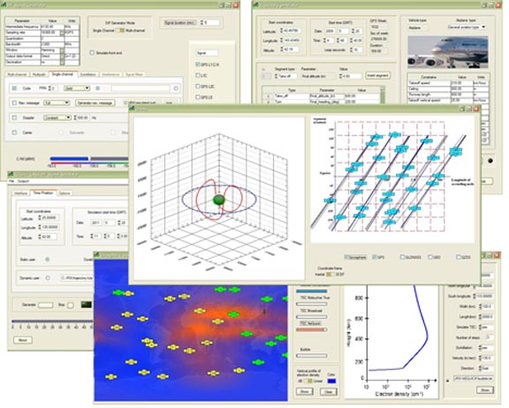 IP Solutions ReGen software simulator GUI
Tokyo, Japan–based IP Solutions has released its ReGen GNSS DIF Signal Simulator, a software simulator that simulates ionospheric effects, generates digital IF (DIF) signals similar to those recorded by an RF recorder, and comes with an optional capability of simulating integrated inertial navigation.
Various configurations can produce multichannel GPS and GLONASS L1 signals and single-channel GPS L1, L2, L5 and GLONASS L1 and L2 signals, as well as simulating noise and interference.
By Inside GNSS
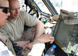 A United States Army specialist explains GPS system to a Croation soldier in their mine-resistant, hardened vehicle, Afghanistan (2011 Photo: Brian Henriksen, US Army)
[Update November 9 2011] In an ex parte filing with the Federal Communications Commission (FCC) on November 8, a leading GPS advocacy group has asked that the agency “promptly rule” that LightSquared not be permitted to pursue high-powered terrestrial operations in the upper Mobile Satellite Services (MSS) band adjacent to the GPS L1 band.
By Inside GNSS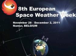
A debate on global navigation satellite systems and their vulnerability to space weather effects will take place at 6:30 p.m. on Tuesday, November 29 at the Palais des Congres in Namur, Belgium. It is free and open to the scientific community and the public.
By Inside GNSS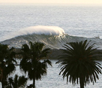 The Wedge, a surfer’s dream at Newport Beach/Corona Del Mar.
 The annual Institute of Navigation International Technical Meeting will take place January 30 through February 1 2012 in Newport Beach, California at the Marriott Hotel and Spa.
By Inside GNSS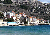
This annual conference on the Croatian Adriatic aims at GNSS experts and covers the risks and vulnerabilities of the global navigation satellite systems and efforts to improve accuracy and reliability.
It will take place at Baska on the resort island of Krk in Croatia from May 21 to May 24, 2012.

 Senator Chuck Grassley
Fed up with the Federal Communications Commission’s (FCC’s) ignoring his repeated requests for information about the agency’s fast-tracking of the LightSquared broadband project, Sen. Chuck Grassley said today (November 3, 2011) that he will hold up the two pending nominees for FCC commissioner positions.
By Inside GNSS
LightSquared is literally pumping up the volume in its efforts to win support for its proposed broadband network adding a host of new lobbyists and a radio campaign to its existing stable of advocates and print advertising efforts.
By Inside GNSS