January 5, 2020
Low-cost GNSS/INS Integration Conquers Harsh Environments
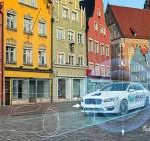
A software-driven navigation engine makes consistent, reliable navigation possible in tunnels, garages and urban canyons.
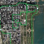
In difficult GNSS signal environments for driving—and here urban canyons, tunnels and parking structures are the standouts—GNSS performance may be severely degraded or completely denied. Inertial aiding has become the standard for ground vehicle navigation. Requirements for autonomous navigation in these circumstances will be rigorous, but those for map-matching, telematics and fleet vehicle tracking are much less so.
By Inside GNSS