
IGS-MGEX
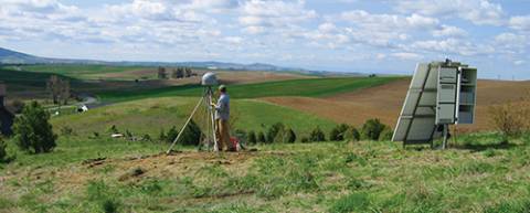
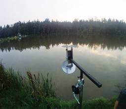
Commonly employed antennas (top) and receivers (bottom) within the MGEX network
The Geospatial World Forum and industry exhibition will be held at the Centre International de Conférences Genève (CICG), Geneva, Switzerland on May 5-9, 2014.
The call for abstracts has closed. Early registration is open until February 15, late registration will be from February 16 to April 25. Spot registration is available after April 25.
This year’s theme is "geoSMART Planet: Resources + Infrastructure & YOU!" Program highlights include:
By Inside GNSS
The eDLoran receiver including antenna is mounted in a standard enclosure (14x14x10cm) for GPS-RTK equipment provided by AD Navigation (Norway)The Dutch Pilots Corporation and Reelektronika announced today (January 7, 2014) the successful development and test of an Enhanced Differential Loran (eDLoran) backup to GNSS in The Netherlands.
Trials at sea and in the Rotterdam Europort harbor area met the requirement for absolute accuracies in the five-meter range, according to Durk van Willigen, CEO of Reelektronika, and Wim van Buuren, Loodswezen’s information & communications technology (ICT) and innovation manager and board member.
By Inside GNSSThe nation’s leading GPS experts are struggling to quantify how the world’s premier navigation and timing system affects the U.S. economy, an effort critical to building a political firewall around GPS spectrum in the face of ballooning demand for broadband capacity.
By Inside GNSS
Crowdsourcing has gained some attention in the GNSS community as a means for detecting and mitigating RF interference and signal spoofing.
In the past year, researchers and commercial ventures have developed ways to take advantage of the GNSS-derived knowledge of real-time location of participants to create ad hoc networks of couriers.
By Inside GNSSLawmakers are poised to sharply limit the ability of foreign nations to own or control satellite system monitoring stations on U.S. territory, a rare show of congressional cooperation triggered by a Russian request to place stations supporting its satellite navigation system on American soil.
By Inside GNSS
The International IEEE Workshop on Asia-Pacific Satellite Navigation and Positioning will be held at CSIRO Centre for Advanced Technologies,
Pullenvale, outside Brisbane, Australia on February 27 to March 1, 2014.
The deadlines for abstract submission and registration are both January 30, 2014.
By Inside GNSS
One of 12 magnetograms recorded at Greenwich Observatory during the Great Geomagnetic Storm of 1859
1996 soccer game in the Midwest, (Rick Dikeman image)
Nouméa ground station after the flood
A pencil and a coffee cup show the size of NASA’s teeny tiny PhoneSat
Bonus Hotspot: Naro Tartaruga AUV
Pacific lamprey spawning (photo by Jeremy Monroe, Fresh Waters Illustrated)
“Return of the Bucentaurn to the Molo on Ascension Day”, by (Giovanni Antonio Canal) Canaletto
The U.S. Naval Observatory Alternate Master Clock at 2nd Space Operations Squadron, Schriever AFB in Colorado. This photo was taken in January, 2006 during the addition of a leap second. The USNO master clocks control GPS timing. They are accurate to within one second every 20 million years (Satellites are so picky! Humans, on the other hand, just want to know if we’re too late for lunch) USAF photo by A1C Jason Ridder.
Detail of Compass/ BeiDou2 system diagram
Hotspot 6: Beluga A300 600ST

1. PAPER, PLEASE.
Silver Spring, Maryland USA
√ The USA will stop printing nautical charts next April, the end of a 150 year tradition. Why? “Declining demand, electronic and digital charts and federal budget realities,” said NOAA’s Office of Coast Survey. They will maintain and update PDFs of more than a thousand coastal charts and refer those who admire traditional lithography to private printers who can do the job.
Elizabeth Rooney at home with Hana and JosephGNSS event that most signified to you that GNSS had “arrived”
Two events stand out:
By Inside GNSS
Main antenna on FOC Galileo satelliteSIDEBAR: Elizabeth Rooney’s Compass Points
Going for her first big job interview after college, Elizabeth Rooney admits she didn’t know what GPS was.
“It was 1995,” she says, “and I was going in to see about this job. I had been looking at some literature from the company I was interviewing with, and there it was, ‘GPS.’ I wondered what the letters meant when I saw them.”
By Inside GNSS
GPS/BeiDou/MEMS configuration and GPS/MEMS configuration (left and right, respectively, top photo), Front view (center photo) and back view (lower photo) of nAX5.2Due to the huge success of GPS in both military and civil applications, several other GNSSs have been developed, built, and operated in the last few decades. GNSS, regional, and augmentation systems are comprise a growing family that also includes GLONASS, Galileo, BeiDou, and Japan’s Quasi-Zenith Satellite System (QZSS). New members, such as the Global Indian Navigation System (GINS), are preparing to join in next decade.
By Inside GNSS
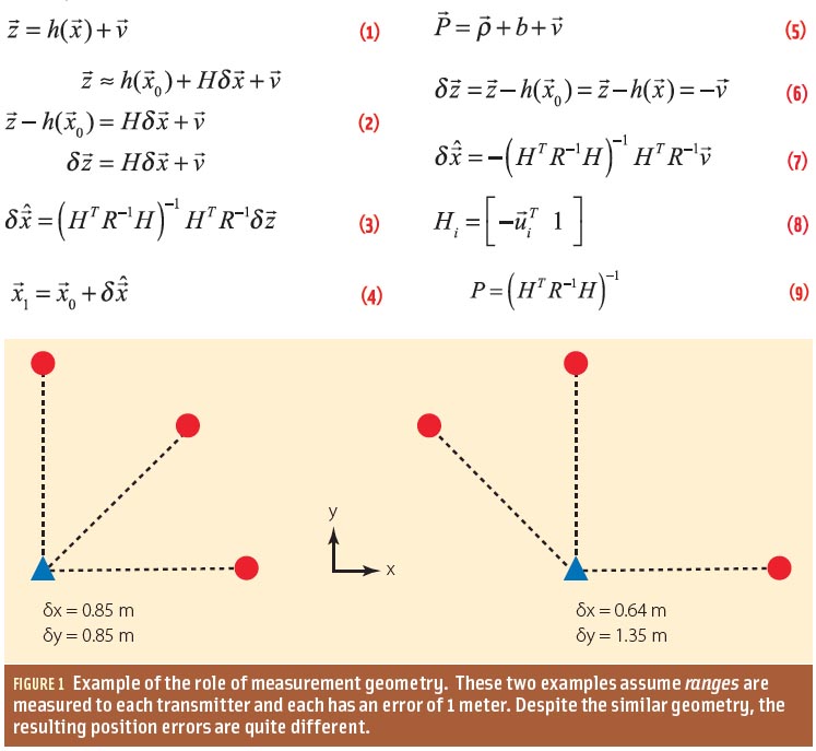
The poor performance of GNSS user equipment in urban canyons in terms of both accuracy and solution availability is a well-known problem that arises where there are tall buildings or narrow streets. This situation is worse in the cross-street direction than in the along-street direction. (See Figure 1.)
By Inside GNSS
The Presidential Palace in Hanoi, VietnamThe fifth Asia Oceania Regional Workshop on GNSS will take place at the Hanoi University of Science and Technology, Hanoi, Vietnam from December 1-3, 2013.
Registration has closed.
The December 1 GNSS Tutorial Session will be "GNSS Positioning Technology".
On December 2 and 3, sessions will be devoted to GNSS applications, a group discussion on the technologies and results of the Multi-GNSS Demonstration experiment and a demonstration of emergency information distribution during disaster using GNSS.
By Inside GNSS