GNSS Hotspots | March 2014
1. WHAT’S LOVE GOT TO DO WITH IT?
Detroit, Michigan USA
1. WHAT’S LOVE GOT TO DO WITH IT?
Detroit, Michigan USA
The world’s GNSS systems are entering a phase of transformation — modernization of existing systems (the U.S. Global Positioning System and Russia’s GLONASS) and development of new systems (China’s BeiDou and Europe’s Galileo) that benefit from the lessons learned from the original GNSSs.
Notable among the modernization initiatives is an interest in implementing new satellite signal designs. These include the GPS L5, L2C, and L1C signals as well as those signals designed for Galileo and BeiDou. GLONASS designers are also working on modernized signals.
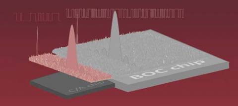
By Inside GNSSIn this article, we will take a look at the various GNSS signals from the perspective of their cost-benefit tradeoffs. First, we’ll look at the evolution of consumer GPS architecture to date — where acquisition speed and sensitivity have been the main drivers of receiver architecture. That architecture has evolved rapidly to take full advantage of the characteristics of the GPS C/A code.
By Inside GNSSThe ENAC (Ecole Nationale de l’Aviation Civile) course "GNSS: Principles, Augmentations and Evolutions of EGNOS" will be held at the ENAC Administrative Head Office in Toulouse, France on May 12 – 23, 2014.
Registration is now open.
By Inside GNSSApplanix Corporation announced that today (November 12, 2013) that the Trimble CenterPoint RTX correction service will be available across its entire airborne mapping portfolio.
Trimble CenterPoint RTX correction service is a GPS-, GLONASS-, and QZSS-enabled correction service built on Trimble RTX technology that provides high-accuracy GNSS positioning without the use of traditional reference station-based differential RTK infrastructure.
By Inside GNSSA common refrain in the world of GNSS is the desire for “interoperability,” the use of signals from multiple systems without a decline — and potentially even an improvement — in the quality of results.
Achieving this depends on large part in establishing comparable parameters — particularly the geodetic references and timing systems — among the GNSSs along with a dense network of ground reference stations that can provide continuous, precise monitoring of satellites’ orbital positions.
By Inside GNSSIonospheric scintillations are rapid temporal fluctuations in both amplitude and phase of trans-ionospheric GNSS signals caused by the scattering of irregularities in the distribution of electrons encountered along the radio propagation path. The occurrence of scintillation has large day-to-day variability. The most severe scintillations are observed near the poles (at auroral latitudes) and near the equator (within ± 20 degrees of geomagnetic equator).
By Inside GNSSGNSS modernization includes not only the global coverage capabilities of GPS, GLONASS, Galileo, and BeiDou, but also regional GNSS enhancement systems such as Japan’s Quasi-Zenith Satellite System (QZSS), the Indian Regional Navigation Satellite System (IRNSS), and the European Geostationary Navigation Overlay Service (EGNOS).
By Inside GNSSThe 8th annual conference on the Croatian Adriatic aims at GNSS experts and and focuses on GNSS resilience and GNSS applications development. It will take place at Baška on the resort island of Krk in Croatia from May 7 to May 9, 2014.
The deadline for abstracts is March 1, 2014.
Topics include:
The Royal Institute of Navigation, London, UK, Faculty of Maritime Studies, University of Rijeka, Croatia and Faculty of Transport and Traffic Sciences, University of Zagreb, Croatia, and is technically co-sponsored by Beihang University of Aeronautics and Astronautics, Beijing, China.
For more information, contact Ms. Sally-Anne Cooke, the RIN conference and events manager at conference@rin.org.uk
By Inside GNSSLawmakers are poised to sharply limit the ability of foreign nations to own or control satellite system monitoring stations on U.S. territory, a rare show of congressional cooperation triggered by a Russian request to place stations supporting its satellite navigation system on American soil.
By Inside GNSS

The International IEEE Workshop on Asia-Pacific Satellite Navigation and Positioning will be held at CSIRO Centre for Advanced Technologies,
Pullenvale, outside Brisbane, Australia on February 27 to March 1, 2014.
The deadlines for abstract submission and registration are both January 30, 2014.
By Inside GNSS