Global Navigation Satellite Systems Engineering, Policy, and Design
Global Navigation Satellite Systems Engineering, Policy, and Design
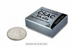
After eight years of successful participation in the Defense Advanced Research Projects Agency (DARPA) chip scale atomic clock (CSAC) initiative, Symmetricom, Inc., announced…
By Inside GNSS
Forecasters at NOAA’s Space Weather Prediction Center (NOAA photo) The annual Space Weather Workshop will take place on April 26-29 2011 in Boulder,…
By Inside GNSS
Nuremberg Pilatushaus and castle The 2011 InterGeo conference and trade fair for geodesy, geoinformation and land managment will take place at the CNN…
By Inside GNSS
Berry Smutny, OHB-System CEO. OHB-System photo OHB-System AG, builder of Galileo navigation satellites, has issued a statement from its chairman denying a WikiLeaks…
By Inside GNSS

View from the MCEC The 2011 International Association of Geodesy (IAG) General Assembly will be part of the International Union for Geodesy and…
By Inside GNSS

[updated January 18, 2011] Carlo des Dorides has been named as the new executive director of the European GNSS Agency (formerly the Galileo…
By Inside GNSS

Higher Colleges of Technology (HCT), Dubai The United Nations International Committee on GNSS (ICG) and the U.S. State Department has organized a workshop…
By Inside GNSS

Topcon X30 controller Topcon Positioning Systems (TPS) and DICKEY-john Corporation, an agricultural systems and machine control manufacturer based in Auburn, Illinois, have formed…
By Inside GNSS

Q: Why is acquisition of GNSS signals generally more difficult than tracking and what are the limiting factors? A: A fairly good analogy…
By Inside GNSS
FIGURE 1: Touching wavelet spectra For the complete story, including figures, graphs, and images, please download the PDF of the article, above. The…
By Inside GNSS

For the complete story, including figures, graphs, and images, please download the PDF of the article, above. Galileo receiver designers require formal interface…
By Inside GNSS
FIGURES 1, 2 & 3 For the complete story, including figures, graphs, and images, please download the PDF of the article, above. In…
By Inside GNSS
Bushy House Britain’s Position, Navigation and Timing Network of the Digital Systems KTN (Knowledge Transfer Network) presents a one-day workshop on "GNSS Interference,…
By Inside GNSS

Bushy House Britain’s Position, Navigation and Timing Network of the Digital Systems KTN (Knowledge Transfer Network) presents a one-day workshop on "Natural Threats…
By Inside GNSS
NavTech GPS will offer its 2011 west coast GNSS technical seminars at the Doubletree Hotel in San Diego, California from Monday, March 28…
By Inside GNSS