“Saying today’s eLoran is what we had in WWII is like saying your 8K Ultra HD television is the same as the 1955 tube set that only got BBC One and ITV. Some fundamentals are the same, but the technology has evolved dramatically.” – U.K. PNT expert.
Loran technology was a critical part of Allied transportation and logistics during WWII with over 70,000 receivers built for ships, aircraft, and submarines. According to the Smithsonian, by the height of the Cold War Loran coverage had extended to 70% of the northern hemisphere.
Although systems were disestablished in much of the west after the advent of GPS and in anticipation of Galileo, Loran systems have continued to provide high power, low frequency positioning, navigation and timing (PNT) services to vast areas in the east and billions of people in China, the Republic of Korea, Saudi Arabia, and Russia.
Today the modernized and more precise version, eLoran, is making a resurgence in the west as a way to greatly reduce the impacts of attacks on GNSS and demotivate those who might make attacks. It will also protect users and economies when space-based PNT is not available for whatever reason.
This western renaissance is being led by the United Kingdom where loss of GPS due to severe space weather was first listed on its National Risk Register in 2012. The nation is establishing both a sovereign eLoran network and a fiber timing network that includes three timing centers to substantially mitigate that risk.
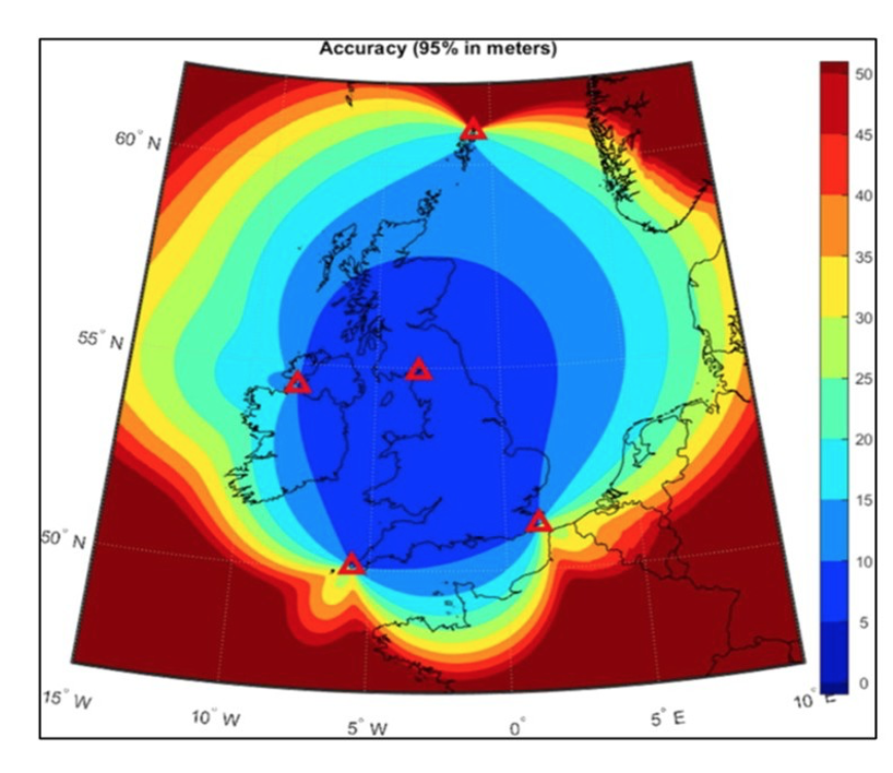
The UK has also committed to establishing four additional transmission sites to add to an eLoran timing signal that has been on-air for decades. Funding has been allocated, a search for the best locations and engagement with potential system providers and operators has begun.
France has committed to joining the U.K. with this effort, though whether they plan to create a sovereign system or merely build upon and broaden the reach of the U.K. network has yet to be announced.
Maritime Use
“As an island nation, we are much more reliant on maritime than others,” observed a British expert recently. “So, we are very concerned with the entire global maritime supply chain.”
An information paper the U.K submitted to a recent International Maritime Organization (IMO) meeting describes in some detail the nation’s plan for and commitment to implement an eLoran network. Along with providing other details it says:
“The system is currently funded to reach full positioning and navigation services in England, Wales, the English Channel, Strait of Dover and Southern approaches to the United Kingdom by 2030, with full coverage to the North Sea, Ireland and Scotland from 2032. These dates are likely to accelerate due to formal partnerships with the Government of France and developing collaboration with other European partners, with formal announcements likely in autumn 2026.”
Expanding beyond Europe, the paper also observes that eLoran systems are already serving areas in “… the Middle East, Northwest Europe and East Asia” and that it can help properly equipped vessels in those areas guard against GNSS disruption.
Some experts have observed that ships in the Strait of Hormuz could greatly benefit by accessing the network operated by the Kingdom of Saudi Arabia. The U.K. paper at IMO obliquely references this by discussing reducing “… the ability of ‘bad actors’ to disrupt strategically important flows…” and “…greater protection at those maritime chokepoints where precise navigation is most required.”
The paper also includes an invitation to other nations that operate or are interested in developing their own sovereign eLoran systems to contact the U.K. team. An industry rep subsequently reported interest from nations from nearly every region and continent.