Trimble announced last week the release of the Trimble GNSS Smart Target Base Station for high-accuracy mapping from Unmanned Aerial Vehicles (UAVs).
The announcement was made in Berlin at INTERGEO 2017, the world’s largest conference on geodesy, geoinformatics and land management.
Trimble announced last week the release of the Trimble GNSS Smart Target Base Station for high-accuracy mapping from Unmanned Aerial Vehicles (UAVs).
The announcement was made in Berlin at INTERGEO 2017, the world’s largest conference on geodesy, geoinformatics and land management.
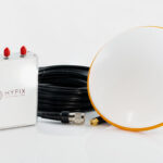
Comprised of a survey grade, multi-frequency, multi-constellation GNSS reference station complete with a foam Ground Control Target with integrated carrying case, the Smart Target Base Station logs the raw GNSS observables required to perform centimeter level post-processed Differential GNSS positioning of UAVs, and acts as a photo-identifiable Ground Control Point (GCP) for quality control.
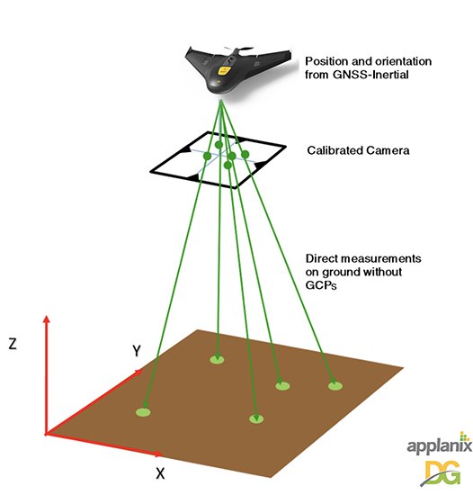
Designed to be cost effective, simple to operate, and supported by both the Applanix POSPac UAV GNSS-Inertial post-processing software for Direct Georeferencing on UAVs and Trimble UASMaster Photogrammetric software, the Smart Target Base Station makes aerial mapping from UAVs easier than ever, according to the company. Simply place the foam target with its receiver in the project area and stake it down. With the included Smartphone app or web UI, users can remotely begin logging the raw GNSS observables data collected by the target that is required for post processing. At the end of the mission, retrieve the target and download the raw GNSS data along with the data collected from the Trimble APX UAV GNSS-Inertial system installed in the UAV. Global coordinates of the reference station are computed automatically using the Trimble Centerpoint RTX post-processing service in POSPac UAV, or if local coordinates are desired, the foam target can be centered over an existing reference point.
“Efficient mapping from UAVs using cameras, LiDAR and other sensors requires the right solutions that need to be simple and easy to use,” said Joe Hutton, director of Inertial Technology and Airborne Products at Applanix, a Trimble Company. “The Smart Target Base Station is a result of listening to our customers’ needs for a GNSS reference station to support Direct Georeferencing on UAVs that is cost-effective, easy to deploy in all terrains, and does not require special knowledge to operate. Aerial surveyors can quickly realize greater value and significant cost savings with this system, while obtaining high accuracy.”
The Trimble GNSS Smart Target Base Station operates autonomously for up to four hours with its embedded lithium ion battery. Extended operation can be achieved with a user supplied external USB battery.
Availability
The Trimble GNSS Smart Antenna Target Base Station is now available globally through Applanix sales channels.

