Echo Ridge LLC of Sterling, Virginia has been working with the Air Force Research Laboratory Center for Rapid Innovation to develop a way to determine position from non-GPS satellite signals in different frequency bands.
[This story is the first in a series of 11 detailing work by firms selected by the Department of Transportation (DOT) in August 2019 to demonstrate technologies that could be used to back up the services provided by GPS should GPS signals be jammed, spoofed or unavailable. Demonstrations are scheduled to take place in March.]
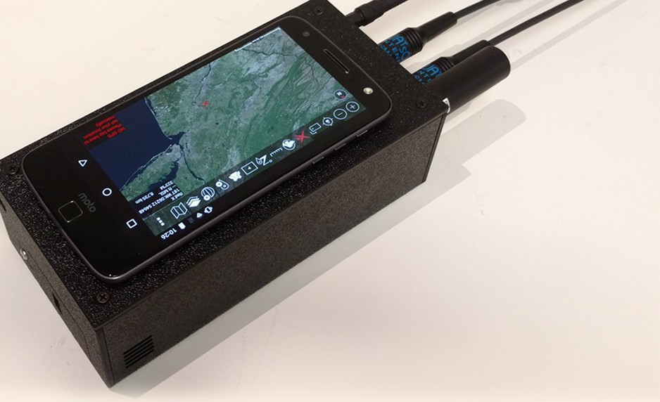
In 2017, Echo Ridge developed a hand-held device for the Air Force Research Laboratory (AFRL) Sensors Directorate that can provide navigation information to ground forces. The device uses an algorithm to aggregate signals of opportunity from various radio frequency sources. The algorithm determines a position based on the time difference of arrival of those signals, which do not operate on the same frequency as GPS. The device connects to a smart phone running the Android Tactical Assault Kit, a device typically carried by Air Force ground operators, to display the navigation solution on a map. Multiple signal sources are used simultaneously, which provides redundancy and increased immunity to adversarial attack.
“We’re measuring signals that have known or discovered geographical locations,” said John Carlson, chief technical officer at Echo Ridge, at that time. “Because we’re able to precisely measure those signals, we can accurately estimate position without error growth over time or distance traveled.”
Echo Ridge and the AFRL Sensors Directorate completed a 2017 field test and demonstration at Fort Bragg in North Carolina. The company has since working to improve usability and address ruggedness issues that would position the device for wider use.
In July 2019, Echo Ridge and Globalstar, Inc. of Covington, LA signed an agreement to collaborate, share data, and jointly pursue market opportunities for a new assured positioning, navigation, and timing (PNT) technology called Augmented Positioning System (APS), to backup and/or complement GPS when GPS is unavailable or unreliable.
The underlying APS technology uses signals from Globalstar’s constellation of low-Earth-orbit (LEO) communications satellites, with Echo Ridge software and user equipment to produce accurate position and timing information. APS incorporates multiple features to boost availability and reliability.


