United Kingdom Archives - Inside GNSS - Global Navigation Satellite Systems Engineering, Policy, and Design

July 14, 2020

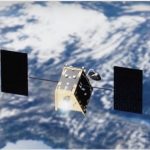
UK Acquires OneWeb LEO Constellation, But Won’t Work for SatNav — Or Maybe It Will

Britain has signed a £900 million ($1.135 billion) deal to buy a part share of satellite operator OneWeb, a low-Earth orbit constellation in-the-making, designed to provide global high-speed broadband services. There had been speculation that the government intended thereby to generate its own satellite-based navigation signals, as it has been shut out of Galileo security signals by its Brexit move. Some satnav experts quickly dashed that notion, but others demonstrated that it just may be possible.

Read More >

By Inside GNSS
May 14, 2020

British GNSS May Die A-borning

Britain’s own satellite navigation system, envisioned to fill the country’s Galileo void created by Brexit, may never see the light of day. Government officials don’t want to spend tax revenues to meet projected increasing costs.

Read More >

By Inside GNSS
August 21, 2019

A Very British GNSS Could Be On the Horizon

As the deal/no-deal Brexit conundrum continues to roil UK politics, the British government has quietly sounded out strategic partners in the so-called “Five Eyes” security alliance for help in launching its own satellite positioning system. Due to leave the European Union on October 31, the UK faces a lockout from the continent’s Galileo system and services, most crucially its–as yet unrealized–Public Regulated Service (PRS), an encrypted navigation signal for governmental-authorized users and sensitive applications, that is, the military.

Read More >

By Inside GNSS
February 19, 2019

GNSS Workaround for a Galileo-less Britain

A recent paper published in The Journal of Electrical and Electronics Engineering, by Lasisi Salami Lawal of Nigeria’s Federal University of Technology, and Chris Reginald Chatwin of the University of Sussex, argues that the United Kingdom could launch a payload on a national military communications satellite to provide navigation overlay services for the United Kingdom territory, surrounding waters and neighboring ally countries.

Read More >

By Peter Gutierrez
IGM_e-news_subscribe