High precision positioning Archives - Page 8 of 10 - Inside GNSS - Global Navigation Satellite Systems Engineering, Policy, and Design

September 26, 2018

Emergency Location Services, Airborne Lidar Systems the Focus of ION GNSS+ Keynotes

Cell phones are helping save lives with their location accuracy during emergencies, but they can get even better.

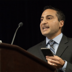
That was one of the messages delivered by Google’s Steve Malkos during his keynote address Tuesday night at the ION GNSS+ Plenary Session in Miami. Malkos, the Technical Program Manager in the Android Location and Context Group at Google, gave one of two keynotes to a packed ballroom of attendees. Paul LaRocque of Teledyne Optech gave the other speech on Tuesday, titled “A Lidar History: From Ship to Air to Space.”

Read More >

By Stan Goff
September 17, 2018

NovAtel Introduces SMART7 Family of Smart Antennas Designed for Agricultural Applications

NovAtel today launched its new SMART7 family of SMART antennas, adding SPAN technology, future-ready Global Navigation Satellite System (GNSS), Wi-Fi and Internet Protocol (IP) connectivity, optimal tracking performance and TerraStar-C PRO corrections to its availability, accuracy, and reliability trusted by major equipment manufacturers for demanding applications like precision agriculture and machine control.

Read More >

By Inside GNSS
August 21, 2018

Swift Navigation’s Latest Firmware Upgrade Brings Full BeiDou and Galileo Support for Piksi Multi

Swift ​​Navigation​, ​​a ​​San ​​Francisco-based ​​tech ​​firm building centimeter-accurate ​​GNSS ​​technology and a Cloud-based Corrections Service​​ designed to ​​power ​​a ​​world ​​of ​​autonomous ​​vehicles, ​​today ​​announced ​​the latest ​​firmware ​​upgrade to ​​its flagship product—the PiksiMulti ​​GNSS ​​Receiver.

Read More >

By Inside GNSS
August 20, 2018

u-blox Offering the First High Precision GNSS Module Based on u blox F9 Technology

u-blox recently announced the ZED-F9P multi-band GNSS module with integrated multi-band real-time kinematics (RTK) technology for machine control, ground robotic vehicles, and high precision unmanned aerial vehicles (UAV) applications. The ZED‑F9P measures just 22 x 17 x 2.4 millimeters and uses technology from the recently announced u‑blox F9 platform to deliver robust high-precision positioning performance in seconds, according to the company.

Read More >

By Inside GNSS
August 10, 2018

Benefits Delivered by Galileo Already Being Felt by EU Citizens, Businesses

The Galileo constellation took another big step towards full operational capability with the successful launch last month of four satellites on-board an Ariane 5 launcher. Representatives of leading industry that have adopted Galileo then held a special press briefing for journalists from across the continent to address updates on how European citizens and businesses are already taking advantage of benefits delivered by Galileo.

Read More >

By Stan Goff
August 9, 2018

Spirent, WMG and Chronos Technology Collaborating to Improve Intelligent Vehicle Location Systems

The need for smart devices to have a highly accurate self-awareness of their own location, and the location of other smart devices around them is becoming increasingly important. Many devices rely on a singular location technology (typically GPS), which is one type of the wider eco system of GNSS. These systems, while becoming more capable, still suffer at times from the deployment environment, typically in urban areas where buildings and other cityscape features interfere with the signal.

Read More >

By Inside GNSS

Septentrio’s AsteRx-i Delivers Accurate, Reliable GNSS/IMU Integrated Positioning

GNSS receiver manufacturer Septentrio recently launched the next generation AsteRx-i which combines the company’s latest compact, multi-frequency multi-constellation GNSS engine with an external industrial grade MEMS based IMU. It can deliver accurate and reliable GNSS/IMU integrated positioning to the cm-level as well as full 3D attitude at high update rates and low latency, according to Septentrio.

Read More >

By Inside GNSS
July 12, 2018

China Launches Another BeiDou Navigation Satellite

China sent a new BeiDou navigation satellite into orbit on a Long March-3A rocket from the Xichang Satellite Launch Center, in the southwestern Sichuan Province, at 4:58 a.m., Tuesday, July 10.

The satellite is the 32nd of the BeiDou navigation system, and one of the BeiDou-2 family, which is the second generation of the system. The state-run Xinhua press agency confirmed the launch within two hours after liftoff.

Read More >

By Inside GNSS
July 10, 2018

NovAtel’s GNSS+INS Combined System with SPAN Technology Now Offered in Rugged, Ultra-Compact Unit

NovAtel announced today that it is now delivering their market-leading SPAN® tightly-coupled GNSS+INS navigation technology in a rugged, ultra-compact unit. Commercially exportable and ideal for integration into a wide variety of applications, the high-performance SPAN CPT7 is designed to deliver assured positioning – anywhere, in a package one-quarter the size of the highly successful SPAN-CPT.

Read More >

By Inside GNSS
IGM_e-news_subscribe