Earlier this month, Standford University hosted its 17th annual PNT Symposium, with two days filled of presentations from student speakers and invited guests.
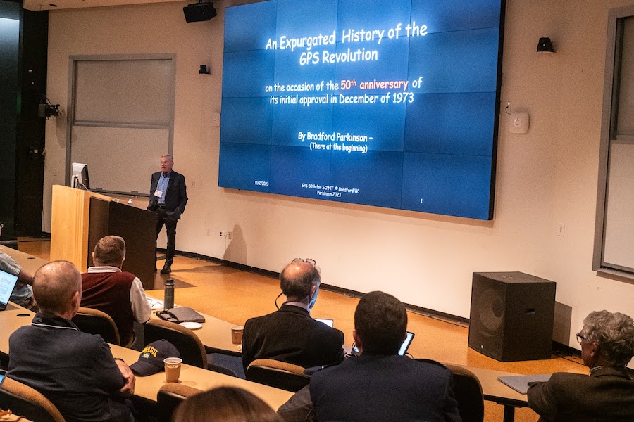
Brad Parkinson was among the presenters, with his talk focusing on the important milestone reached in 2023: the 50-year anniversary of gaining approval for full scale GPS demonstration. He covered some of the key moments leading up to that December 1973 approval, including what he described as the “noteworthy failure” and the famous Labor Day weekend meeting at the Pentagon.
Parkinson highlighted the predecessor to GPS, Transit, which lasted more than 30 years. Transit was sponsored by the Navy and developed jointly by DARPA and the Johns Hopkins Applied Physics Laboratory. The engineers working on GPS were able to build on some of the techniques it pioneered, including the ionospheric corrections technique. Parkinson also gave credit to Dr. Richard Kirschner, who led Transit’s development.
Transit, of course, had its challenges and by 1964 the general consensus was there had to be a better way. The U.S. Air Force began a secret system study, which was completed in 1966 and looked across a broad set of ways to navigate from space. It was classified when published and wasn’t declassified until long after GPS was defined, but Parkinson said it set a “real foundation for what we were doing. We picked the hardest of the alternatives that were there.” There were 12.
Numerous talented engineers played a role in getting to that initial approval, and Parkinson gave many of them credit during his talk, including Malcolm Currie, who he describes as the GPS Godfather.
When Parkinson went to the Pentagon in 1973 to make the case for GPS to the Defense Systems Acquisition Review Council (DSARC), Currie was at the table of admirals and generals who rejected it. He talked with Parkinson after the meeting and told him the current design was not optimal, but with a redesign, it had a good chance of gaining approval.
To make it happen, about 12 people gathered in the Pentagon over Labor Day weekend with the goal of defining GPS. They confirmed the fundamental concept, which was four satellites in view, but switched to a new modulation scheme. The space hardened clocks and code division multiple access (CDMA) signals that exist in every GNSS today were also added over that weekend, and made possible by “great engineering talent” that included Gaylord Green, Steve Gilbert and Mel Birnbaum.
“Armed with a new proposal I hit the road, and 50 years ago I got approval,” Parkinson said. “I went to the same platform with the same generals and this time, as Dr. Currie had predicted, they said yes.”
They approved $150 million for an 18-month test program that included the four satellites, launch vehicles and other equipment. Between 1973 and 1978 there was a period of very intense activity, with the first satellite launching 44 months after the contract was received. The team had to overcome great opposition and all the challenges that come with pursing a new idea, but what they accomplished led to the system so many rely on today.
U.S. Space Force Lt. Col. Robert Wray, 2nd Space Operations Squadron commander, also presented on the second day of the symposium, focusing on where we are today with GPS and its continued importance to both military and civilian users.
The industry remains focused on updating GPS and improving its resiliency, which can be seen in the next generation of satellites, GPS IIIF. These satellites will provide regional military protection (RMP) for a boosted M-code signal, more M-code power and resiliency in disadvantaged areas and a search and rescue (SAR) payload. By the end of this decade, Wray said, they’ll be able to update satellites while they’re still in orbit, pushing modernization forward with the ability for much faster updates.
The first GPS IIIF satellite is set to launch toward the end of 2026, he said, with launches then slated every four months after to “get more satellites on orbit that can provide more capability” rather than just staying ahead of the curve as satellites retire. Because the components work so well, satellites typically have a lifespan of 25 years or more, and usually are put out of commission because of atomic clock failure.
“We have four satellites that are built and ready to launch out of Cape Canaveral, with the next one set to launch in June 2024,” Wray said. “We’re trying to balance how to modernize GPS and take care of the current systems. Now the limiting factor is launch vehicles. Next June will be our 80th launch, a huge milestone. By 2026 we will have launched all of our GPS III satellites.”
Other invited speaker presentations included PNT from the DARPA Perspective, PNT as a Service (PNTaaS) Leveraging Commercial SATCOM, Operational, Global, and Persistent GNSS Disruption Monitoring and PNT Effects on AI Flight Testing.
As always, the meeting started with student presentations. Students from the University of Colorado Boulder, Virginia Tech, Standford University, National Cheng Kung University and Auburn University covered various topics including navigating accurately in cities using vision-sensor aided GNSS, multipath detection using the Normalized Early, Prompt, Late Area (NEPLA) method, radar-based multitarget estimation for a large-scale satellite deployment and adaptive informative path planning with multimodal sensing.
During the meeting, Todd Walter, a Research Professor in the Department of Aeronautics and Astronautics at Stanford University, introduced CARNATIONS, a new research team that will focus on resilient PNT (R-PNT) in multimodal transportation. The consortium of partner institutions that make up CARNATIONS includes Standford University, Illinois Tech, Chicago State University, the University of California-Riverside and Virginia Tech.
“We’ll be conducting research in signal processing and antennas, multi sensor systems, connectivity and transportation,” Walter said. “We’ll define the threats and make sure we have resilient solutions to them.”
Image courtesy of Stanford University.


