Humphreys’ UT Radionavigation Lab worked with Stanford to identify satellites.
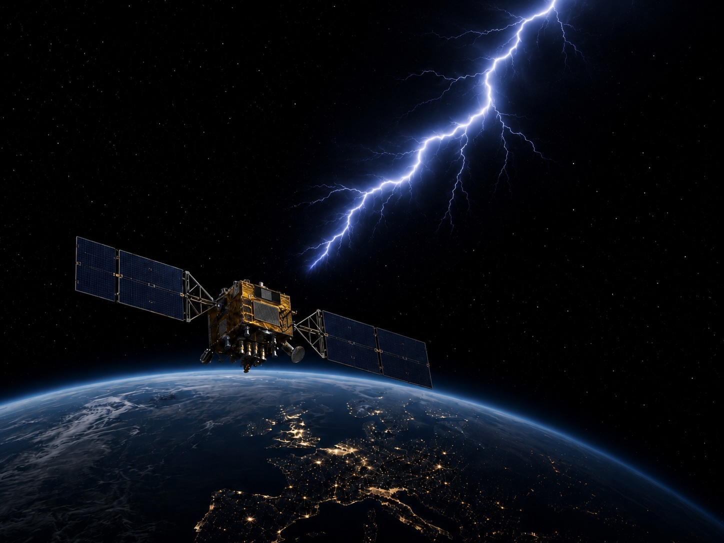
“Chasing Lightning: Detecting, Characterizing, and Identifying a Powerful Space-Based GNSS Interference Source” is the title of a new paper Zachary Clements, Argyris Kriezis, and Prof Todd Humphreys. It details how, after almost two years of effort, they were able to identify a constellation of Russian early warning satellites in Molniya (“lightning”) orbits as the source of a series of difficult-to-detect disruptions to GPS signals.
The paper identified 75 events over a seven-year period in which terrestrial reference stations operated by the International GNSS Service in Europe, Greenland and Canada recorded simultaneous and significant drops in carrier to noise ratio (CNR).
The story of this jammer hunt in space began in September 2024. During a presentation to the Civil GPS Service Interface Committee in Baltimore, Humphreys opined “There is every reason to believe China’s BeiDou global navigation satellite system has the ability to imitate American GPS signals and those of Europe’s Galileo,” His remarks were reported in SpaceNews along with speculation about Russia’s capabilities.
The SpaceNews article prompted a call to the Resilient Navigation and Timing Foundation from a researcher in the United Kingdom. The researcher reported that deliberate disruption from space was not just speculation – he had observed it. While the researcher did not want to be publicly identified, he was happy to provide the data and allow others to confirm his findings.
With the researcher’s permission, the Foundation connected him with several GNSS experts who could confirm his findings and met with U.S. government officials to convey the extensive data package.
Clements and Humphreys reported on their initial findings in the paper “Transient Space-Based GNSS Interference: Observations and Analysis” at the Institute of Navigation Conference in September 2025. At that point they had not yet identified the source of the interference.
In the new paper the researchers outline how they accessed data from 165 reference stations. Seventy-five simultaneous drops in CNR across multiple stations, with at least one station recording a drop of 5 dB or more, were identified.
Humphreys is confident that the interference is purposeful, not hardware malfunctions or accidental emissions.
“The pattern is far too consistent for this to be accidental. In fact, our data shows it has to be intentional.”
The interference:
- Has almost always been on a weekday – usually Tuesday through Thursday,
- Events are not regularly spaced out and are transient (less than 10 seconds) rather than periodic or continuous as would be expected from an equipment malfunction,
- Events are quite powerful. CNR drops of up to 10 dB have been observed in some cases, and
- Impacts are to the most commonly used GPS frequency, L1, but don’t affect other GPS bands like L5.
Also, the signals interfering with GPS are not exactly astride the L1 frequency but are slightly offset. They are centered at 1577.5 MHz, about 2 MHz above the GPS L1 center frequency. This may be an effort to test the capability while avoiding detection.
Perhaps most damning, Humphreys’ team has found that the same Russian constellation has been impacting signals from China’s Bei Dou satellite navigation system in an almost identical way since June 2020.
It is clear that one of this constellation’s primary capabilities is disruption and denial of America’s GPS and China’s Bei Dou navigation systems, should the Kremlin decide to do so. A slight change in frequency and an increase in transmitted power is all that is needed to prevent reception across continental size areas.
The new paper provides six insights for GNSS experts and observers. It:
- Provides measurement models and a detection framework for transient wide area interference,
- Details the spatial, temporal, and spectral properties of multiple wide-area GNSS outage events from the space-based interference source and distinguishes these from a naturally occurring solar radio burst,
- Presents a basic satellite identification strategy to narrow the candidate satellites and estimate the minimum satellite altitude at apogee,
- Presents an advanced satellite associate framework using the generalized likelihood ratio test (GRLT) and applies the framework to a test scenario,
- Details a framework for instantaneously identifying an interference satellite based on a brief time history of TDOA measurements, and gives an error sensitivity analysis, and
- Combines IGS CNR data and raw wideband samples from two additional receivers in Europe to confidently identify the source, which is revealed to be a small constellation of Russian satellites in Molniya (“lightning”) orbit.
The paper reveals a significant threat to GPS and other GNSS that has heretofore been unknown to the general public. Findings have already been reported by the New York Times and a video about the discovery has been posted on YouTube by the science education channel Veritasium.
Many in the community expect that it will increase already high levels of concern about the vulnerability of GPS and other GNSS and how it is used as a tool in great power competition.
Russia has been particularly open about its use interference from terrestrial sources to punish its neighbors in the Baltic and eastern Europe for growing closer to the West.
In November 2021 as it prepared to invade Ukraine, Russia shot down one of its defunct satellite with a ground-based missile. The following day state-sponsored media threatened that if NATO got in its way in Ukraine, Russia would shoot down all 32 GPS satellites.
While Russia many not have had the capability to destroy all GPS satellites, it is now clear they had the ability to prevent reception of signals across very wide areas of the globe.
It is unknown how Russia’s threat influenced the West’s actions in Ukraine. Or how Russia’s ability to turn off reception of GPS and other GNSS with the flip of the switch will impact international relations and actions in the future.
What we do know is that Russia and China have terrestrial PNT systems to complement and backup their systems in space.
Unlike the United Kingdom and France which are building such systems, and South Korea and Saudi Arabia which have them already in place, the United States has yet to act.
GPS is an amazing and priceless asset. Yet without the protection of a robust and resilient complementary and backup system it remains, as a member of the National Security Council once said, “a single point of failure” for America.


