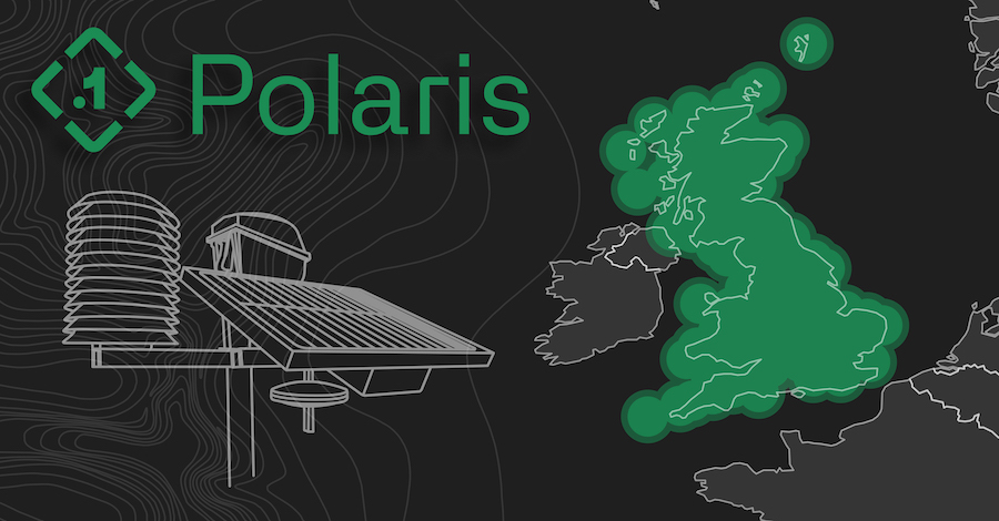
Point One Navigation’s Polaris Precise Positioning Network now covers all of Great Britian, providing precision location for applications such as advanced driver assistance (ADAS), robotics, mapping, delivery and infrastructure inspection.
Ordnance Survey (OS net) base stations have been integrated into the Polaris Network, according to a news release, providing advanced positioning capabilities to this new coverage area. Polaris is an RTK corrections network that enables centimeter-level accuracy and also covers the United States, EU, Australia and Canada. Existing Polaris customers can use the UK integration immediately at no additional cost.
Point One’s integrated location platform is complemented by FusionEngine software, which further integrates inertial measurement, wheel odometry and other sensors to achieve the level of precision required—even when there are no satellite signals.
The localization service features a robust GraphQL-based API that makes it easy to integrate Polaris RTK into developer-built applications. By early next year, Point One will be able to support State Space Representation (SSR) corrections delivered by L-band, even without cellular networks or in bandwidth constrained applications.
“Point One Navigation wants precise location to be available everywhere,” Point One CEO and co-founder Aaron Nathan said, according to the release. “We are committed to bringing our Polaris RTK network to new markets and sectors, to enable existing and new applications that demand the most accurate, reliable and current location data possible. The expansion to the UK is another significant step in realizing this goal.”
Point One also recently introduced Atlas, an affordable inertial navigation system (INS) that offers high accuracy for autonomous vehicles, mapping and other applications. Atlas, designed for deployment in large fleets, provides ground-truth level accuracy in real time, simplifying engineering workflows, reducing costs and enhancing operational efficiency.
“We envision a future where businesses, researchers and automotive companies can harness the power of centimeter-level, real-time accuracy without the complexities and cost associated with post-processing,” Nathan said.


![STMicroPointOne_PRMed[45]](https://insidegnss.com/wp-content/uploads/2023/10/STMicroPointOne_PRMed45-150x150.jpg "Point One Navigation Joins STMicroelectronics Partner Program")
