In an Android developers’ blog post titled “Improving urban GPS accuracy for your app,” satnav expert and a principal engineer at Google Frank van Diggelen reports that the company has addressed “the last great unsolved GPS problem”: the wrong-side-of-the-street position error.
While this may not be the last nor the greatest GPS problem, it is one encountered by ride-share requesters and in-car navigators looking for a specific street address: multipath and other urban canyon-created errors.
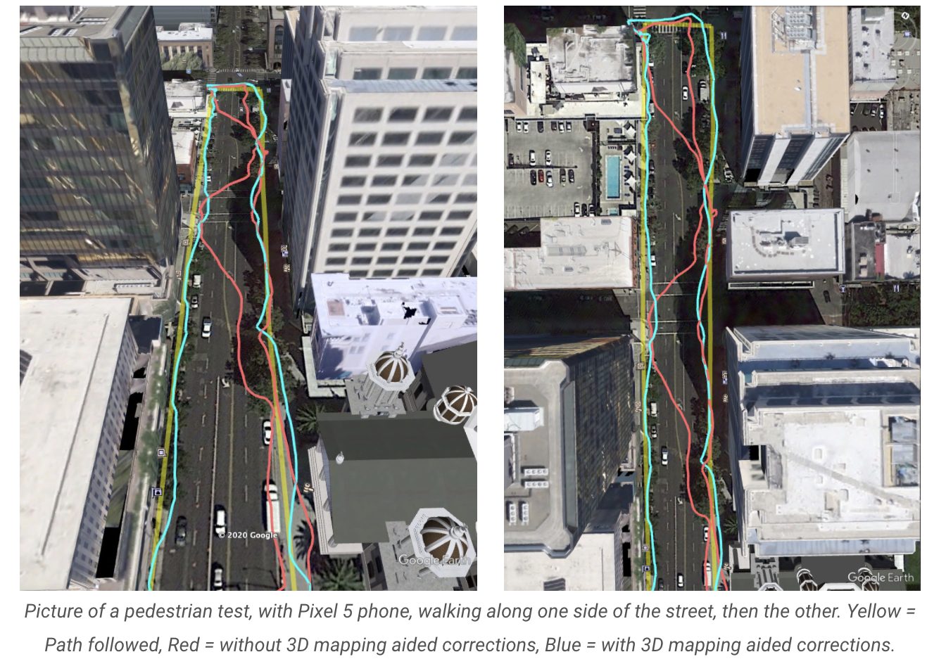
“Our solution uses 3D mapping-aided corrections, and is only feasible to be done at scale by Google because it comprises 3D building models, raw GPS measurements, and machine learning. The December Pixel Feature Drop adds 3D mapping aided GPS corrections to Pixel 5 and Pixel 4a (5G). With a system API that provides feedback to the Qualcomm Snapdragon 5G Mobile Platform that powers Pixel, the accuracy in cities (or “urban canyons”) improves spectacularly.”
The blog was co-authored with Jennifer Wang, product manager at the company. Van Diggelen is also a co-author of a 2018 Inside GNSS article, “GNSS Analysis Tools from Google.”


