NASA successfully launched eight Cyclone Global Navigation Satellite System (CYGNSS) microsatellites this morning (December 15, 2016) from Cape Canaveral Air Force Station in Florida.
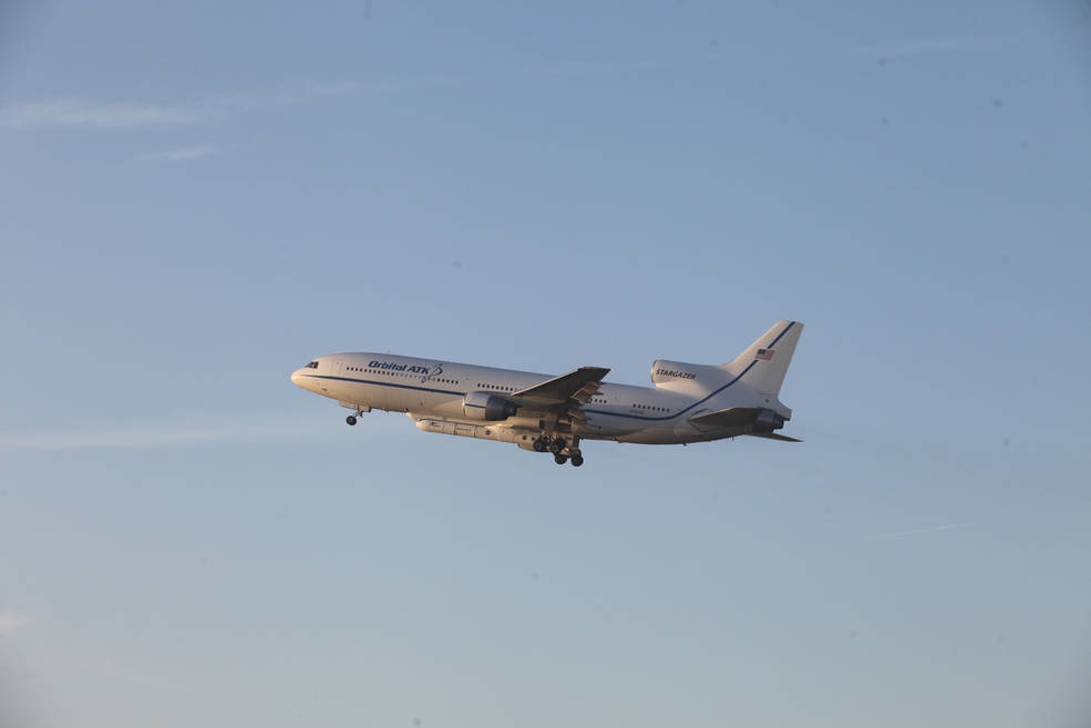
The CYGNSS spacecraft rode into orbit onboard an Orbital ATK air-launched Pegasus XL rocket. Orbital ATK’s modified L-1011 aircraft deployed the Pegasus XL and its CYNGSS payload at 39,000 feet, the agency said.
NASA successfully launched eight Cyclone Global Navigation Satellite System (CYGNSS) microsatellites this morning (December 15, 2016) from Cape Canaveral Air Force Station in Florida.
The CYGNSS spacecraft rode into orbit onboard an Orbital ATK air-launched Pegasus XL rocket. Orbital ATK’s modified L-1011 aircraft deployed the Pegasus XL and its CYNGSS payload at 39,000 feet, the agency said.
"We think everything looks really, really good. About three hours after launch we’ll attempt first contact, and after that, we’ll go through a series of four contacts where we hit two [observatories] each time, checking the health and status of each spacecraft," said John Scherrer, CYGNSS project manager at the Southwest Research Institute, in a NASA blog.
NASA said it had to cancel two previous launch dates this week because of a hydraulic system malfunction that operates the mechanism to release the Pegasus rocket from the L-1011 aircraft and a software problem.
As Inside GNSS reported earlier, CYGNSS will measure the surface roughness of the world’s oceans. Mission scientists will use data collected to calculate surface wind speeds, providing a better picture of a storm’s strength and intensity, and storm surges, which include walls of water that do the most damage when hurricanes make landfall.
While in orbit, the satellites will receive both direct and reflected signals from GPS satellites.
During the two-year mission, the eight CYGNSS microsatellites will fly in formation about 316 miles above Earth’s surface, focusing on the tropics and studying wind speeds and intensification of tropical cyclones such as hurricanes, according to the NASA blog.
Other weather satellites cannot penetrate heavy rain in a hurricane’s eyewall to gather intense inner core storm data, but CYGNSS can, NASA said. In addition, CYGNSS small satellite observatories will monitor surface winds over the oceans across Earth’s tropical hurricane-belt latitudes, the agency said.
The University of Michigan’s Space Physics Research Laboratory leads the overall mission in partnership with the Southwest Research Institute, which heads up the science investigation. The Earth Science Division of NASA’s Science Mission Directorate oversees the mission.
NASA expects receive CYGNSS data as early as next week, said Chris Ruf, CYGNSS principal investigator from the University of Michigan, in the agency blog.
There will be a one- to two-month commissioning phase in which each microsatellite will be checked out and maneuvered into its final position, NASA said. The agency expects the CYGNSS constellation to be fully operational for the 2017 hurricane season.


