In the wake of the latest COP session on international climate change, and as the world continues to deal with the effects of a warming planet, researchers say more and better data can help ameliorate the damage and provide answers on how to respond to it.
GIS giant Esri hosted a webinar on Nov. 30 to discuss how imagery from satellites and drones, combined with artificial intelligence and cloud storage, can help hold United Nations members and other states accountable in creating a more sustainable world.
The answer: By generating more data, taking more measurements, making the data more accessible and putting it into products that are easy to understand by even non-scientists.
Panelist Steve Brumby, cofounder and CEO of Impact Observatory, said he sees a pending era of “radical transparency” where people have the information they need to understand the choices their governments make.
“In the next 12 months, we’re moving from a situation where anyone can expect to get an annual map from one year ago … to having essentially continuous monitoring,” Brumby said. “Anybody in the world should be able to say, here’s my area of interest … let me understand how this area is changing.”
He said anyone should be able to get information on how much land has been urbanized, how much coastland has eroded, and other measurements. Such data should no longer be just the realm of experts, but “there should be no barrier to people getting that type of data.”
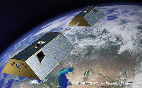
Panelist “Stinger” Gerald Guala, a program scientist at NASA, said a record number of Earth-observing satellites means more data than ever.
“We’ve got a lot of new data sets coming in,” he said. “More data is always better than less data. … we’ve got a bigger fleet [of satellites] right now that address climate change directly than we’ve ever had before. We’re going to have a lot more information in the future.”
Panelist Amos Desjardins, the data inspection, enhancement and delivery section chief at the U.S. Department of Agriculture, said his agency has about 7 petabytes of data, nine million frames of imagery, including one data set of a county in Wisconsin dating back to 1951.
“I always like to pivot and look backwards a little bit, and see where have we come from, what has changed over time?” he said. “Going forward, how can we collect imagery that will be useful?” The USDA maps the entire United States every other year (half one year, half the next) at resolutions as low as 15 centimeters, “and make that publicly available … so researchers and the general public can utilize that information.”
Brumby said the results from COP27, the 27th United Global Climate Change Conference, were disappointing to the conservation community in terms of practical results for fighting global warming.
With data from satellites, aircraft and on the ground, “things are changing faster than some of the models we hoped were correct not too long ago. The impacts on everyday life are already becoming undeniable, and there’s going to be a period where better decision making is not going to be some sort of luxury … it’s just going to be something people have to adapt to.”


