 One of 12 magnetograms recorded at Greenwich Observatory during the Great Geomagnetic Storm of 1859
 1996 soccer game in the Midwest, (Rick Dikeman image)
 Nouméa ground station after the flood
 A pencil and a coffee cup show the size of NASA’s teeny tiny PhoneSat
 Bonus Hotspot: Naro Tartaruga AUV
 Pacific lamprey spawning (photo by Jeremy Monroe, Fresh Waters Illustrated)
 “Return of the Bucentaurn to the Molo on Ascension Day”, by (Giovanni Antonio Canal) Canaletto
 The U.S. Naval Observatory Alternate Master Clock at 2nd Space Operations Squadron, Schriever AFB in Colorado. This photo was taken in January, 2006 during the addition of a leap second. The USNO master clocks control GPS timing. They are accurate to within one second every 20 million years (Satellites are so picky! Humans, on the other hand, just want to know if we’re too late for lunch) USAF photo by A1C Jason Ridder.
  Detail of Compass/ BeiDou2 system diagram
 Hotspot 6: Beluga A300 600ST

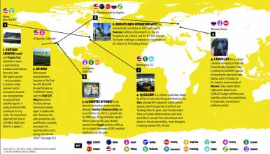
1. NOTHING BEATS FREE
Mountain View, California
√ Google’s open-source, customizable Android OS uses its own maps for a free GPS feature on the new Verizon Motorola “Droid” phone. It’s shaking mobile map giants Navteq and Tele Atlas and the smart phone and PND developers who lease from them. Google’s free GPS could appear on the iPhone as well.
2. ATTRACTIVE NUISANCE
Boulder, Colorado USA
√ University of Colorado geophysicist Kristine Larson always thought GPS signal echoes were a nuisance. Last year, her team discovered that changes in snow depth can clearly be tracked in the corresponding multipath modulation of the signal. Receivers installed in the snowy Western U.S. to trace earth movement can now do double duty.
3. NO SIGNAL AVAILABLE
Washington, DC
√ The Loran-C signal goes silent on January 4 if the Coast Guard confirms it is not needed for navigation and Homeland Security says it is not needed as a GPS backup. On October 28, President Obama signed 2010 defense appropriations bills that cut eLoran, among other GPS-related programs. (See related November 11 Inside GNSS news story)
4. MOLA MOLA!
Plymouth, England
√ It’s hard to track a 2,200 lb. jellyfish-eating sunfish that feeds in deep water. Now a GPS tag that acquires a signal in under a second enabled Plymouth’s UK Marine Biological Association to follow one mola mola 12 miles per day for three months. “Unparalleled accuracy,” says lead researcher David Sims.
5. THE EUROPEAN POV
Oberpfaffenhofen, Germany
√ A workshop, GNSS Signals 2009, will take place at the German Aerospace Center (DLR) on December 10-11. As the name reflects, it’s all about the European perspectives on signals and signal processing, with a keynote speech by GNSS signal expert Frédéric Bastide, from the EC Directorate of Energy & Transport. (See Inside GNSS event page for GNSS Signals 2009)
6. REACH FOR THE SKY
India
√ India hopes to launch its first GPS Aided Geo Augmented Navigation (GAGAN, the acronym is Sanskrit for “sky”) payload into space on board the GSAT-4 satellite, which may launch as soon as December 2009.


