 One of 12 magnetograms recorded at Greenwich Observatory during the Great Geomagnetic Storm of 1859
 1996 soccer game in the Midwest, (Rick Dikeman image)
 Nouméa ground station after the flood
 A pencil and a coffee cup show the size of NASA’s teeny tiny PhoneSat
 Bonus Hotspot: Naro Tartaruga AUV
 Pacific lamprey spawning (photo by Jeremy Monroe, Fresh Waters Illustrated)
 “Return of the Bucentaurn to the Molo on Ascension Day”, by (Giovanni Antonio Canal) Canaletto
 The U.S. Naval Observatory Alternate Master Clock at 2nd Space Operations Squadron, Schriever AFB in Colorado. This photo was taken in January, 2006 during the addition of a leap second. The USNO master clocks control GPS timing. They are accurate to within one second every 20 million years (Satellites are so picky! Humans, on the other hand, just want to know if we’re too late for lunch) USAF photo by A1C Jason Ridder.
  Detail of Compass/ BeiDou2 system diagram
 Hotspot 6: Beluga A300 600ST

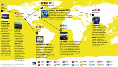
1. BOMBS AWAY
China Lake, California
√ The U.S. Air Force successfully dropped a live 500-pound GPS-guided missile on target from an MQ-9 Reaper unmanned aerial vehicle at the Naval Air Warfare Center in California on May 13. It’s bound to happen: GPS-assisted UAVs and GPS-aided robots with GPS-guided bombs will carry on our wars without us.
2. BOOTS ON THE GROUND
Cleveland, Ohio; Bedford, Massachusetts; Washington D.C.
√ Soldiers and first responders may look forward to really, really accurate inertial navigation sensors that fit in the heels of their boots – (indoor/ outdoor positioning accuracy < 1% distance traveled.) Case Western Reserve is developing the sensor and InterSense Inc. is collaborating with their own precision motion technology. DARPA’s MINT program is picking up the check.
3. ACCESS
Brussels, Belgium & Washington D.C.
√ Galileo’s Interface Control Document is still in draft form, but Galileo-capable simulators are slipping into the market. The ICD will take its final form soon, we hear. But, the U.S. Trade Representative’s July 15 Congressional Report worries that U.S. equipment manufacturers may not be welcome at the ensuing Galileo procurement party. (See news story here).
4. MEET UP
St. Petersburg, Russia
√ Vienna, Bangalore, Pasadena . . . St. Petersburg. The International Committee on GNSS gives everyone a chance to play on home turf. The UN-sponsored group of system providers and operators gathers for a fourth meeting in Russia on September 14. They’ll focus on interoperability advantages for GNSS users and manufacturers. (China in 2010!).
5. TREMBLORS
Sichuan Province, China
√ Scientists from China and Europe used SAR satellite data, InSAR, and GPS data to measure ground deformation from last year’s Wenchuan earthquake in Sichuan. They created before and after images that showed how stress was accumulating along the fault — a step in predicting future quakes.
The team is part of ESA’s Dragon 2 program.
6. THE CATCH
Tokyo, Japan
√ Central Tokyo’s Aoyama Gakuin University gave 550 free GPS-enabled iPhone 3Gs to everyone in its School of Social Informatics in May. Here’s the catch — the custom app students must use to register their attendance locates them precisely. And if it’s not on campus — you are so busted! (Can’t live with your iPhone . . . can’t live without.)


